MyTopo
Classic USGS Herrick Illinois 7.5'x7.5' Topo Map
Couldn't load pickup availability
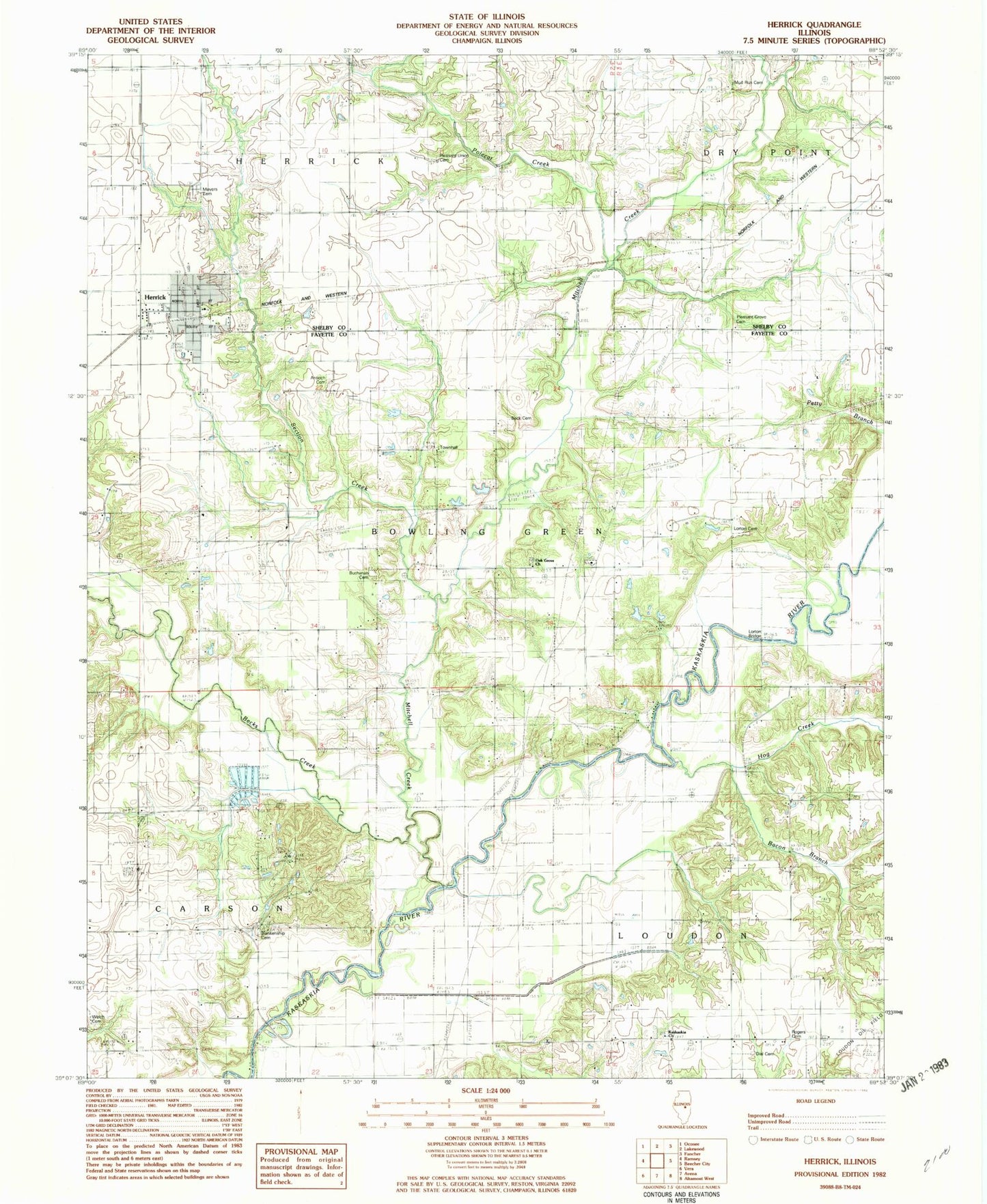
Historical USGS topographic quad map of Herrick in the state of Illinois. Map scale may vary for some years, but is generally around 1:24,000. Print size is approximately 24" x 27"
This quadrangle is in the following counties: Fayette, Shelby.
The map contains contour lines, roads, rivers, towns, and lakes. Printed on high-quality waterproof paper with UV fade-resistant inks, and shipped rolled.
Contains the following named places: Antioch Cemetery, Bacon Branch, Beck Cemetery, Becks Creek, Blankenship Cemetery, Bowling Green Townhall, Buchanan Cemetery, Dean Hills, Dean Hills Nature Preserve, Dial Cemetery, Good Hope School, Herrick, Herrick Elementary School, Herrick Fire Department, Herrick Post Office, Hog Creek, Hog Creek School, Kaskaskia Cemetery, Kaskaskia Church, Liberty School, Lorton Bridge, Lorton Cemetery, Lorton Church, Mitchell Creek, Mud Run Cemetery, Mud Run School, Myers Cemetery, Oak Grove Cemetery, Oak Grove Church, Pint Creek, Pleasant Grove Cemetery, Pleasant Grove School, Pleasant Union Cemetery, Pleasant Union School, Polecat Creek, Rogers Cemetery, School Number 10, Section Creek, Shady Lane School, Township of Bowling Green, Township of Carson, Township of Herrick, Township of Loudon, Valley School, Victory School, Village of Herrick, Welch Cemetery, Wren Bridge, ZIP Codes: 62422, 62431