MyTopo
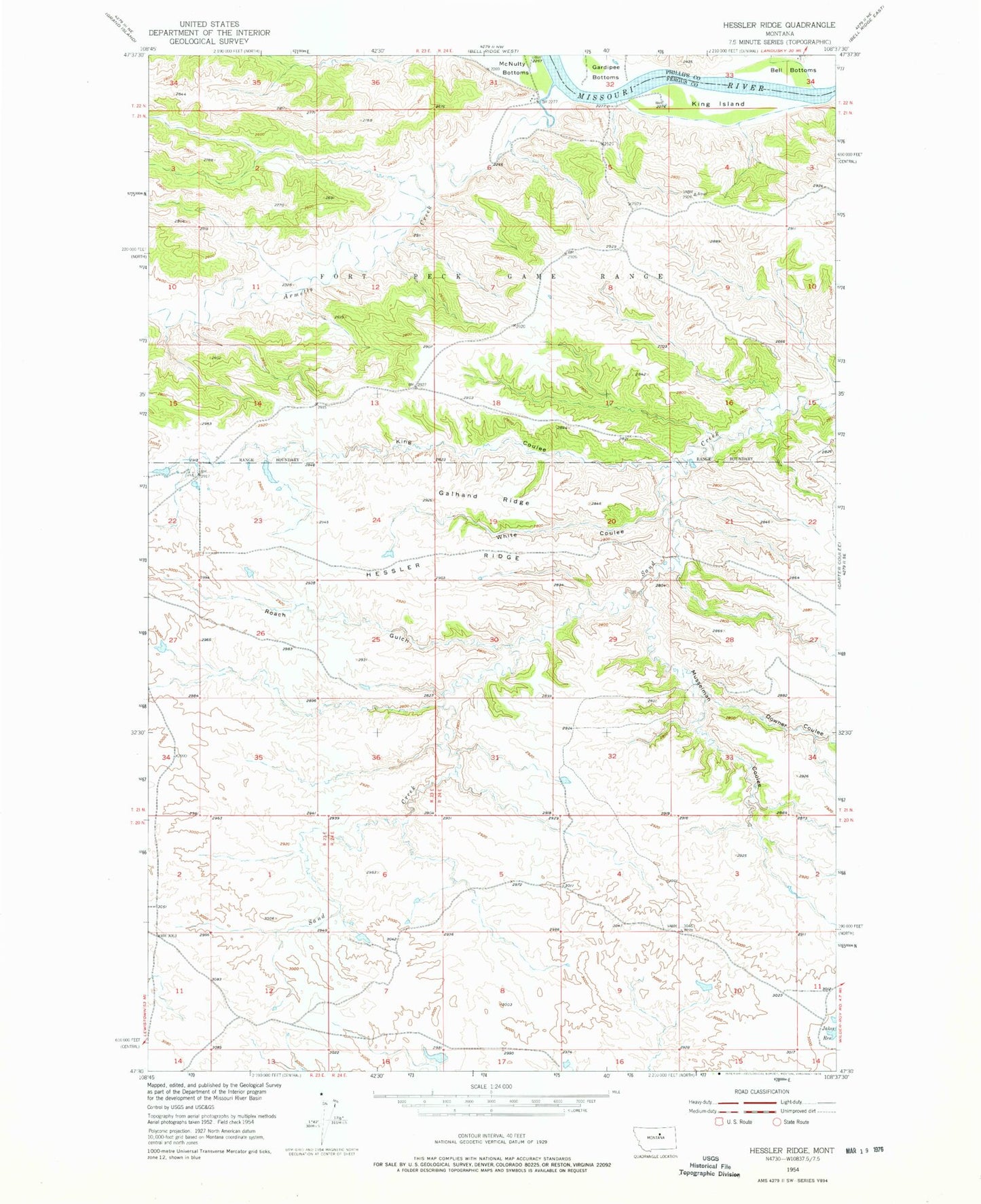
Classic USGS Hessler Ridge Montana 7.5'x7.5' Topo Map
Couldn't load pickup availability
Historical USGS topographic quad map of Hessler Ridge in the state of Montana. Map scale may vary for some years, but is generally around 1:24,000. Print size is approximately 24" x 27"
This quadrangle is in the following counties: Fergus, Phillips.
The map contains contour lines, roads, rivers, towns, and lakes. Printed on high-quality waterproof paper with UV fade-resistant inks, and shipped rolled.
Contains the following named places: 21N23E12AD__01 Well, 21N23E13CBBB01 Well, 21N24E06BB__01 Well, Armells Creek, Bundane School, Cope Dam, Downer Coulee, Fergus Number 1 Dam, Galhand Ridge, Gardipee Bottoms, Hessler Ridge, King Coulee, King Coulee Number 1 Dam, King Island, Mobridge, Musselman Coulee, Roach Gulch, Sagebrush Number 3 Dam, Sand Creek Wildlife Station Airport, White Coulee