MyTopo
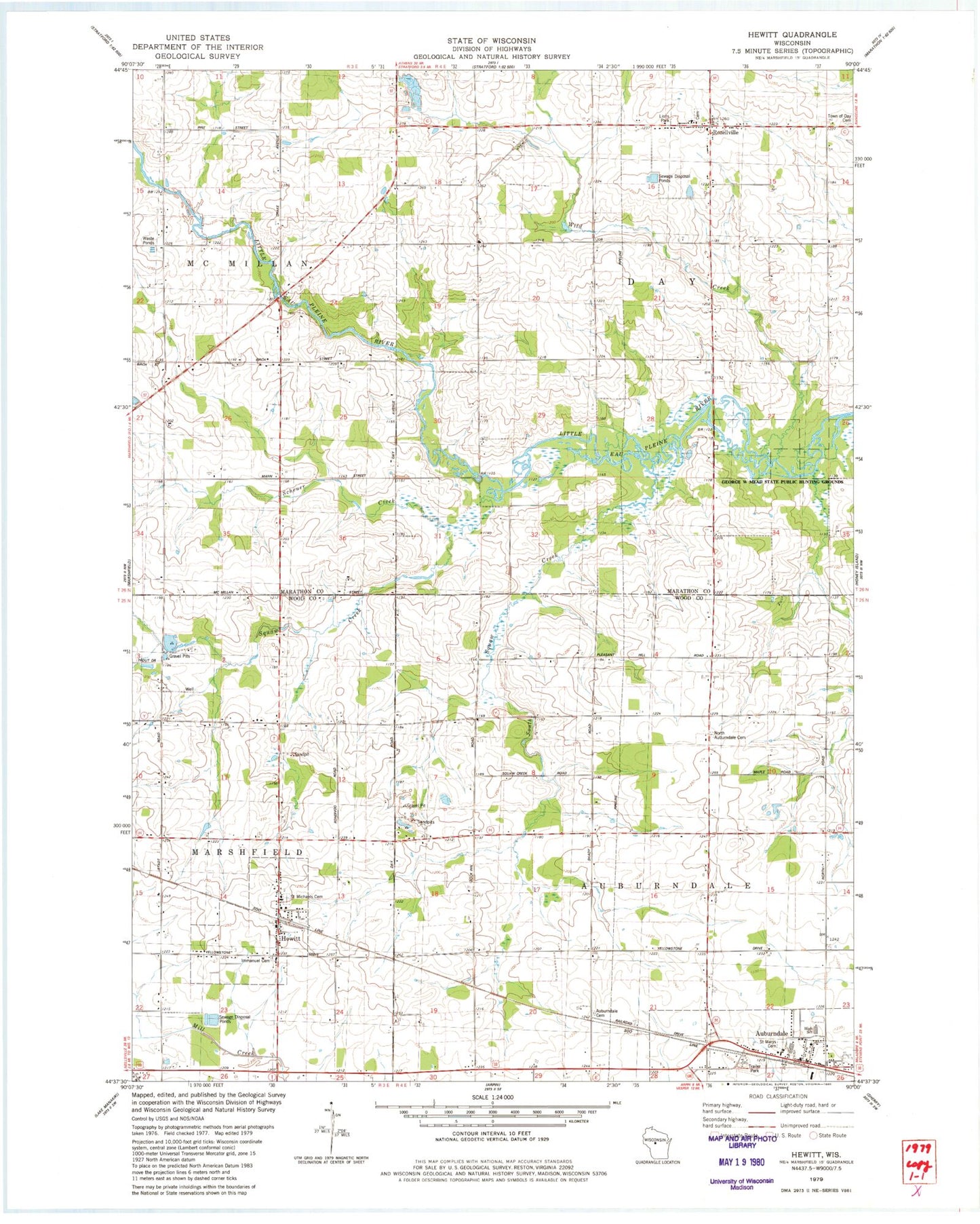
Classic USGS Hewitt Wisconsin 7.5'x7.5' Topo Map
Couldn't load pickup availability
Historical USGS topographic quad map of Hewitt in the state of Wisconsin. Map scale may vary for some years, but is generally around 1:24,000. Print size is approximately 24" x 27"
This quadrangle is in the following counties: Marathon, Wood.
The map contains contour lines, roads, rivers, towns, and lakes. Printed on high-quality waterproof paper with UV fade-resistant inks, and shipped rolled.
Contains the following named places: Auburndale, Auburndale Cemetery, Auburndale Elementary School, Auburndale High School, Auburndale Joint Fire Department, Auburndale Post Office, Dodge School, Evergreen Hill School, Hewitt, Hewitt Area Fire Department, Hillside School, Immanuel Lutheran Cemetery, Immanuel Lutheran Church, North Auburndale Cemetery, Pleasant Hill School, Riverside School, Rozellville, Saint Johns Lutheran Church, Saint Mary Grade School, Saint Marys Catholic Cemetery, Saint Marys Catholic Church, Saint Michaels Catholic Church, Saint Michaels Cemetery, Scheuer Creek, Squaw Creek, Stratford Area Fire Department Station 2, Town of Auburndale, Town of Day, Village of Auburndale, Village of Hewitt, White Oak School, Wild Creek, ZIP Code: 54441