
MyTopo
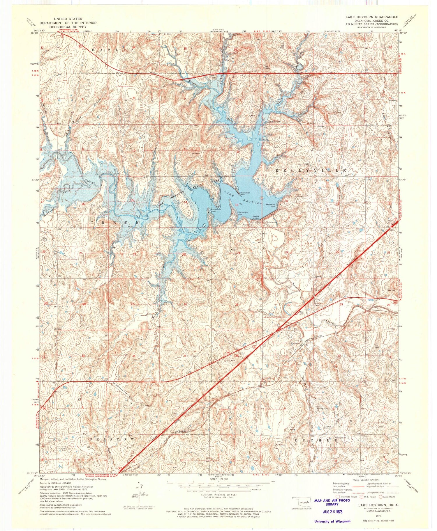
Classic USGS Heyburn Reservoir Oklahoma 7.5'x7.5' Topo Map
Couldn't load pickup availability
Historical USGS topographic quad map of Heyburn Reservoir in the state of Oklahoma. Map scale may vary for some years, but is generally around 1:24,000. Print size is approximately 24" x 27"
This quadrangle is in the following counties: Creek.
The map contains contour lines, roads, rivers, towns, and lakes. Printed on high-quality waterproof paper with UV fade-resistant inks, and shipped rolled.
Contains the following named places: Browns Creek, Creek County, East Side Presbyterian Church, East Winkey Branch, Heyburn, Heyburn Dam, Heyburn Lake, Heyburn Reservoir, Heyburn Wildlife Management Area, Lake Heyburn State Park, Mosquito Creek, Neversweat Airport, Neversweat Creek, Oak Hill Cemetery, Oknoname 037016 Dam, Oknoname 037016 Reservoir, Oknoname 037021 Dam, Oknoname 037021 Reservoir, Oknoname 037022 Dam, Oknoname 037022 Reservoir, Oknoname 037035 Dam, Oknoname 037035 Reservoir, Oknoname 037044 Dam, Oknoname 037044 Reservoir, Oknoname 037078 Dam, Oknoname 037078 Reservoir, Provens Cemetery, Rowland Creek, Sunrise Cemetery, Tiger Creek, Township of Creek, Turkey Creek, Waterfowl Refuge, Wildhorse Prairie, Winkey Branch, Worman Junction


