MyTopo
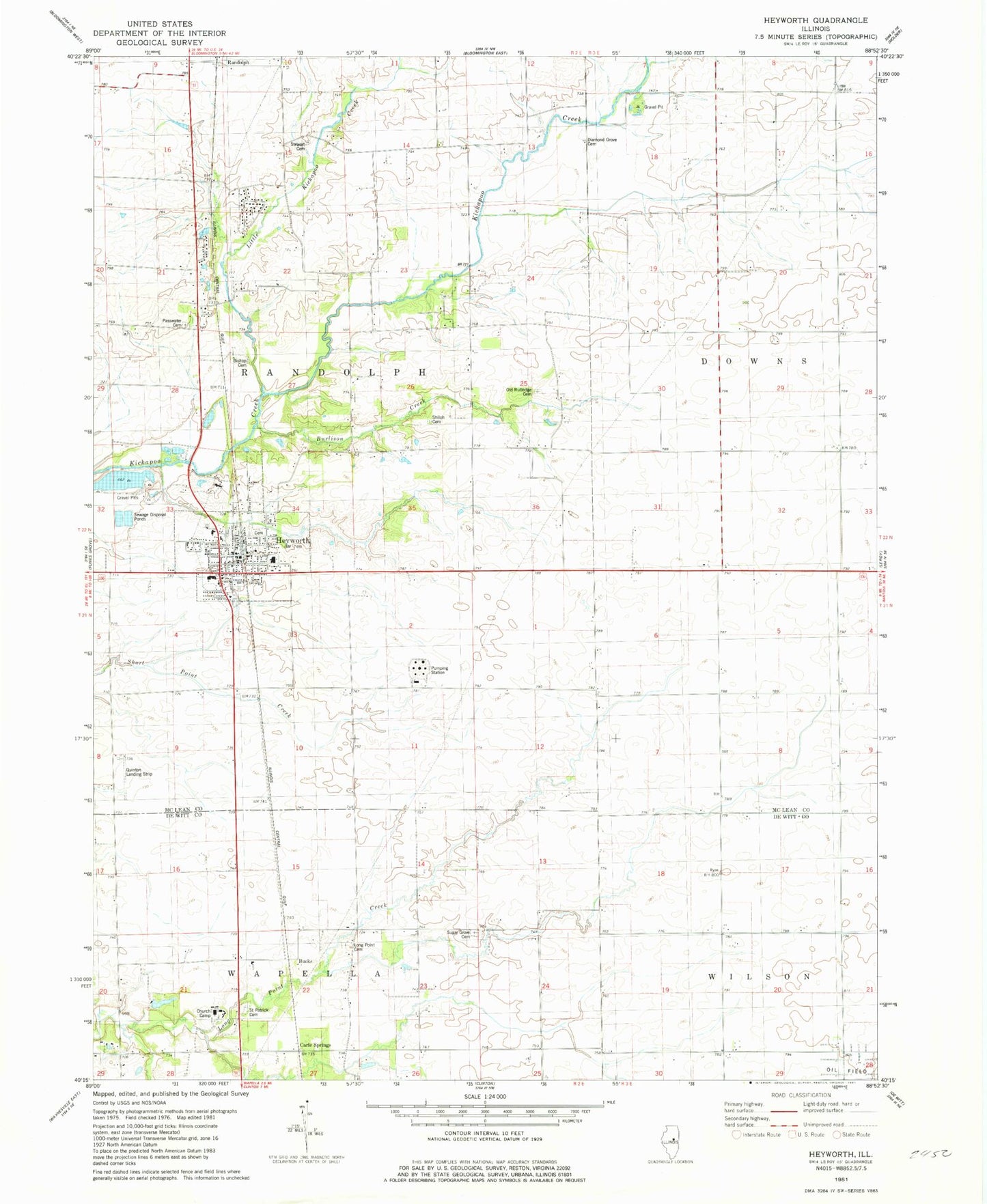
Classic USGS Heyworth Illinois 7.5'x7.5' Topo Map
Couldn't load pickup availability
Historical USGS topographic quad map of Heyworth in the state of Illinois. Map scale may vary for some years, but is generally around 1:24,000. Print size is approximately 24" x 27"
This quadrangle is in the following counties: De Witt, McLean.
The map contains contour lines, roads, rivers, towns, and lakes. Printed on high-quality waterproof paper with UV fade-resistant inks, and shipped rolled.
Contains the following named places: Bishop Cemetery, Bucks, Burlison Creek, Carle Springs, Diamond Grove Cemetery, Diamond Grove Church, Hamlow RLA Airport, Heyworth, Heyworth Ambulance Service, Heyworth Cemetery, Heyworth Elementary School, Heyworth High School, Heyworth Post Office, Johnson Airport, Liberty School, Little Kickapoo Creek, Littleville, Long Point Cemetery, Long Point Church, Lytleville School, Old Rutledge Cemetery, Progress School, Quinton Landing Strip, Randolph Township Cemetery, Randolph Township Fire Department, Saint Patrick Cemetery, Shiloh Cemetery, Stewart Cemetery, Sugar Grove Cemetery, Township of Randolph, Valley Center Church, Village of Heyworth, ZIP Code: 61745