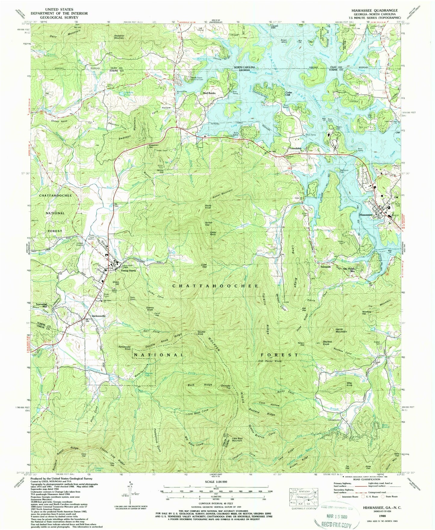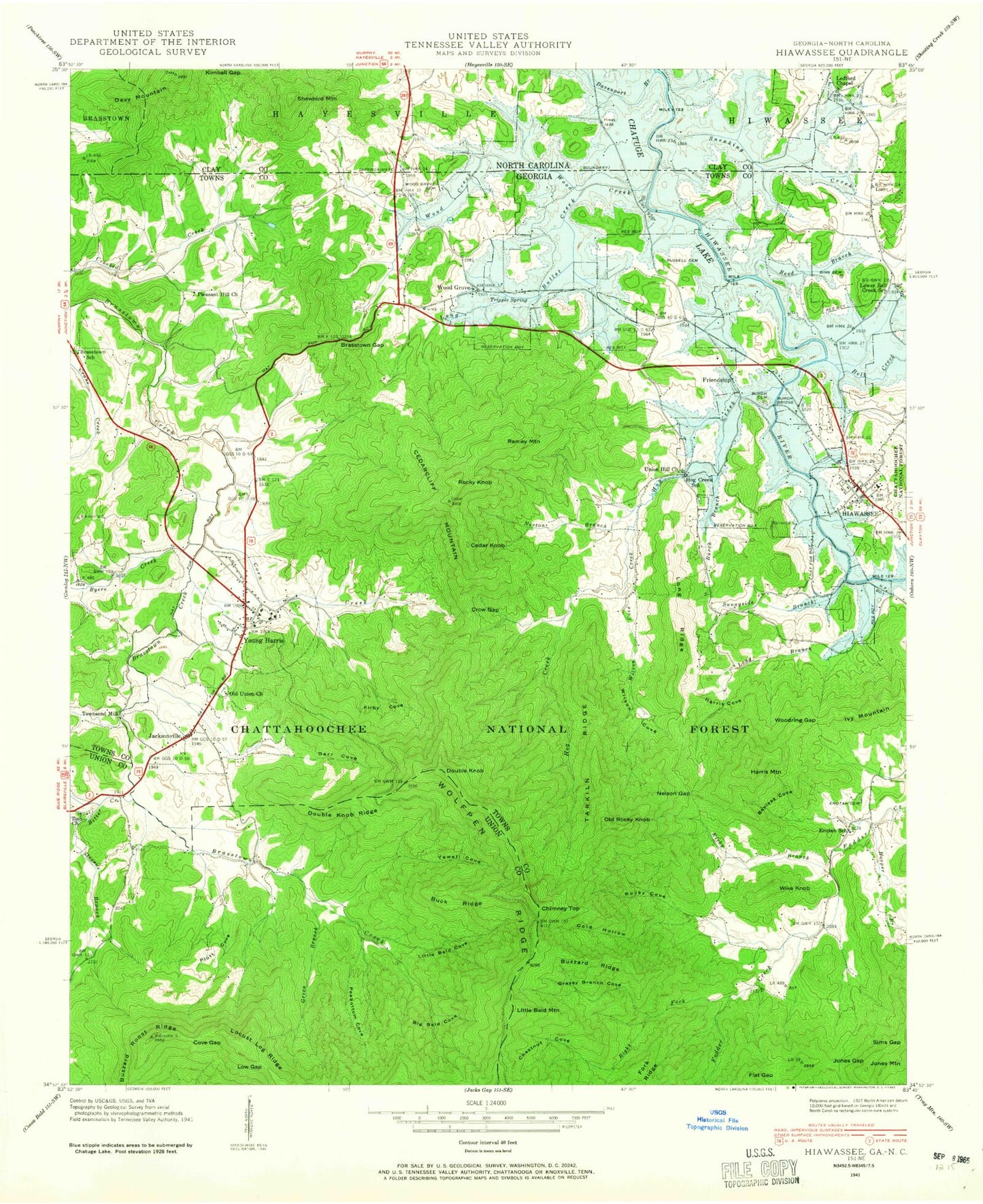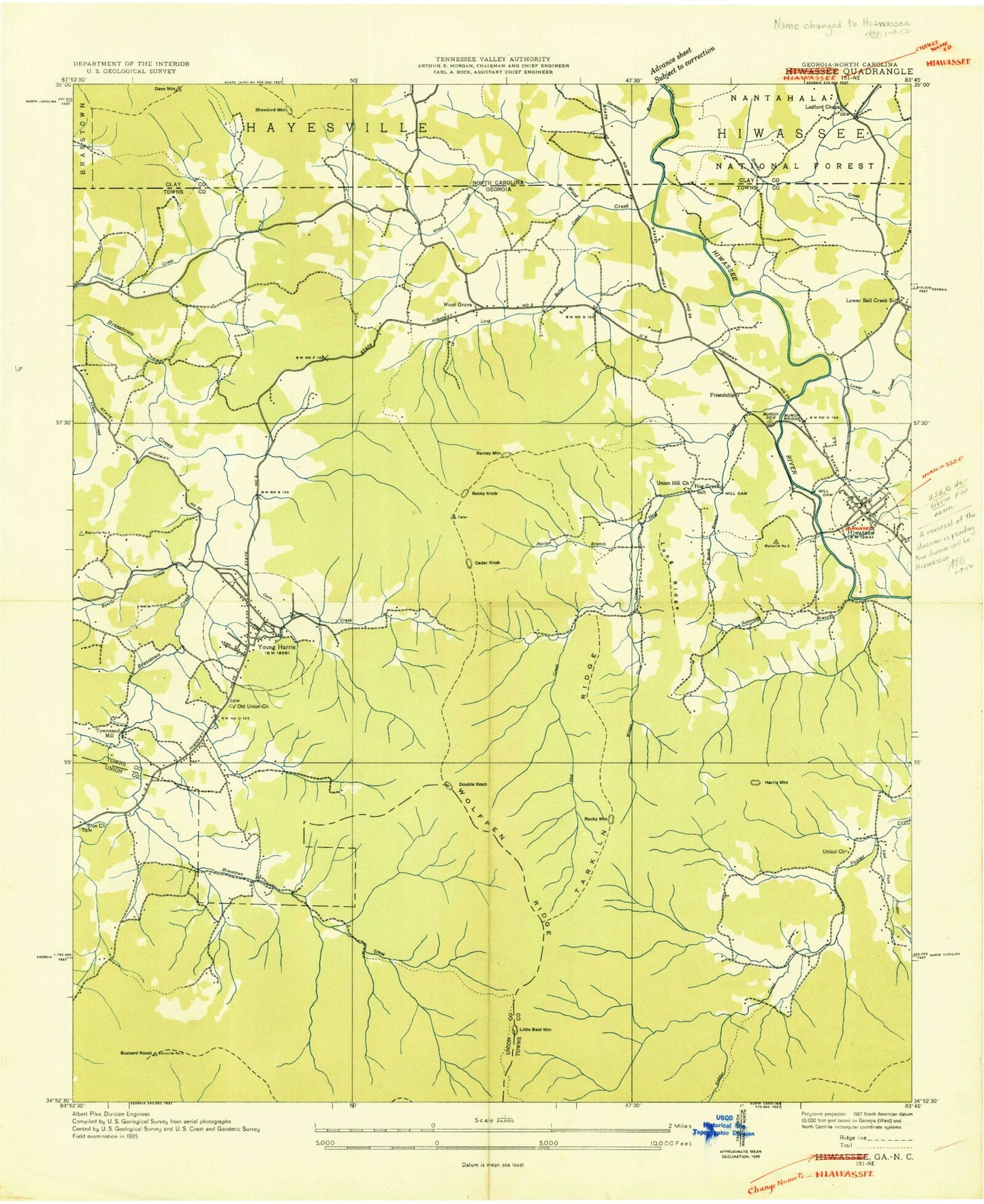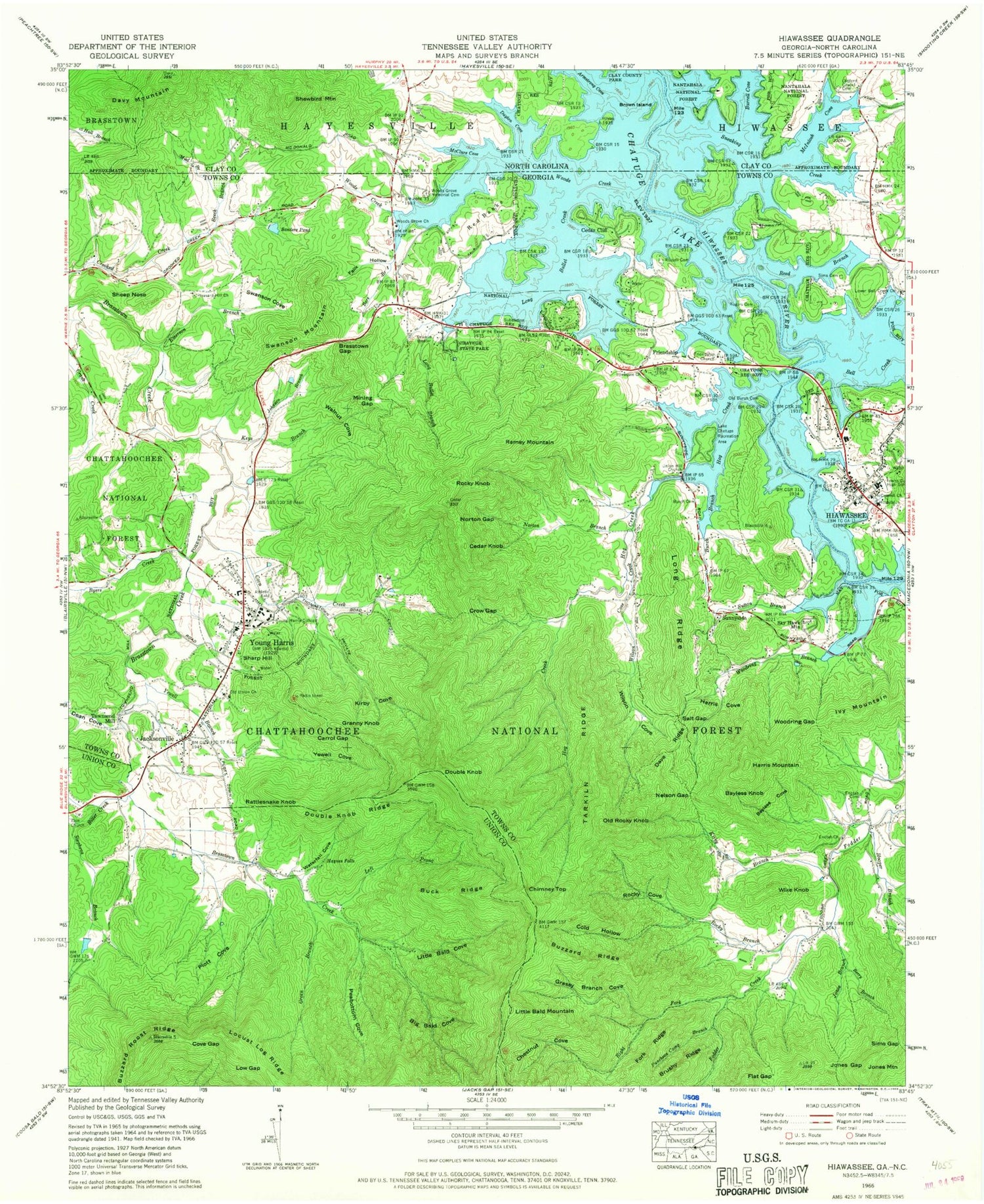
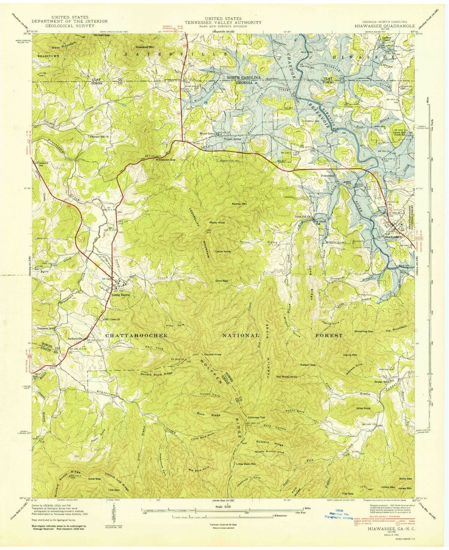

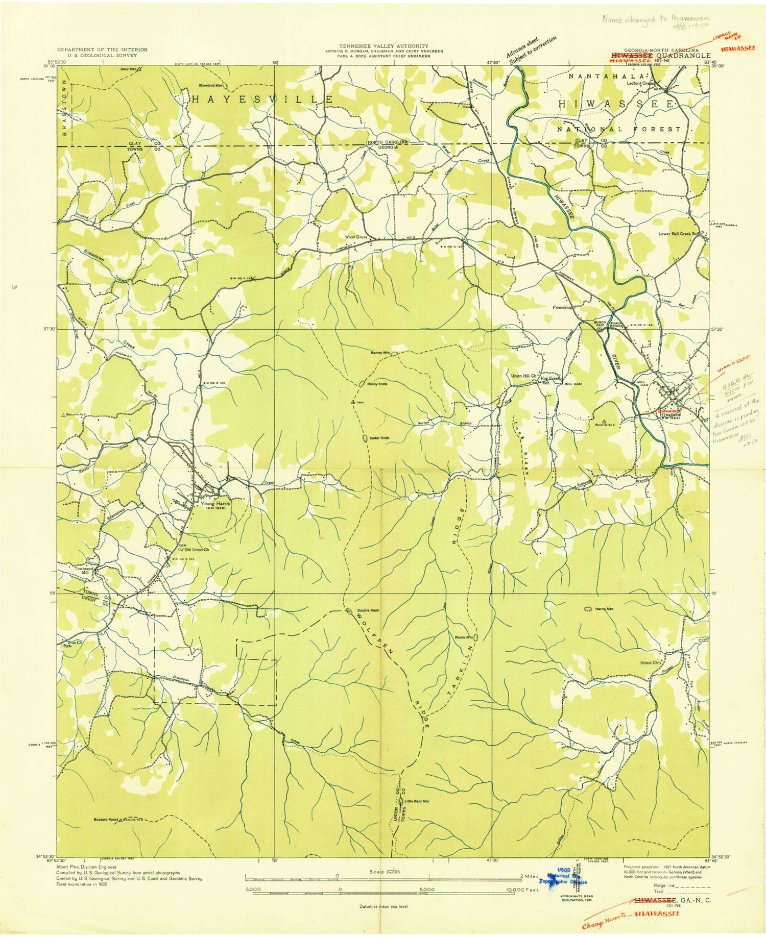
MyTopo
Classic USGS Hiawassee Georgia 7.5'x7.5' Topo Map
Couldn't load pickup availability
Historical USGS topographic quad map of Hiawassee in the states of Georgia, North Carolina. Typical map scale is 1:24,000, but may vary for certain years, if available. Print size: 24" x 27"
This quadrangle is in the following counties: Clay, Towns, Union.
The map contains contour lines, roads, rivers, towns, and lakes. Printed on high-quality waterproof paper with UV fade-resistant inks, and shipped rolled.
Contains the following named places: Bare Branch, Bayless Cove, Bell Creek (historical), Berry Branch, Big Bald Cove, Bitter Creek, Brasstown Gap, Brushy Ridge, Buck Ridge, Burch Branch, Buzzard Ridge, Buzzard Roost Ridge, Caldwell Branch, Carrol Gap, Chatuge State Park, Chestnut Cove, Cold Hollow, Corn Creek, Cove Gap, Crow Gap, Dave Ridge, Dean Cove, Double Knob Ridge, Emerson Branch, Enotah Cemetery, Felix Hollow, Flat Gap, Grassy Branch Cove, Green Branch, Harris Cove, Harris Mountain, Haynes Falls, Hiawassee, Hiwassee Church, Hog Creek, Hooper Branch, Johnson Branch, Jones Branch, Jones Gap, Keys Branch, Kirby Branch, Kirby Cove, Lake Chatuge Recreation Area, Left Prong Brasstown Creek, Little Bald Cove, Long Bullet Branch, Long Bullet Creek (historical), Long Ridge, Low Gap, Lower Bell Creek Church, McConnell Church, Mining Gap, Nelson Gap, Norton Branch, Norton Gap, Old Burch Cemetery, Old Union Church, Peabottom Cove, Pleasant Hill Church, Plott Cove, Puncheon Camp Branch, Red Banks, Reed Branch, Right Fork Fodder Creek, Rocky Branch, Rocky Cove, Rogers Cemetery, Russell Cemetery, Salt Gap, Sanders Pond, Sheep Nose, Sims Cemetery, Sims Gap, Sky Hawk Mountain, Sneaking Creek, Stephens Branch, Sutton Branch, Swanson Cove, Tarkiln Ridge, Union Hill Church, Walnut Cove, Waterfall Cove, Wilson Cove, Wilson Cove Creek, Woodring Branch, Woodring Gap, Woods Creek, Woods Grove Church, Woods Grove Memorial Cemetery, Yewell Branch, Darr Cove, Zion Church, Arkaquah Trail, WZEL Radio Tower, Burch Cemetery, Brasstown Bald Recreation Site, Brasstown Wilderness, Towns County Park, Victory Church, Bayless Knob, Cedar Cliff, Chimney Top, Double Knob, Friendship, Granny Knob, Ivy Mountain, Jacksonville, Jones Mountain, Little Bald Mountain, Old Rocky Knob, Ramey Mountain, Rattlesnake Knob, Rocky Knob, Sharp Hill, Sunnyside, Swanson Mountain, Townsend Mill, Wike Knob, Plott Cove Reserve Nature Area, Brasstown School (historical), Calvary Church, Calvary School, Enotah School (historical), Hiawassee Methodist Church, Kingdom Hall Church, Lower Bell Creek School (historical), Missionary Church, Old Union Cemetery, Pleasant Hill Cemetery, Sharp Hill United Methodist Church, Chatuge Regional Hospital, Young Harris College Historic District, WZEL-AM (Young Harris), Union and Towns County Jail, Zion Cemetery, Byers Creek, Cedar Knob, Enotah Church, Friendship Church, Young Harris, Young Harris College, Campagne (historical), Hunt (historical), Trackrock (historical), Young Harris Division, City of Hiawassee, City of Young Harris, Towns County Fire and Rescue Station 1, Towns County Fire and Rescue Station 6, Towns County Fire and Rescue Station 2, Towns County Fire and Rescue Station 3, Towns County Emergency Medical Service, Hiawassee Police Department, Towns County Sheriff's Office, Young Harris College Police Department, Hiawassee Post Office, Young Harris Post Office, Beech Branch, Mud Branch, Woods Creek, Brown Island, Burrell Cove, Chatuge Lake, Davy Mountain, Dayton Cove, Old Ledford Chapel Cemetery, McClure Cove, McIntosh Cove, Sneaking Creek, Shewbird Mountain, Bare Branch, Bayless Cove, Bell Creek (historical), Berry Branch, Big Bald Cove, Bitter Creek, Brasstown Gap, Brushy Ridge, Buck Ridge, Burch Branch, Buzzard Ridge, Buzzard Roost Ridge, Caldwell Branch, Carrol Gap, Chatuge State Park, Chestnut Cove, Cold Hollow, Corn Creek, Cove Gap, Crow Gap, Dave Ridge, Dean Cove, Double Knob Ridge, Emerson Branch, Enotah Cemetery, Felix Hollow, Flat Gap, Grassy Branch Cove, Green Branch, Harris Cove, Harris Mountain, Haynes Falls, Hiawassee, Hiwassee Church, Hog Creek, Hooper Branch, Johnson Branch, Jones Branch, Jones Gap, Keys Branch, Kirby Branch, Kirby Cove, Lake Chatuge Recreation Area, Left Prong Brasstown Creek, Little Bald Cove, Long Bullet Branch, Long Bullet Creek (historical), Long Ridge, Low Gap, Lower Bell Creek Church, McConnell Church, Mining Gap, Nelson Gap, Norton Branch, Norton Gap, Old Burch Cemetery, Old Union Church, Peabottom Cove, Pleasant Hill Church, Plott Cove, Puncheon Camp Branch, Red Banks, Reed Branch, Right Fork Fodder Creek, Rocky Branch, Rocky Cove