MyTopo
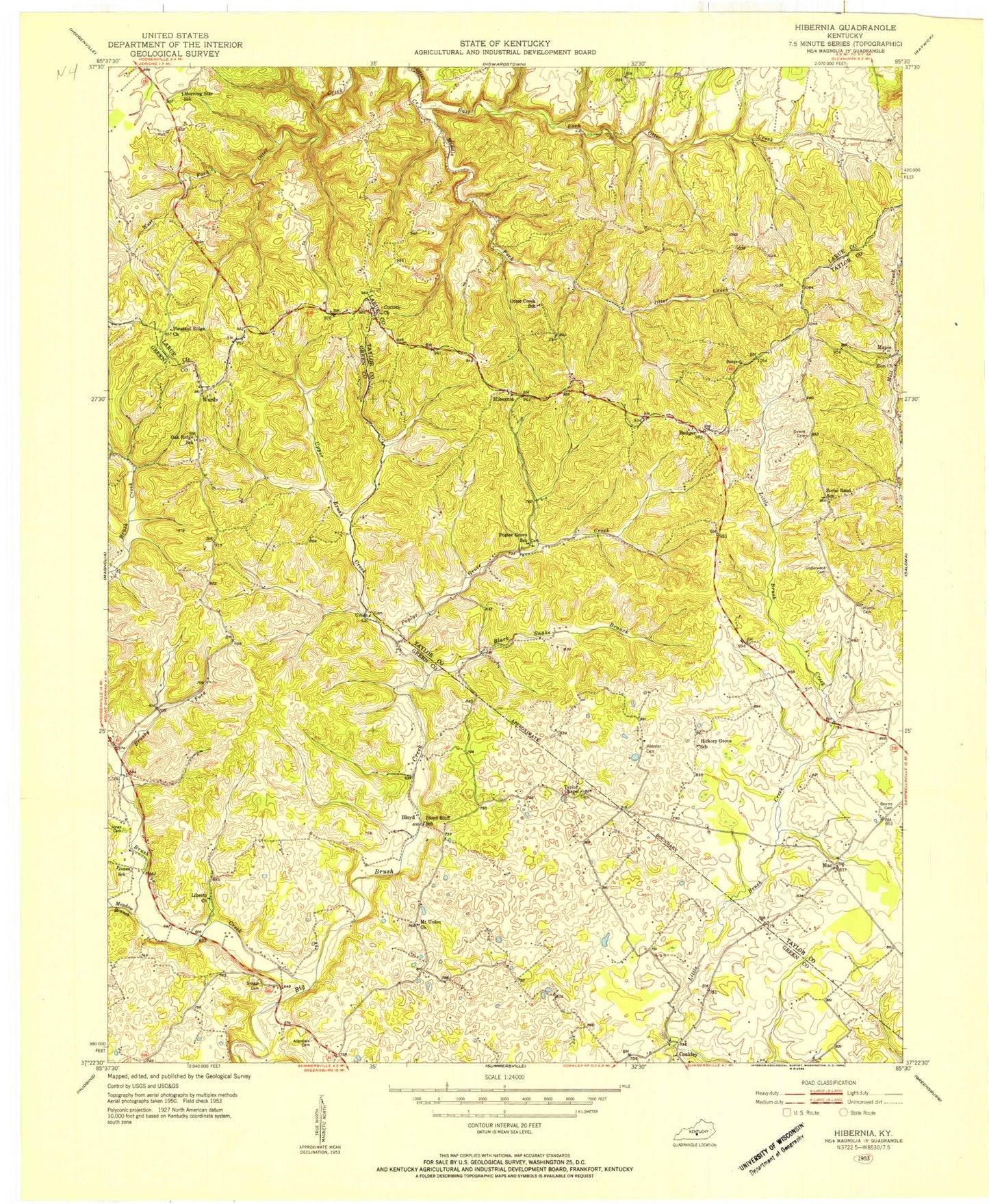
Classic USGS Hibernia Kentucky 7.5'x7.5' Topo Map
Couldn't load pickup availability
Historical USGS topographic quad map of Hibernia in the state of Kentucky. Map scale may vary for some years, but is generally around 1:24,000. Print size is approximately 24" x 27"
This quadrangle is in the following counties: Green, Larue, Taylor.
The map contains contour lines, roads, rivers, towns, and lakes. Printed on high-quality waterproof paper with UV fade-resistant inks, and shipped rolled.
Contains the following named places: Badger, Ball Hollow Prong, Beams Cemetery, Bell Cemetery, Black Snake Branch, Bloyd, Brush Creek, Brushy Fork, Coakley, Corinth Missionary Baptist Church, Dewitt Cemetery, East Fork Otter Creek, Hibernia, Hibernia Post Office, Jones Cemetery, Liberty Church, Mac, Malt, Malt Post Office, Maple, Meadow Branch, Middle Fork Otter Creek, Morris Cemetery, Mount Union Church, Oak Ridge Church, Otter Creek Church, Otter Creek Mill, Pleasant Ridge Church, Pleasant Valley Church, Poplar Grove Branch, Poplar Grove Church, Poteet School, School Number Eleven, Skaggs Cemetery, Taylor Chapel, Underwood Cemetery, Union Church, Upper Brush Creek, Walker Cemetery, Wards, Webster Cemetery, Zion Separate Baptist Church, ZIP Codes: 42716, 42764