MyTopo
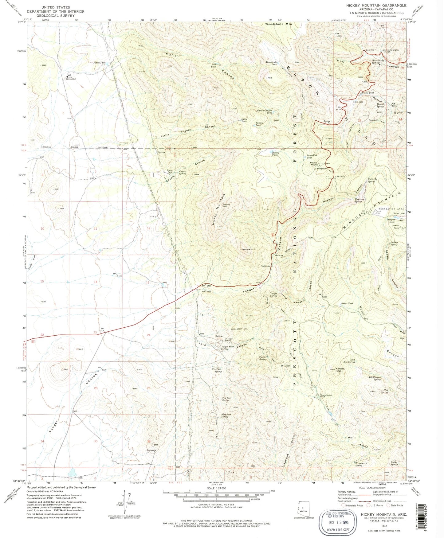
Classic USGS Hickey Mountain Arizona 7.5'x7.5' Topo Map
Couldn't load pickup availability
Historical USGS topographic quad map of Hickey Mountain in the state of Arizona. Typical map scale is 1:24,000, but may vary for certain years, if available. Print size: 24" x 27"
This quadrangle is in the following counties: Yavapai.
The map contains contour lines, roads, rivers, towns, and lakes. Printed on high-quality waterproof paper with UV fade-resistant inks, and shipped rolled.
Contains the following named places: Ash Canyon Spring, Blue Rock Spring, Boiler Spring, Burnt Tank, Butterfly Spring, Coyote Canyon, Coyote Spring, East Ash Spring, Elks Well, Gaddes Spring, Haywood Canyon, Haywood Spring, Hickey Mountain, Hickey Tanks, Hog Spring, James Tank, James Well, Jerome Grande Shaft, Kendall Peak, Lang Canyon, Little Coyote Canyon, Little Tank, Little Yaeger Canyon, Martin Canyon, Martin Canyon Tank, Mescal Spring, Mescal Tank, Mingus Lake, Mingus Springs Ranch, Potato Patch, Powerline Tank, Rick Tank, Strawberry Spring, Tin Tank Spring, Tin Tub Spring, Tunnel Spring, Turkey Tank, Walnut Springs, Woodchute Mountain, Woodchute Tank, Woodchute Trail, Yaeger Mine, Yaeger Mine Spring, Yaeger Spring, Cabin Spring, Gaddes Canyon Trail, Mingus Substation, North Mingus Trail Number One Hundred Six, Playground Jerome Family Picknicking Ground, Potato Patch Recreational Area, Red Seep Spring, View Point Trail Number One Hundred Five, Yaeger Canyon Ranger Station, Young Seep Spring, Trick Tank, Trick Tank, Lang Spring, Coyote Ranch, Mingus Tank, Butterfly Tank, Arizona Highway Maintenance Mingus Mountain Yard, Mingus Mountain Division, Mingus Mountain Academy, Potato Patch Campground