MyTopo
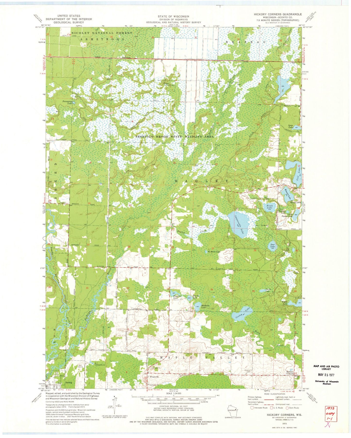
Classic USGS Hickory Corners Wisconsin 7.5'x7.5' Topo Map
Couldn't load pickup availability
Historical USGS topographic quad map of Hickory Corners in the state of Wisconsin. Map scale may vary for some years, but is generally around 1:24,000. Print size is approximately 24" x 27"
This quadrangle is in the following counties: Oconto.
The map contains contour lines, roads, rivers, towns, and lakes. Printed on high-quality waterproof paper with UV fade-resistant inks, and shipped rolled.
Contains the following named places: Bagley Creek, Bagley Lookout Tower, Community Church, Cooley Lake, Deer Lake, Frostville, Funk Lake, Hickory Cemetery, Hickory Corners, Hoerth Lake, Impassable Lake, Little Squaw Lake, Makholm Lake, No Mans Lake, Our Redeemers Church, Papoose Lake, Peshtigo Brook School, Peshtigo Brook State Wildlife Area, Peterson Lake, Ponsegrau Lake, Spies Lake, Suring Volunteer Fire Department, Town of Bagley, Turtle Lake, Ucil Lake, Village of Suring, Wescott Lake