MyTopo
Classic USGS Hickory Grove South Carolina 7.5'x7.5' Topo Map
Couldn't load pickup availability
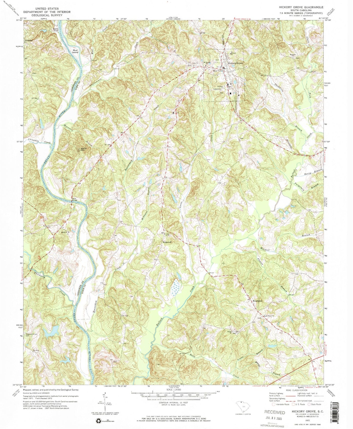
Historical USGS topographic quad map of Hickory Grove in the state of South Carolina. Map scale may vary for some years, but is generally around 1:24,000. Print size is approximately 24" x 27"
This quadrangle is in the following counties: Cherokee, York.
The map contains contour lines, roads, rivers, towns, and lakes. Printed on high-quality waterproof paper with UV fade-resistant inks, and shipped rolled.
Contains the following named places: Abingdon, Abingdon Creek, Beauty Spot, Beaverdam Creek, Bells Creek, Berry Branch, Borax, Bullock Creek Fire Department, Clark Fork, Coon Hill School, Dorothy Gold Mine, Dowdle Branch, Ebenezer Methodist Church, Etta, Guyonmoore Creek, Hickory Grove, Hickory Grove Division, Hickory Grove Fire Department, Hickory Grove Lifesaving Squad, Hickory Grove School, Hickory Grove-Sharon Elementary School, Holiness Church, Hoodtown, Hopewell, Hopewell School, Howells Ferry, Irene Bridge, Loves Creek, Mattox Pond Dam D-3421, McDaniel Branch, McGowan Island, Mitchell Branch, Mount Vernon United Methodist Church, Mount Zion Number 2 African Methodist Episcopal Zion Church, Mountain Branch, Mud Creek, Mud Island, Pleasant Grove Cemetery, Pleasant Grove Church, Pleasant Grove School, Plexico Branch, Prater Branch, Purgatory Branch, Quinton Branch, Saint James African Methodist Episcopal Church, Saint Paul Church, Saint Pauls Baptist Church, Salem Church, Shady Grove Church, Shiloh Baptist Church, Shiloh School, Smith Ford, Smith Ford School, Smith School, Smiths Ford, Smiths Ford Ferry, South Carolina Noname 11010 D-3422 Dam, South Carolina Noname 11011 D-3423 Dam, Thicketty Creek, Thompson Branch, Town of Hickory Grove, Unity Baptist Church, Wilkerson School, Worth Mountain, ZIP Code: 29717


