MyTopo
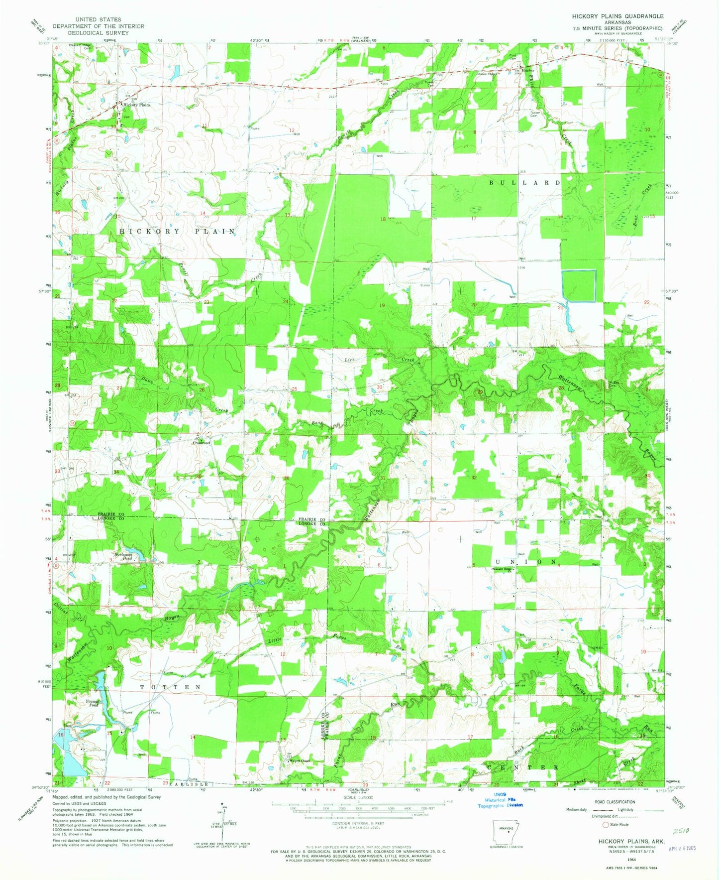
Classic USGS Hickory Plains Arkansas 7.5'x7.5' Topo Map
Couldn't load pickup availability
Historical USGS topographic quad map of Hickory Plains in the state of Arkansas. Map scale may vary for some years, but is generally around 1:24,000. Print size is approximately 24" x 27"
This quadrangle is in the following counties: Lonoke, Prairie.
The map contains contour lines, roads, rivers, towns, and lakes. Printed on high-quality waterproof paper with UV fade-resistant inks, and shipped rolled.
Contains the following named places: Arkansas Noname 12 Dam, Arkansas Noname 13 Dam, Bane Creek, Big Pond Dam, Brown Grove School, Brown Grove Volunteer Fire Department, Buck Creek, Burlesons Pond, Collins Creek, Cross Roads Church, Cross Roads School, Crossroad, Crossroads Volunteer Fire Department, Dunn Creek, Ford Cemetery, Hayley, Hickory Plains, Hickory Plains Church, Hickory Plains Post Office, Hickory Plains School, Hodges School, Johnson Chapel, Johnson Chapel Cemetery, Johnson Chapel School, Lick Creek, Little Faras Run, Little Pond, Little Pond Dam, McBee Cemetery, McBy Church, McCallie - North Lake, McCallie - South Reservoir, Murdocks Mill, Omni Corporation Pond Dam, Omni Pond, Peters School, Plainview School, Pleasant Ridge Cemetery, Pleasant Ridge Church, Powell Cemetery, Reservoir Number One, Short Creek, Township of Bullard, Township of Hickory Plain, Township of Union, Tucker Cemetery, Uzzett, Walters Chapel, Walters Chapel Cemetery, Winborn School, Youngs Pond, Youngs Reservoir Number One Dam