MyTopo
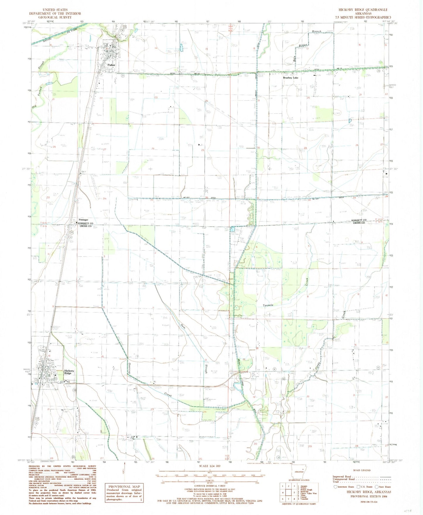
Classic USGS Hickory Ridge Arkansas 7.5'x7.5' Topo Map
Couldn't load pickup availability
Historical USGS topographic quad map of Hickory Ridge in the state of Arkansas. Map scale may vary for some years, but is generally around 1:24,000. Print size is approximately 24" x 27"
This quadrangle is in the following counties: Cross, Poinsett.
The map contains contour lines, roads, rivers, towns, and lakes. Printed on high-quality waterproof paper with UV fade-resistant inks, and shipped rolled.
Contains the following named places: Bale Brown Branch, Brushey Lake, Bushy Creek Ditch, Caney Creek, City of Fisher, City of Hickory Ridge, Cooper Pond, Ditch Number 15, Fisher, Fisher Post Office, Fisher Volunteer Fire Department, Gum Slough, Hickory Ridge, Hickory Ridge Elementary School, Hickory Ridge High School, Hickory Ridge Post Office, Hickory Ridge Volunteer Fire Station, McCoy Ditch, One Mile Branch, Overcup Creek, Pittinger, Township of Hickory Ridge, Twomile Creek, Wyatts Cemetery