MyTopo
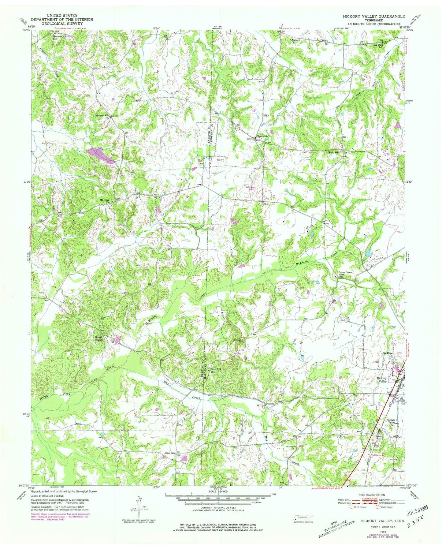
Classic USGS Hickory Valley Tennessee 7.5'x7.5' Topo Map
Couldn't load pickup availability
Historical USGS topographic quad map of Hickory Valley in the state of Tennessee. Map scale may vary for some years, but is generally around 1:24,000. Print size is approximately 24" x 27"
This quadrangle is in the following counties: Fayette, Hardeman.
The map contains contour lines, roads, rivers, towns, and lakes. Printed on high-quality waterproof paper with UV fade-resistant inks, and shipped rolled.
Contains the following named places: Antioch Church, Fletcher Church, Flying D Airport, Hardeman County Rescue Squad, Henleys Store, Hickory Valley, Hickory Valley Baptist Church, Hickory Valley Post Office, Hickory Valley School, Hickory Valley Volunteer Fire Department, Jones Grove School, Jopic School, May Creek, May Hill School, McKinnie Creek, Morrow Hill Church, Morrow Hill School, Mount Comfort Cemetery, Mount Hope Church, Mount Olive Cemetery, Mount Olive Church, Newcastle, Oak Dain School, Polk School, Shady Grove Church, Stuart Chapel, Tanyard, Terra Alta Dam, Terra Alta Lake, Town of Hickory Valley, Wings Field, Woods Cemetery, ZIP Code: 38042