MyTopo
Classic USGS Hico Kentucky 7.5'x7.5' Topo Map
Couldn't load pickup availability
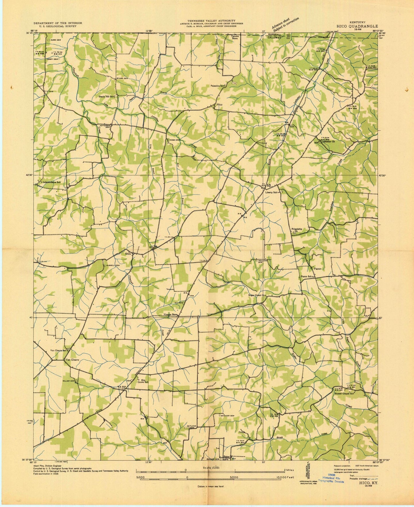
Historical USGS topographic quad map of Hico in the state of Kentucky. Map scale may vary for some years, but is generally around 1:24,000. Print size is approximately 24" x 27"
This quadrangle is in the following counties: Calloway, Marshall.
The map contains contour lines, roads, rivers, towns, and lakes. Printed on high-quality waterproof paper with UV fade-resistant inks, and shipped rolled.
Contains the following named places: Barnett Cemetery, Bonner Cemetery, Brush Creek, Burr Branch, Buzzard Roost, Byars Cemetery, Calloway County Fire and Rescue Station 3, Crisp Branch, Curd Cemetery, Elm Grove Cemetery, Elm Grove Church, Faxon, Faxon School, Friendship Cemetery, Friendship Church, Harris Cemetery, Hico, Holland Cemetery, Hopkins Branch, Independence, Independence School, Irvin Cobb Resort, Ivy Cemetery, Jeffrey Cemetery, Kenlake State Park, Ledbetter Church, Liberty, Liberty Church, Little Jonathan Creek, Little Sugar Creek, McDaniel Cemetery, Miller Cemetery, Outland Cemetery, Palestine, Palestine Cemetery, Palestine Church, Roberts Cemetery, Ross Cemetery, Russell Cemetery, Russell Chapel, Russell Chapel Cemetery, Sage Hill Cemetery, Shiloh, Shiloh Cemetery, Shiloh Division, Skinner Cemetery, Smithson Cemetery, Sugar Creek, Sugar Creek Church, Terry Cemetery, Van Cleave, Wall Cemetery, Winters Cemetery, ZIP Code: 42036