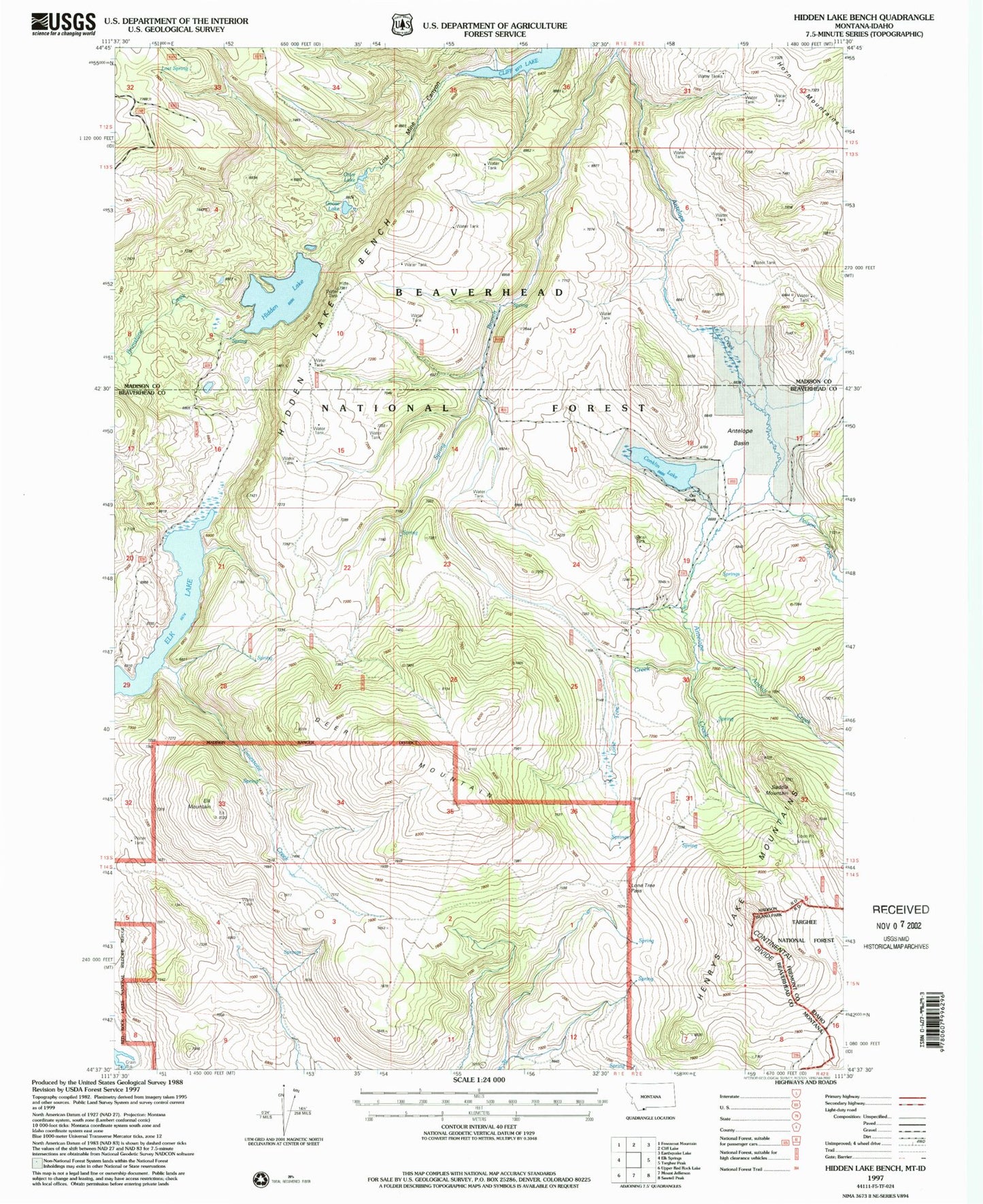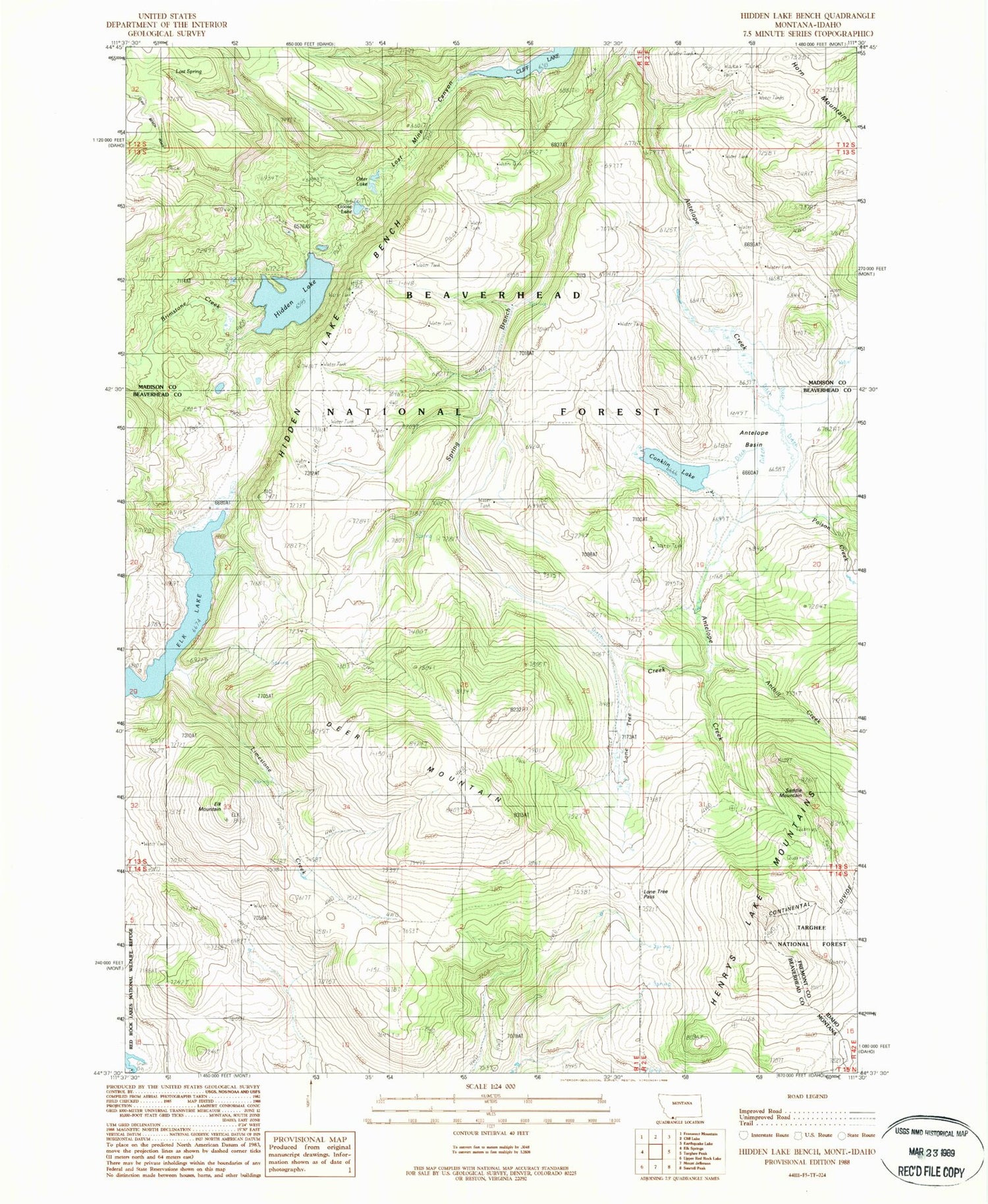
MyTopo
Classic USGS Hidden Lake Bench Montana 7.5'x7.5' Topo Map
Couldn't load pickup availability
Historical USGS topographic quad map of Hidden Lake Bench in the state of Montana. Typical map scale is 1:24,000, but may vary for certain years, if available. Print size: 24" x 27"
This quadrangle is in the following counties: Beaverhead, Fremont, Madison.
The map contains contour lines, roads, rivers, towns, and lakes. Printed on high-quality waterproof paper with UV fade-resistant inks, and shipped rolled.
Contains the following named places: Conklin Lake, Antelope Creek, Antelope Basin, Anthill Creek, Brimstone Creek, Deer Mountain, Elk Lake, Elk Mountain, Goose Lake, Hidden Lake, Hidden Lake Bench, Hidden Lake Camp Ground, Limestone Creek, Lone Tree Creek, Lone Tree Pass, Lost Mine Canyon, Lost Spring, Orr Ranch, Otter Lake, Poison Creek, Saddle Mountain, Spring Branch, Horn Mountains, 14S02E07CBAD01 Spring, 14S02E06CCCB01 Spring, 13S01E36DDD_01 Spring, 13S01E33AAC_01 Spring, 13S01E28AACD01 Spring