MyTopo
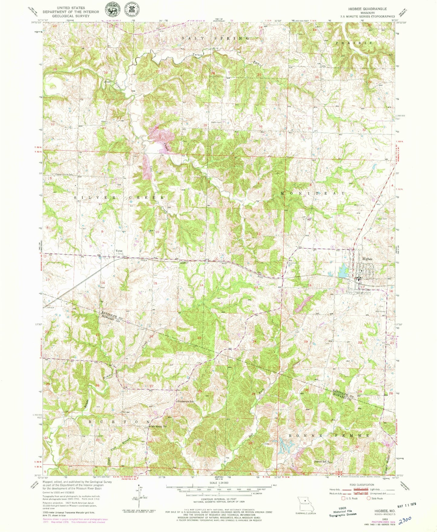
Classic USGS Higbee Missouri 7.5'x7.5' Topo Map
Couldn't load pickup availability
Historical USGS topographic quad map of Higbee in the state of Missouri. Map scale may vary for some years, but is generally around 1:24,000. Print size is approximately 24" x 27"
This quadrangle is in the following counties: Howard, Randolph.
The map contains contour lines, roads, rivers, towns, and lakes. Printed on high-quality waterproof paper with UV fade-resistant inks, and shipped rolled.
Contains the following named places: Bagby Cemetery, City of Higbee, Coal Creek, Dover School, Ebenezer School, Hickory Grove School, Higbee, Higbee Area Fire Protection District, Higbee Cemetery, Higbee Elementary School, Higbee High School, Higbee Lake, Higbee Lake Dam, Higbee Post Office, McDonald Mine, Mount Ararat Church, Old Higbee School, Pemberton School, Possum School, Ross Lake Dam, Russell, Shady Oaks Lake Dam, Township of Moniteau, Turner Fork, Walnut Grove School, Whitmore Cemetery, Yates, Yates School, ZIP Code: 65257