MyTopo
Classic USGS High Falls Reservoir Wisconsin 7.5'x7.5' Topo Map
Couldn't load pickup availability
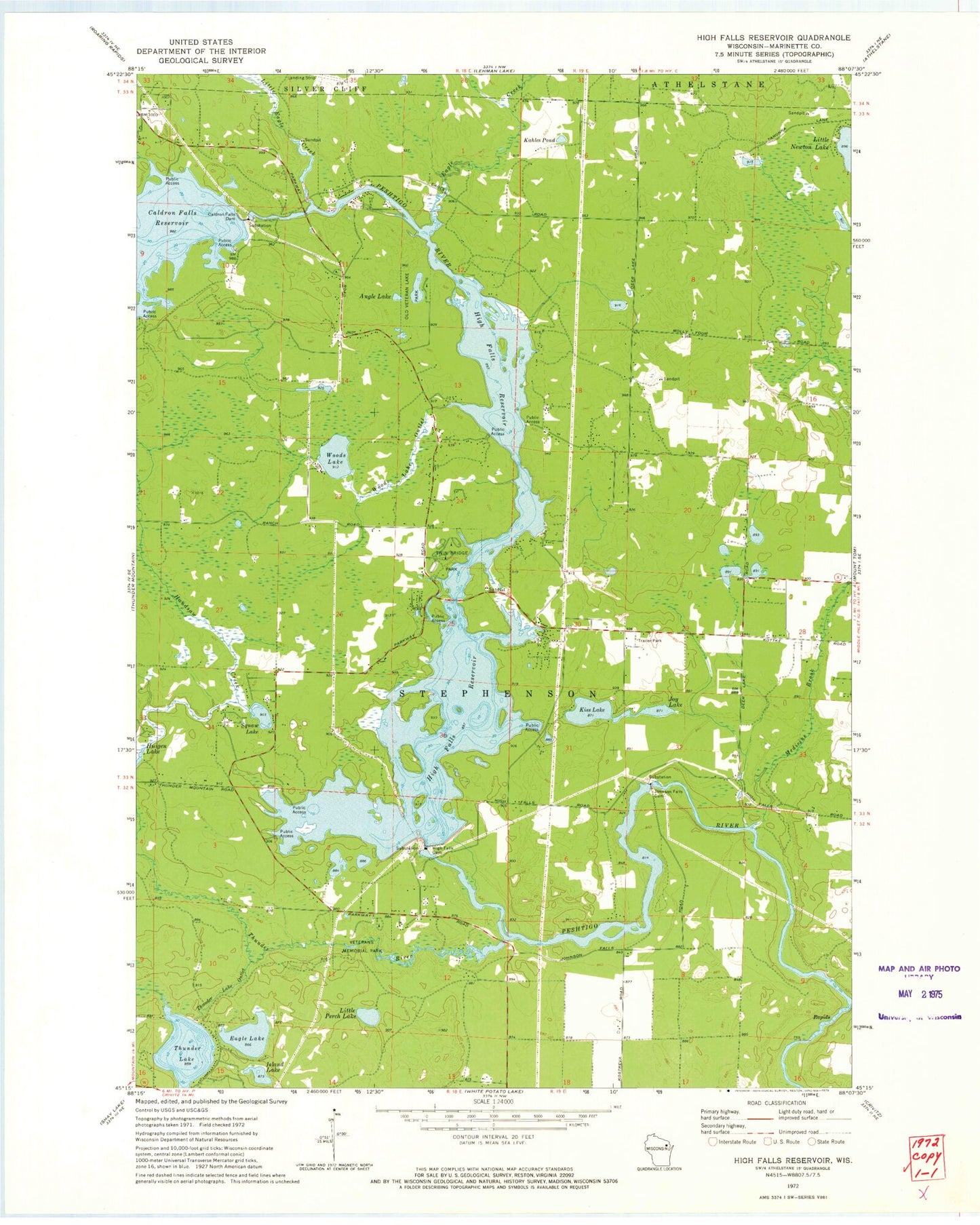
Historical USGS topographic quad map of High Falls Reservoir in the state of Wisconsin. Typical map scale is 1:24,000, but may vary for certain years, if available. Print size: 24" x 27"
This quadrangle is in the following counties: Marinette.
The map contains contour lines, roads, rivers, towns, and lakes. Printed on high-quality waterproof paper with UV fade-resistant inks, and shipped rolled.
Contains the following named places: Angle Lake, Caldron Falls Dam, Eagle Creek, Eagle Lake, High Falls Dam, High Falls Reservoir, Island Lake, Johnson Falls Dam, Joy Lake, Kahles Pond, Kiss Lake, Little Eagle Creek, Little Perch Lake, Medicine Brook, Old Veteran Lake Park, Squaw Lake, Thunder Lake, Thunder Lake Outlet, Twin Bridge Park, Woods Lake, Woods Lake Outlet, Huigen Lake, Thunder Lake Inlet, Thunder River, Neveln Field Airport (historical), Town of Stephenson, Glen Lake Dam, Kiss Lake, High Falls 2WP928 Dam, Johnson Falls WP 153 Dam, Johnson Falls Flowage 647, Caldron Falls WP186 Dam, Caldron Falls Reservoir 496, Caldron Falls School (historical), High Falls School (historical), Old Veterans Lake, Veterans Memorial Park, Stephenson Volunteer Fire Department Town Hall Station, Medbrook Lake