MyTopo
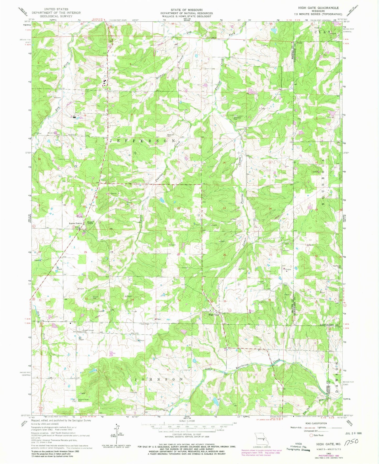
Classic USGS High Gate Missouri 7.5'x7.5' Topo Map
Couldn't load pickup availability
Historical USGS topographic quad map of High Gate in the state of Missouri. Map scale may vary for some years, but is generally around 1:24,000. Print size is approximately 24" x 27"
This quadrangle is in the following counties: Gasconade, Maries, Phelps.
The map contains contour lines, roads, rivers, towns, and lakes. Printed on high-quality waterproof paper with UV fade-resistant inks, and shipped rolled.
Contains the following named places: Bowles Chapel Cemetery, Cook Cemetery, Cowan Lake Dam, Dixie School, East Fairview School, Grove Dale Cemetery, Grovedale, Grovedale Church, Grovedale School, Harrison Center School, Hart Cemetery, Hickory Grove Cemetery, Hickory Grove Church, Hidden Lake Dam, High Gate, High Gate Cemetery, Hoffmann Lake Dam, Holman Branch, Lanes Prairie, Love Cemetery, Lower Peavine Creek, Moreland Cemetery, Number 69 Lake, Number 70 Lake, Oak Forest Cemetery, Peavine Creek, Pin Oak Branch, Shinkles School, Skaggs Chapel, Slinkman Lake Dam, Township of Jefferson, Upper Peavine Creek, Walker Family Cemetery, Wensler Lake Dam, Whippoorwill Hill Farm Lake, Whippoorwill Lake Dam, Yarna