MyTopo
Classic USGS High Plateau Mountain California 7.5'x7.5' Topo Map
Couldn't load pickup availability
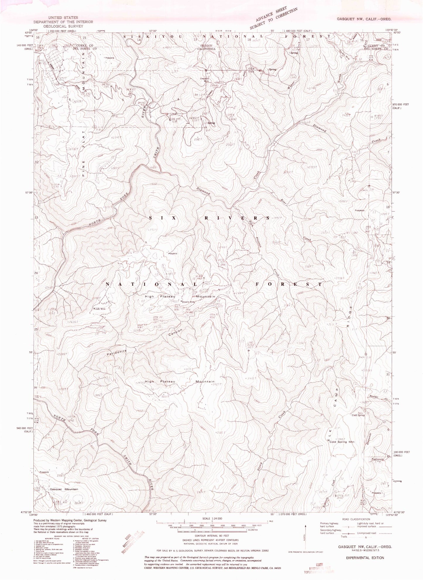
Historical USGS topographic quad map of High Plateau Mountain in the states of California, Oregon. Map scale may vary for some years, but is generally around 1:24,000. Print size is approximately 24" x 27"
This quadrangle is in the following counties: Curry, Del Norte.
The map contains contour lines, roads, rivers, towns, and lakes. Printed on high-quality waterproof paper with UV fade-resistant inks, and shipped rolled.
Contains the following named places: Bear Creek, Big Boy Mine, Bluebird Mine, Bonanza Mine, Browns Mine, Cedar Creek, Cleopatra Mine, Cold Spring, Cold Spring Mountain, Diamond Creek, Diamond Creek Mine, Elk Camp, Elk Camp Ridge, Elk Camp Ridge Trail, Gasquet Mountain, High Plateau Creek, High Plateau Mountain, Judy Mine, Lee Brown Ranch, North Fork Diamond Creek, Peridotite Canyon, Pine Flat Chromite Mine, Pine Flat Mountain, Rockland, Skyline Mine, Still Creek, Sunny Brook Prospect, Tangarene Mine, Toujours Gal Mine, Webb Mine, Wimer Creek