MyTopo
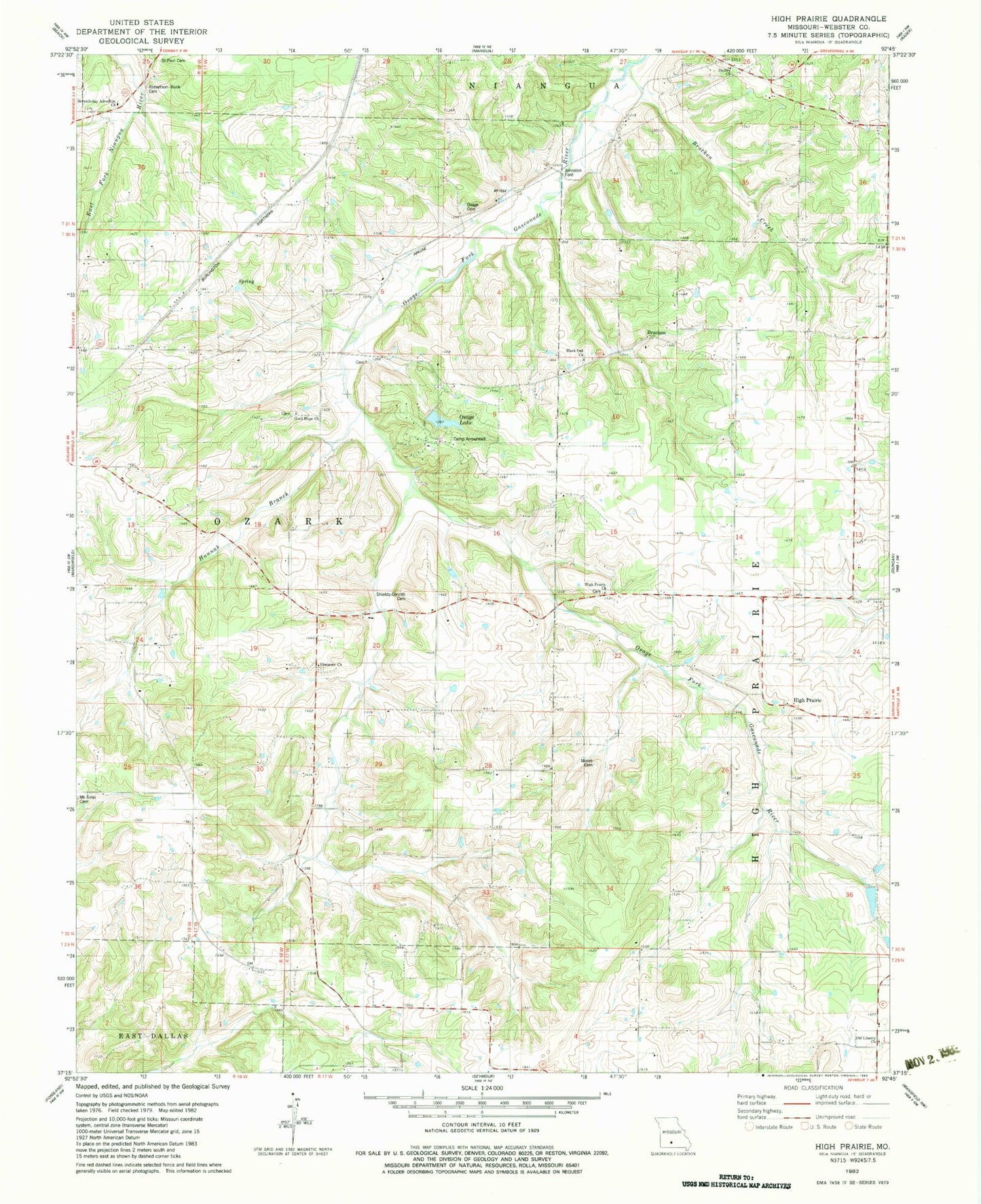
Classic USGS High Prairie Missouri 7.5'x7.5' Topo Map
Couldn't load pickup availability
Historical USGS topographic quad map of High Prairie in the state of Missouri. Map scale may vary for some years, but is generally around 1:24,000. Print size is approximately 24" x 27"
This quadrangle is in the following counties: Webster.
The map contains contour lines, roads, rivers, towns, and lakes. Printed on high-quality waterproof paper with UV fade-resistant inks, and shipped rolled.
Contains the following named places: Black Oak Cemetery, Black Oak Church, Black Oak School, Bracken, Bracken Bridge, Bracken Creek, Burk Bridge Company East Lake Dam, Burk Bridge Company West Lake Dam, Camp Arrowhead, Camp Arrowhead Dam, Corinth Church, Dudley Church, Ebenezer Church, Eighty Eight School, Good Hope Church, Good Hope School, Hannah Branch, High Prairie, High Prairie Church, High Prairie School, Johnston Ford, Letchworth School, Moore Cemetery, Old Liberty Church, Osage Church, Osage Lake, Osage School, Rader Bridge Cemetery, Rocky Point School, Saint Paul Cemetery, Seventh Day Adventist Church, Shields - Corinth Cemetery, Township of East Ozark, Township of High Prairie, Wells Airport