
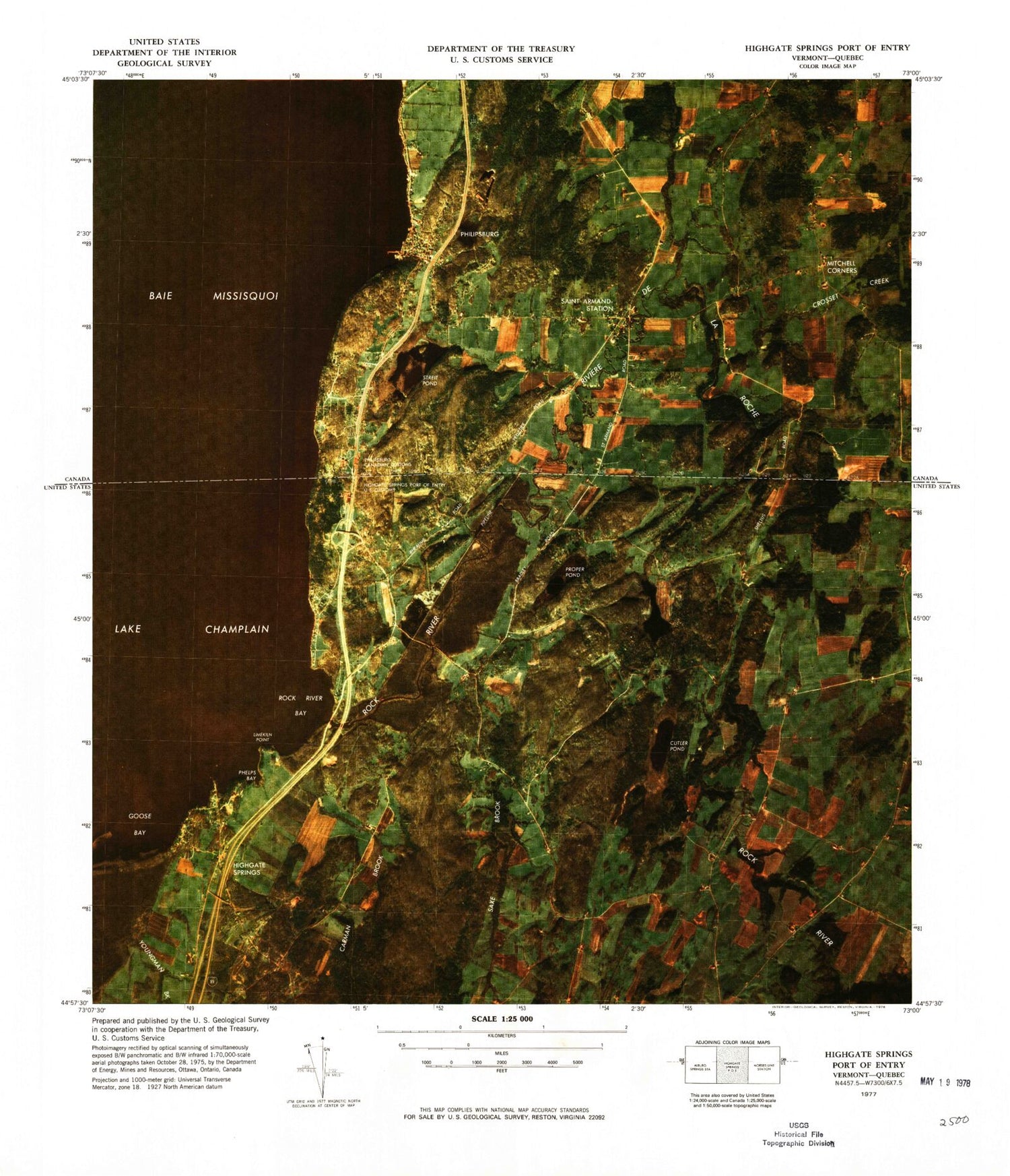
MyTopo
Classic USGS Highgate Springs Port of Entry Vermont 7.5'x7.5' Topo Map
Couldn't load pickup availability
Historical USGS topographic quad map of Highgate Springs Port of Entry in the state of Vermont. Map scale may vary for some years, but is generally around 1:24,000. Print size is approximately 24" x 27"
This quadrangle is in the following counties: Franklin.
The map contains contour lines, roads, rivers, towns, and lakes. Printed on high-quality waterproof paper with UV fade-resistant inks, and shipped rolled.
Contains the following named places: Brewer Cemetery, Carman Brook, Carman Cemetery, Cutler Pond, De La Bruere Dairy, Deal Cemetery, Highgate Springs, Highgate Springs Census Designated Place, Highgate Springs Post Office, J G Saxes Monument, Limekiln Point, Phelps Bay, Platt Cemetery, Proper Pond, Rock River, Rock River Bay, Rock River Bridge, Saxe Brook, Sherwood Cemetery, Steele Brook, Sternes Cemetery, Stimet Cemetery, Town of Highgate, Youngman Brook


