MyTopo
Classic USGS Highland East Wisconsin 7.5'x7.5' Topo Map
Couldn't load pickup availability
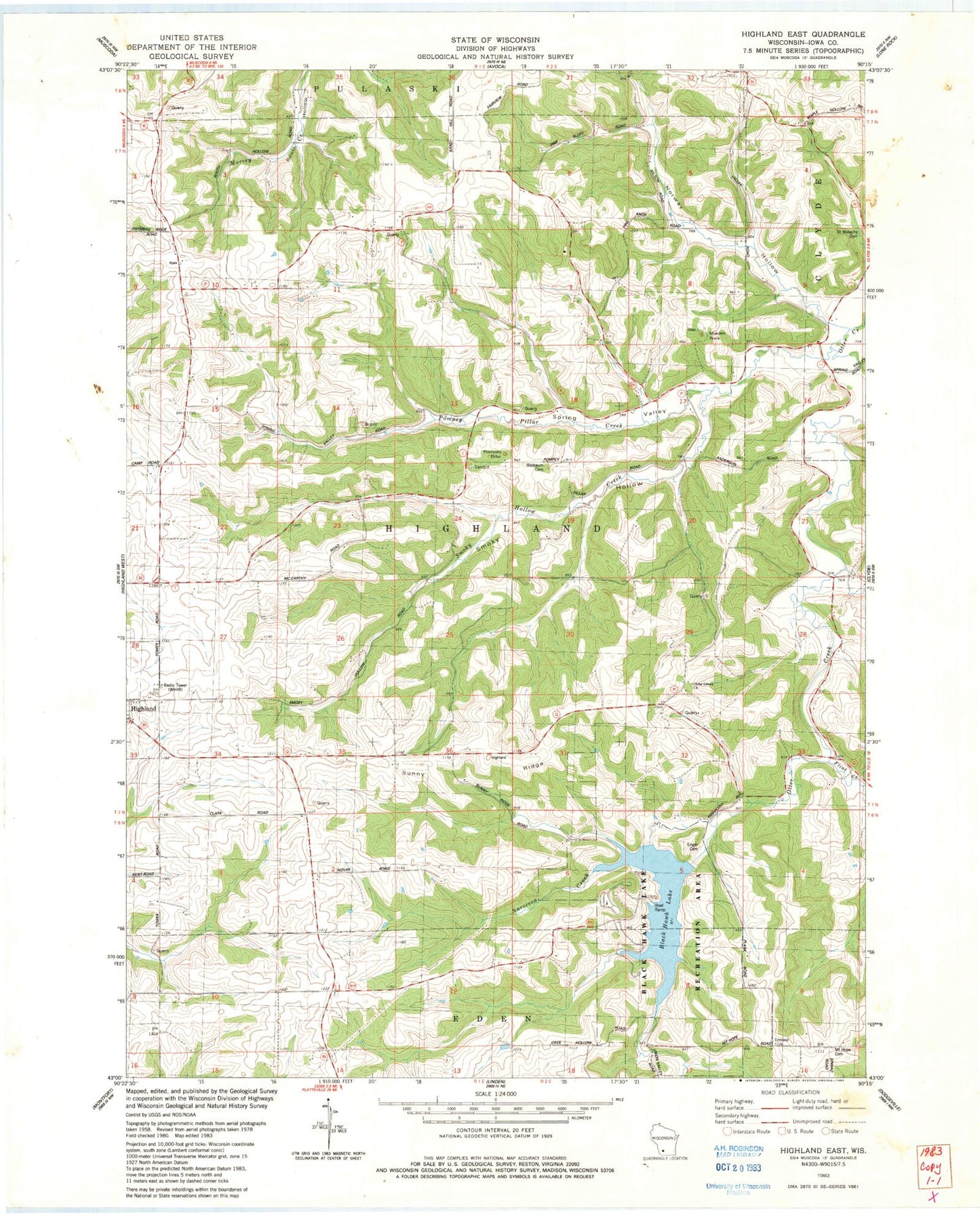
Historical USGS topographic quad map of Highland East in the state of Wisconsin. Map scale may vary for some years, but is generally around 1:24,000. Print size is approximately 24" x 27"
This quadrangle is in the following counties: Iowa.
The map contains contour lines, roads, rivers, towns, and lakes. Printed on high-quality waterproof paper with UV fade-resistant inks, and shipped rolled.
Contains the following named places: Big Spring School, Blabaum Cemetery, Black Hawk Lake, Black Hawk Lake Recreation Area, Blackhawk Lake Dam, Dickinson Creek, Dorota H 581 Dam, Enger Cemetery, Flint Creek, Forest Field School, Hackl Quarry, Maiden Rock, Mount Hope Cemetery, Norway Hollow, Norway Hollow Creek, Otter Creek Church, Pierick Airport, Pine Knob School, Pompey Pillar, Pompey Pillar Creek, Smoky Hollow, Smoky Hollow Creek, Spring Valley, Spring Valley Church, Strawberry School, Sunny Ridge, Town of Highland, Union Mill School, WHHI-FM (Highland), ZIP Code: 53543