MyTopo
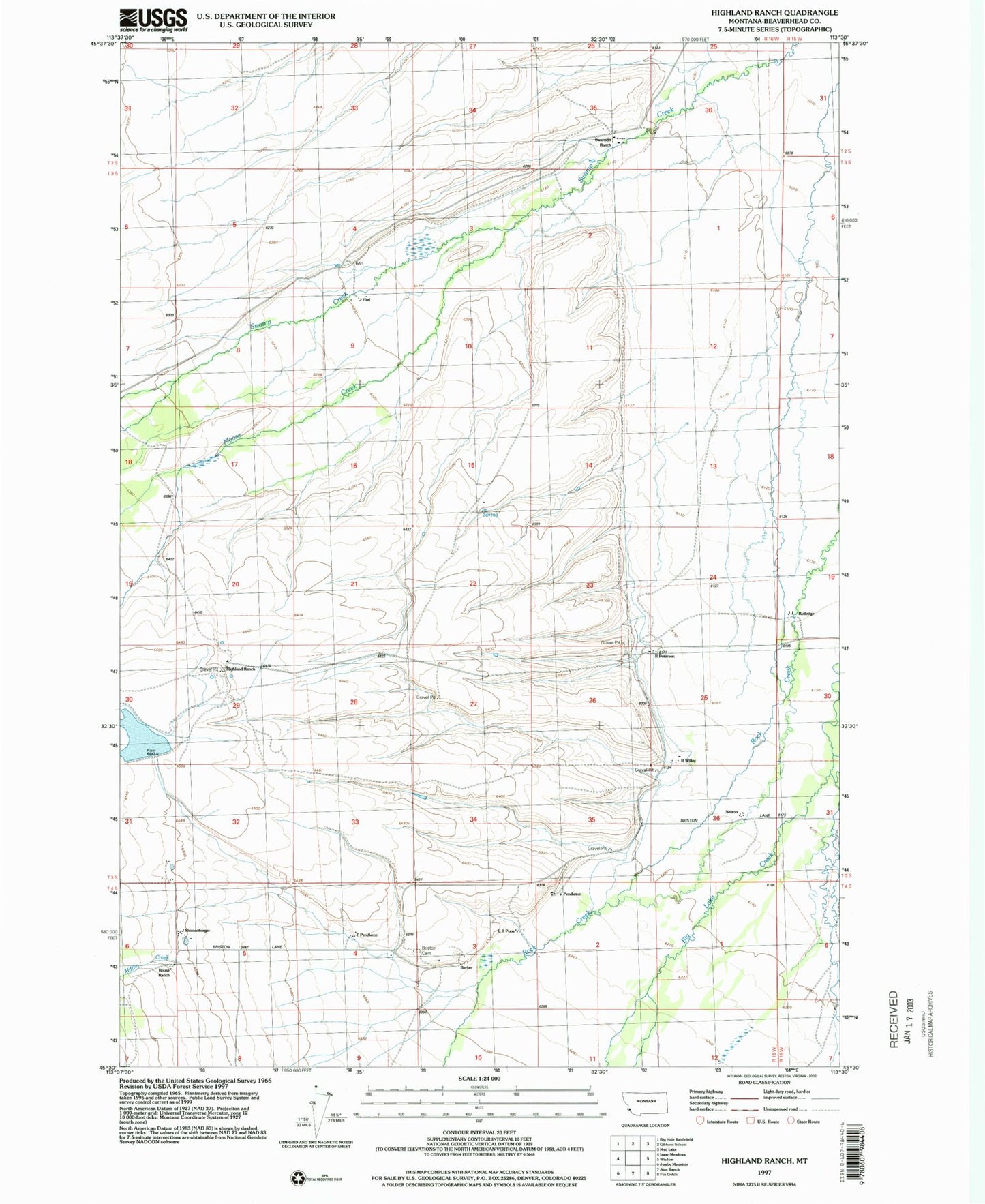
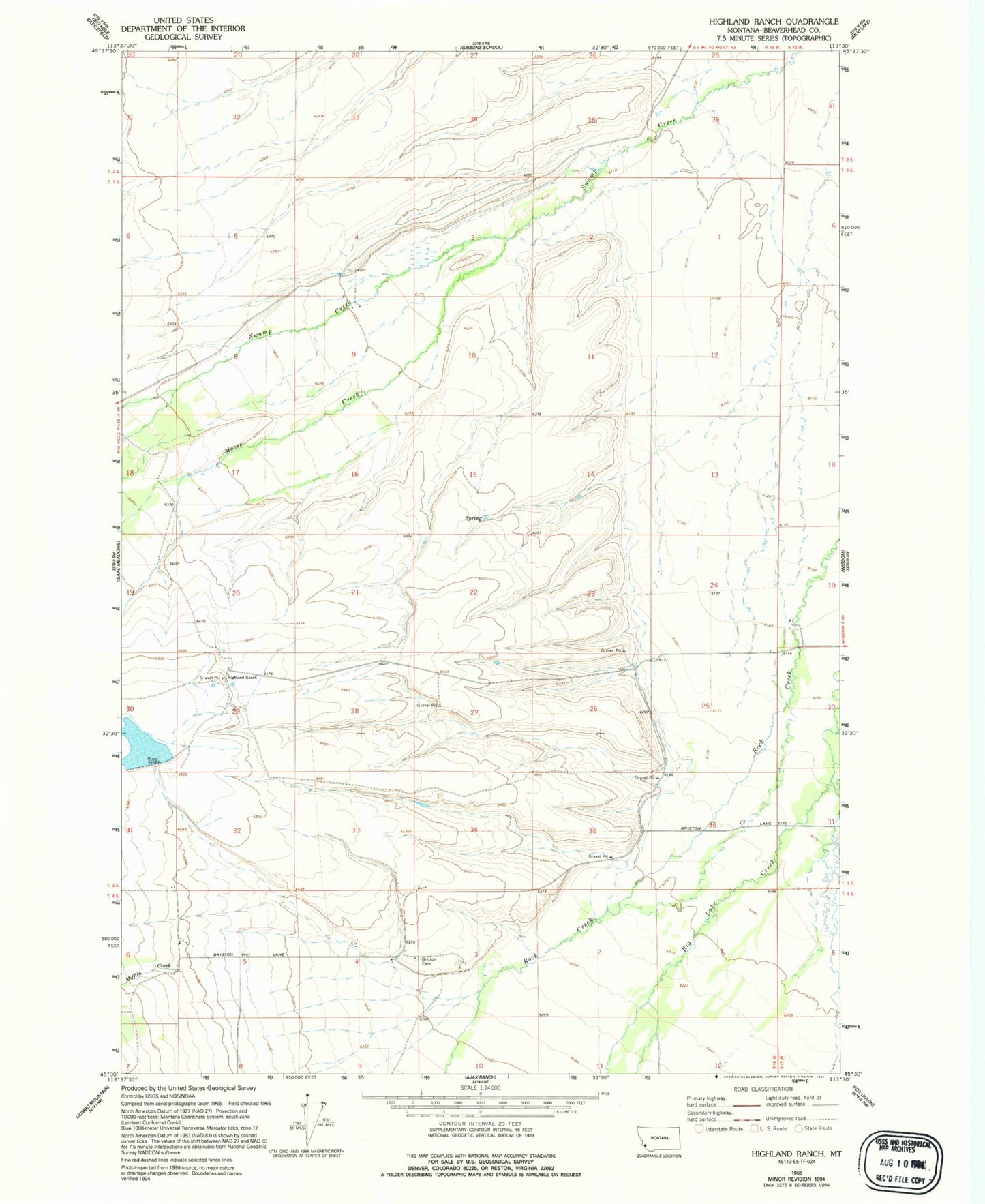
Classic USGS Highland Ranch Montana 7.5'x7.5' Topo Map
Couldn't load pickup availability
Historical USGS topographic quad map of Highland Ranch in the state of Montana. Map scale may vary for some years, but is generally around 1:24,000. Print size is approximately 24" x 27"
This quadrangle is in the following counties: Beaverhead.
The map contains contour lines, roads, rivers, towns, and lakes. Printed on high-quality waterproof paper with UV fade-resistant inks, and shipped rolled.
Contains the following named places: 03S16W09ABBC01 Well, 03S16W31DDAD01 Well, 03S16W31DDDD01 Well, 03S16W36ACDA01 Well, 03S16W36ACDD01 Well, 04S16W03CBBB01 Well, 04S16W06DAAA01 Well, 04S16W06DAAD01 Well, Alps Mine, Briston Cemetery, Briston Post Office, Briston School, Highland Ranch, Hirschy Dam, Hirschy Reservoir, Mifflin Creek, Moose Creek, Nelson, R Willey