MyTopo
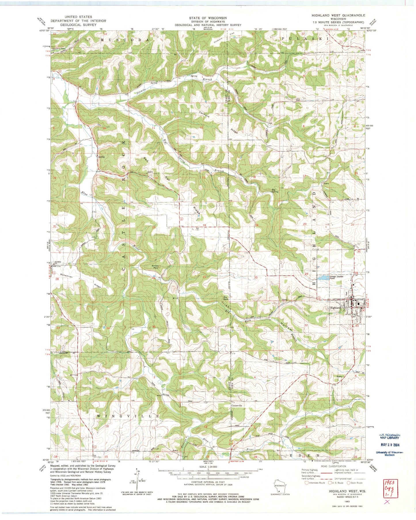
Classic USGS Highland West Wisconsin 7.5'x7.5' Topo Map
Couldn't load pickup availability
Historical USGS topographic quad map of Highland West in the state of Wisconsin. Typical map scale is 1:24,000, but may vary for certain years, if available. Print size: 24" x 27"
This quadrangle is in the following counties: Grant, Iowa.
The map contains contour lines, roads, rivers, towns, and lakes. Printed on high-quality waterproof paper with UV fade-resistant inks, and shipped rolled.
Contains the following named places: Badger Hollow, Big Rock, Big Rock Branch, Big Spring, Big Spring Branch, Blue River Mill School, Blue River Valley Church, Bohemian Ridge, Brick School, Farmers Ridge, Farmers Ridge School, Highland, Pipal Cemetery, Red Oak Ridge, Red Oak School, Saint Johns Church, Sixmile Branch, Sunset Rock, Badger Hollow Creek, Bronson Creek, Centerville, Town of Castle Rock, Village of Highland, Irish Hollow, Highland Volunteer Fire Department, Highland Ambulance Service, Highland Wastewater Treatment Facility, Highland Elementary School, Highland High School, Highland Police Department, Highland Post Office