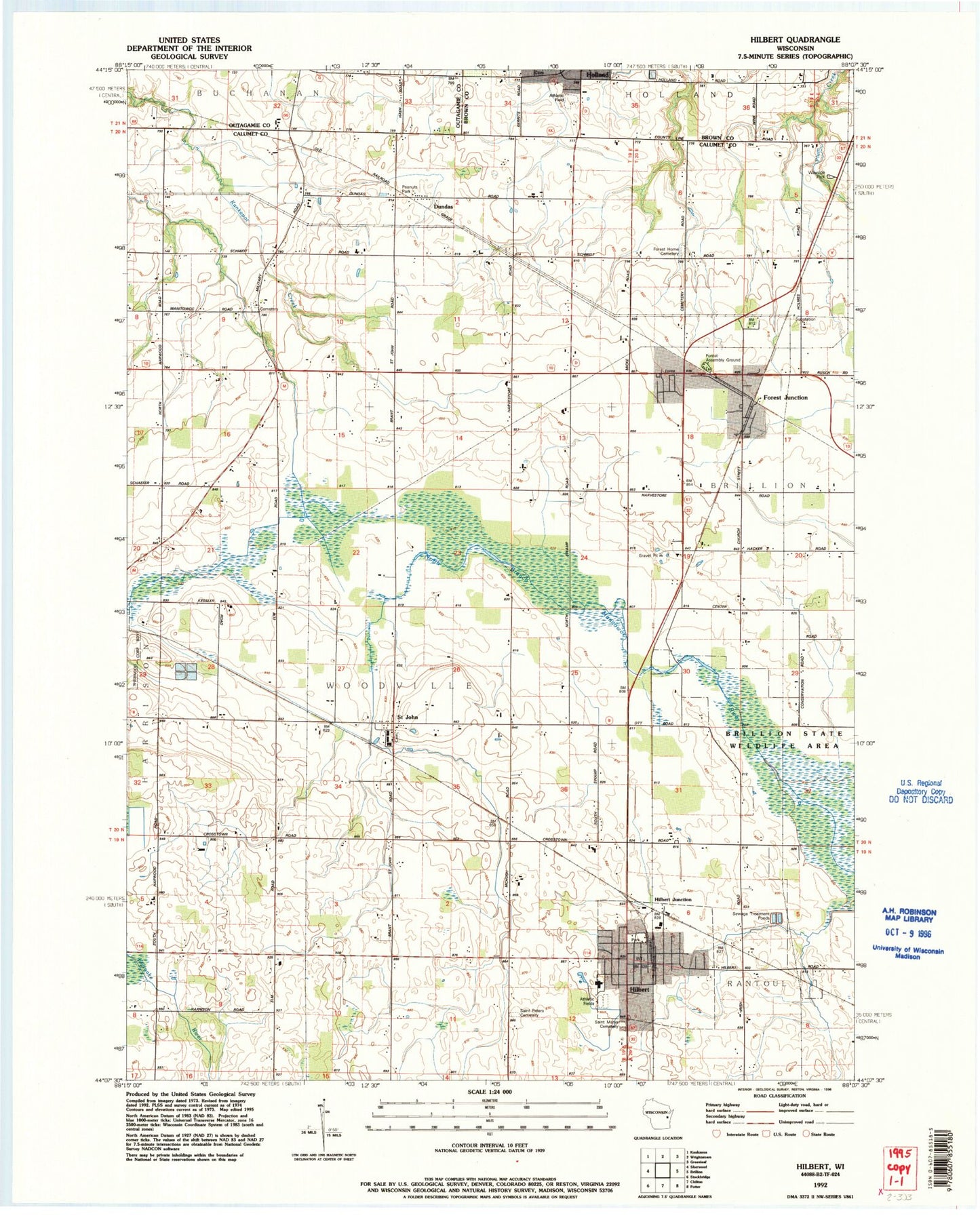
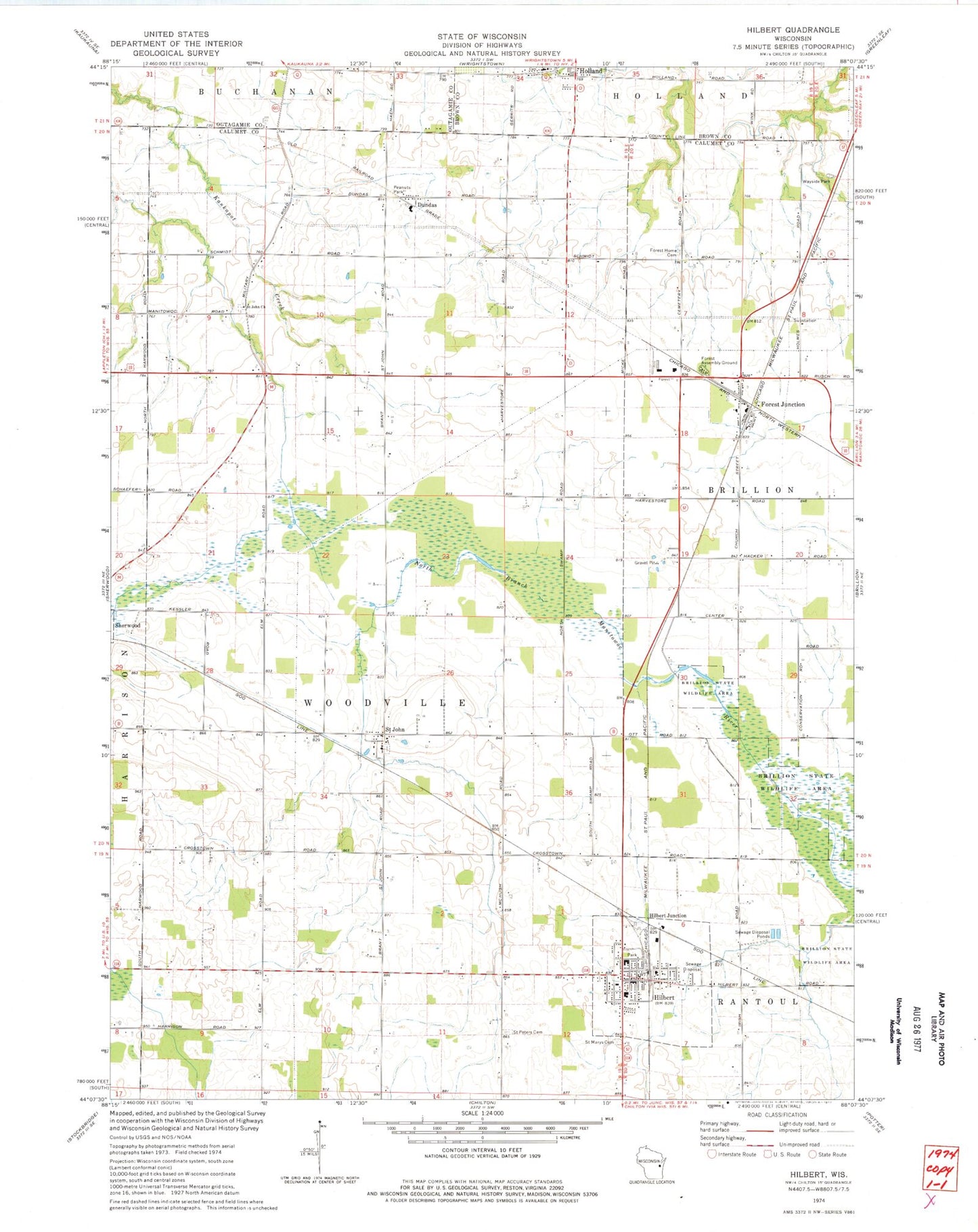
MyTopo
Classic USGS Hilbert Wisconsin 7.5'x7.5' Topo Map
Couldn't load pickup availability
Historical USGS topographic quad map of Hilbert in the state of Wisconsin. Map scale may vary for some years, but is generally around 1:24,000. Print size is approximately 24" x 27"
This quadrangle is in the following counties: Brown, Calumet, Outagamie.
The map contains contour lines, roads, rivers, towns, and lakes. Printed on high-quality waterproof paper with UV fade-resistant inks, and shipped rolled.
Contains the following named places: Byron School, Dundas, Forest Assembly Ground, Forest Home Cemetery, Forest Junction, Forest Junction Census Designated Place, Forest Junction Post Office, Forest Junction Volunteer Fire Department, Foxden Dairy Farms, Hilbert, Hilbert Elementary School, Hilbert High School, Hilbert Junction, Hilbert Post Office, Hilbert School, Hilbert Village Volunteer Fire Department, Hilbert Wastewater Treatment Plant, Holland, Holland Town Fire Department, Holmes School, Howe School, Jackson School, Longfellow School, Peanuts Park, Saint John, Saint John Church, Saint John Lutheran Cemetery, Saint Johns Catholic Cemetery, Saint Mary Catholic School, Saint Marys Catholic Church, Saint Mary's Cemetery, Saint Peter Cemetery, Saint Peter Lutheran Church, Saint Peter Lutheran School, Town of Woodville, Village of Hilbert, Webster School, ZIP Codes: 54123, 54129