MyTopo
Classic USGS Hildreth Peak California 7.5'x7.5' Topo Map
Couldn't load pickup availability
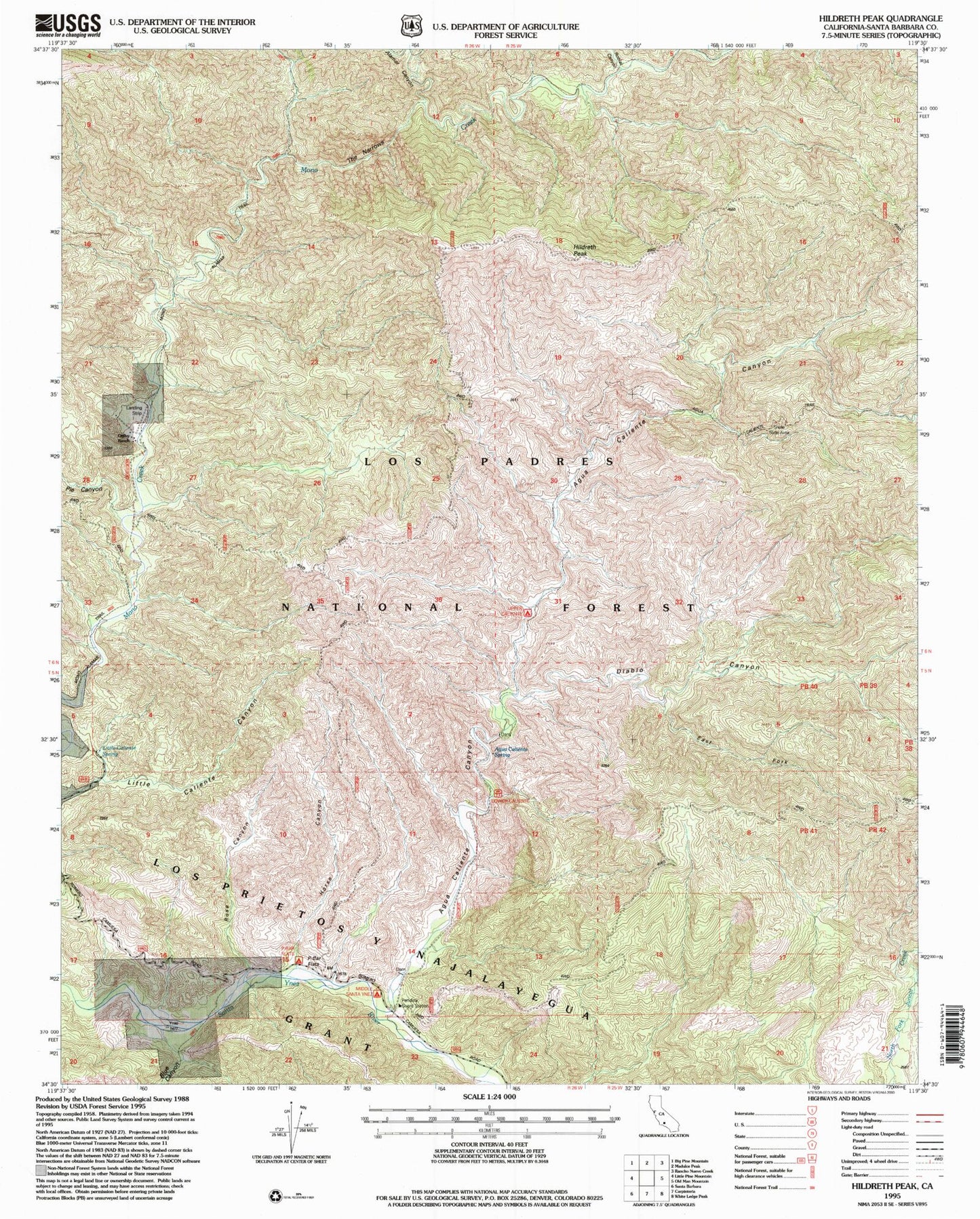
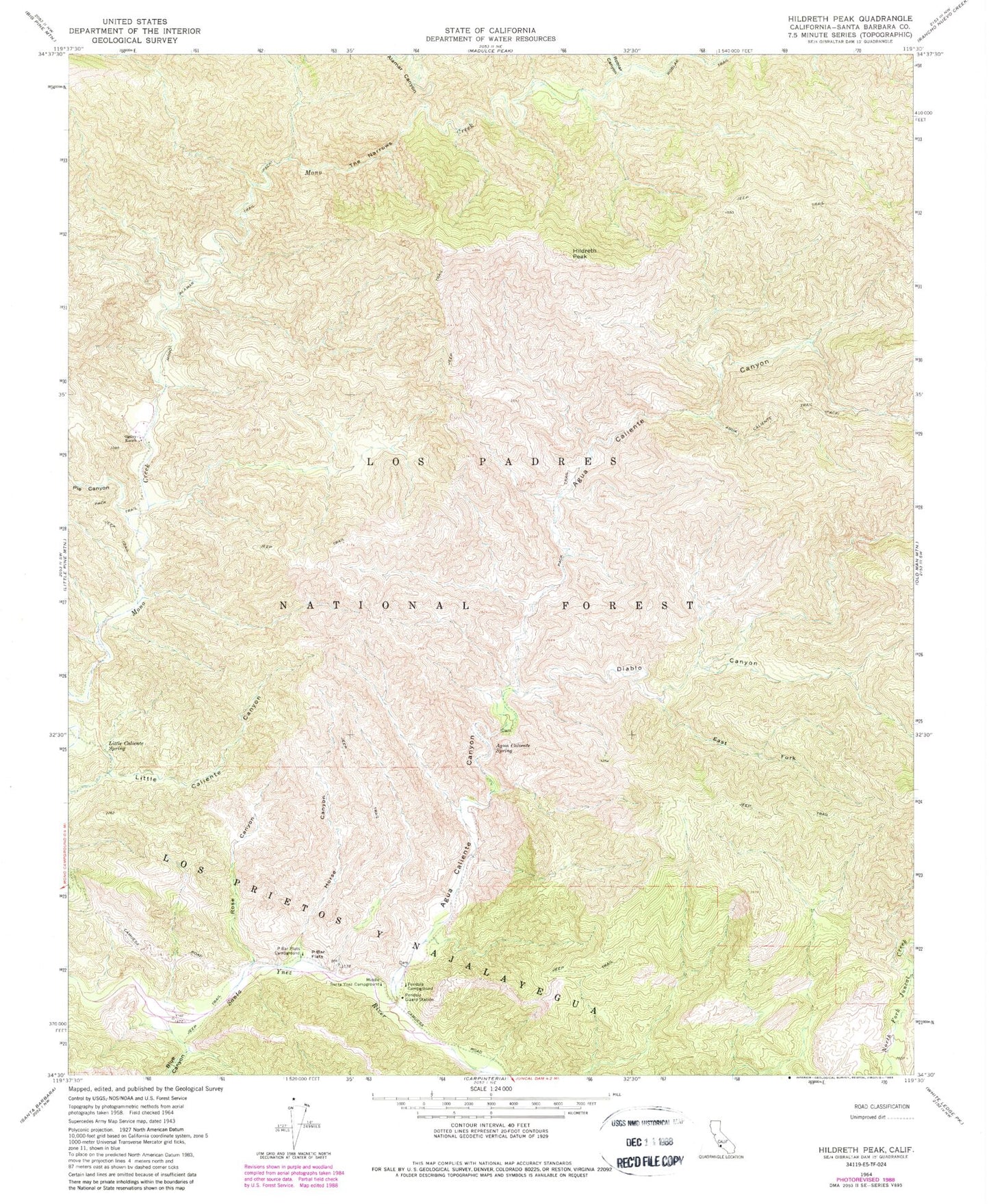
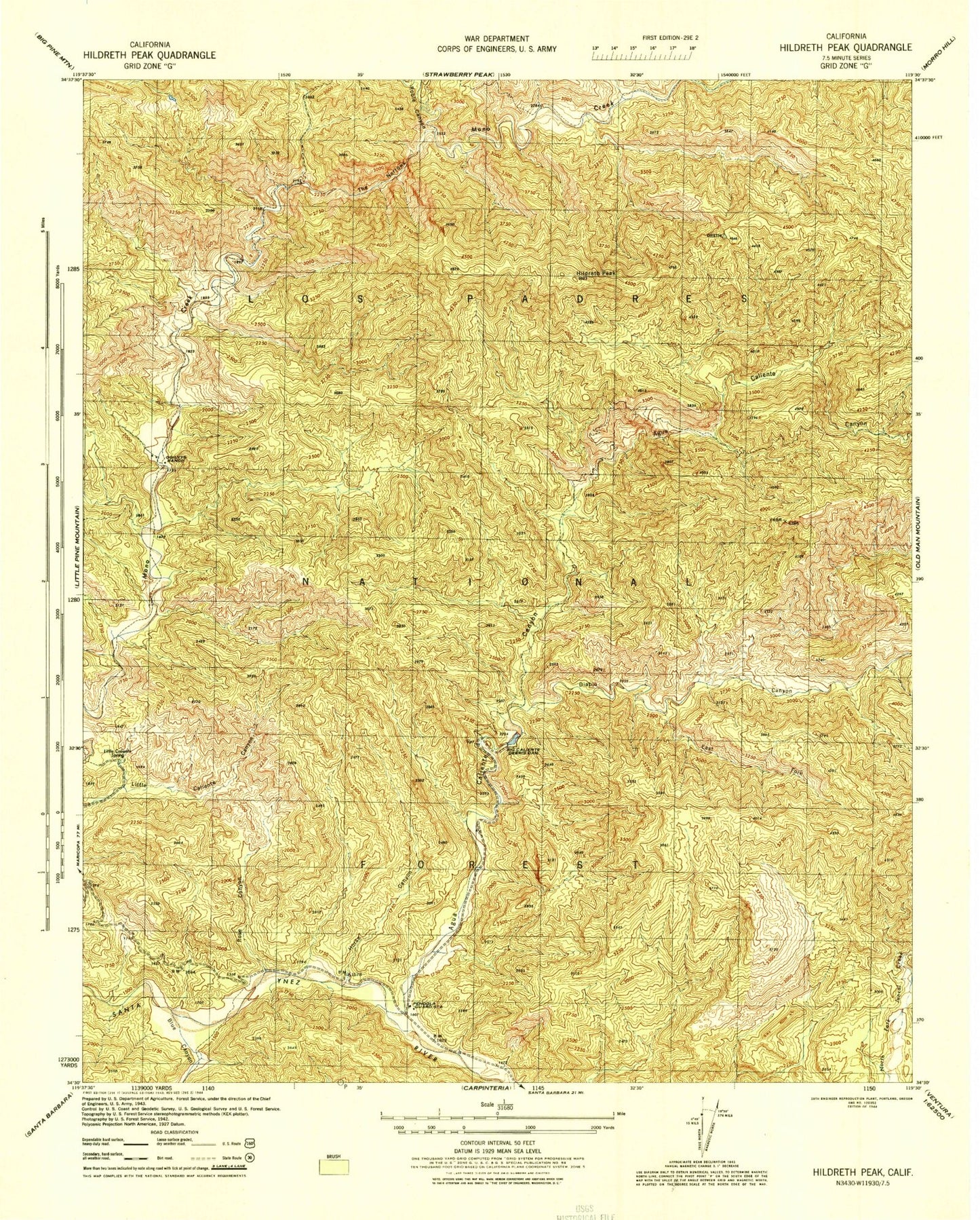
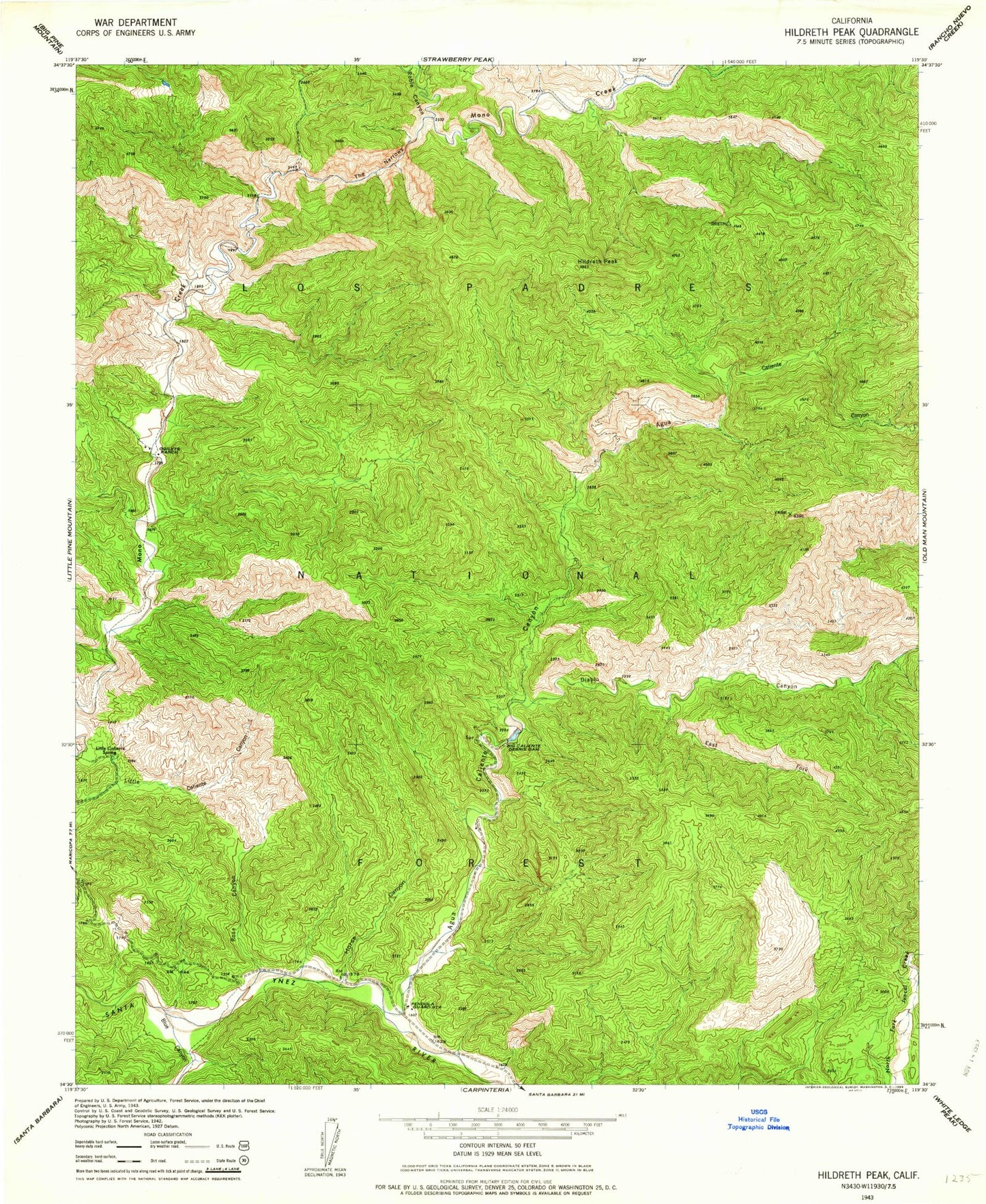
Historical USGS topographic quad map of Hildreth Peak in the state of California. Map scale may vary for some years, but is generally around 1:24,000. Print size is approximately 24" x 27"
This quadrangle is in the following counties: Santa Barbara.
The map contains contour lines, roads, rivers, towns, and lakes. Printed on high-quality waterproof paper with UV fade-resistant inks, and shipped rolled.
Contains the following named places: Agua Caliente Canyon, Agua Caliente Spring, Agua Caliente Trail, Alamar Canyon, Big Caliente Debris Dam, Big Caliente Recreation Site, Big Cliente Debris Dam, Blue Canyon, Diablo Canyon, East Fork Diablo Canyon, Hildreth Peak, Horse Canyon, Little Caliente Spring, Lower Caliente Recreation Site, Middle Santa Ynez Campground, Mono Alamar Trail, Ogilvy Ranch, P-Bar Flats, P-Bar Flats Campground, Pendola Campground, Pendola Debris Dam, Pendola Guard Station, Pie Canyon, Roblar Canyon, Roblar Trail, Rose Canyon, The Narrows