MyTopo
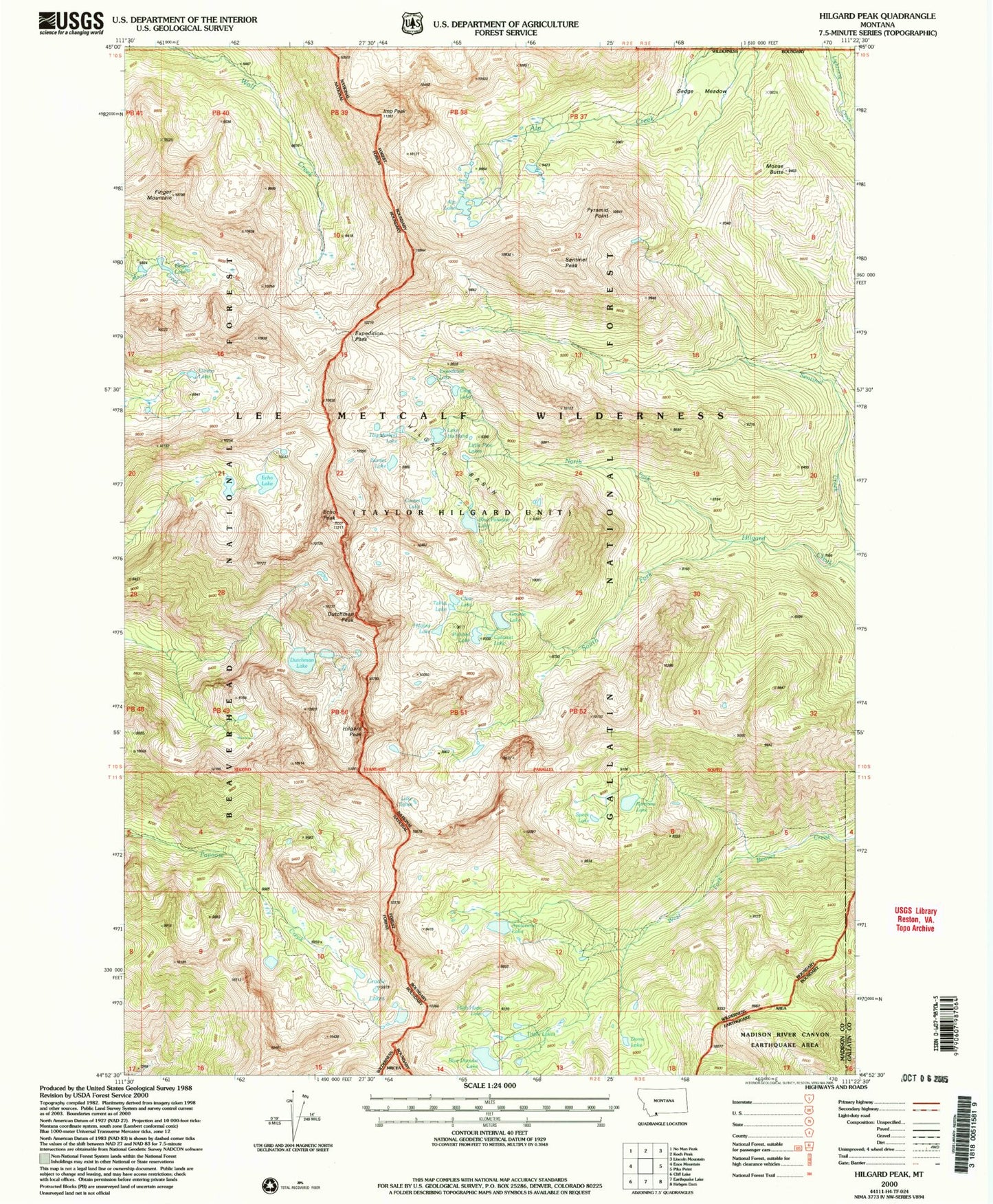
USGS Classic Hilgard Peak Montana 7.5'x7.5' Topo Map
Couldn't load pickup availability
Historical USGS topographic quad map of Hilgard Peak in the state of Montana. Scale: 1:24000. Print size: 24" x 27"
This quadrangle is in the following counties: Gallatin, Madison.
The map contains contour lines, roads, rivers, towns, lakes, and grids including latitude / longitude and UTM / MGRS. Printed on high-quality waterproof paper with UV fade-resistant inks.
Contains the following named places: Avalanche Lake, Blue Danube Lake, Blue Paradise Lake, Cataract Lake, Clear Lake, Comet Lake, Coney Lake, Cradle Lakes, Crag Lake, Cutoff Trail, Dead Lakes, Dome Lake, Dutchman Peak, Echo Lake, Echo Peak, Lake Eglise, Expedition Lake, Expedition Pass, Finger Lake, Finger Mountain, Gnome Lake, Lake Ha Hand, High Hope Lake, Hilgard Basin, Hilgard Lake, Hilgard Peak, Imp Peak, Lightning Creek Trail, Little Pine Lakes, Moose Butte, North Fork Hilgard Creek, Painted Lake, Pyramid Point, Ramona Lake, Sedge Meadow, Sentinel Peak, South Fork Hilgard Creek, Speck Lake, Sunset Lake, Tallus Lake, Thunderbolt Lake, Triple Lakes, Alp Lake, Sedge lake, Dutchman Lake, 10S01E07BDD_01 Well