
MyTopo
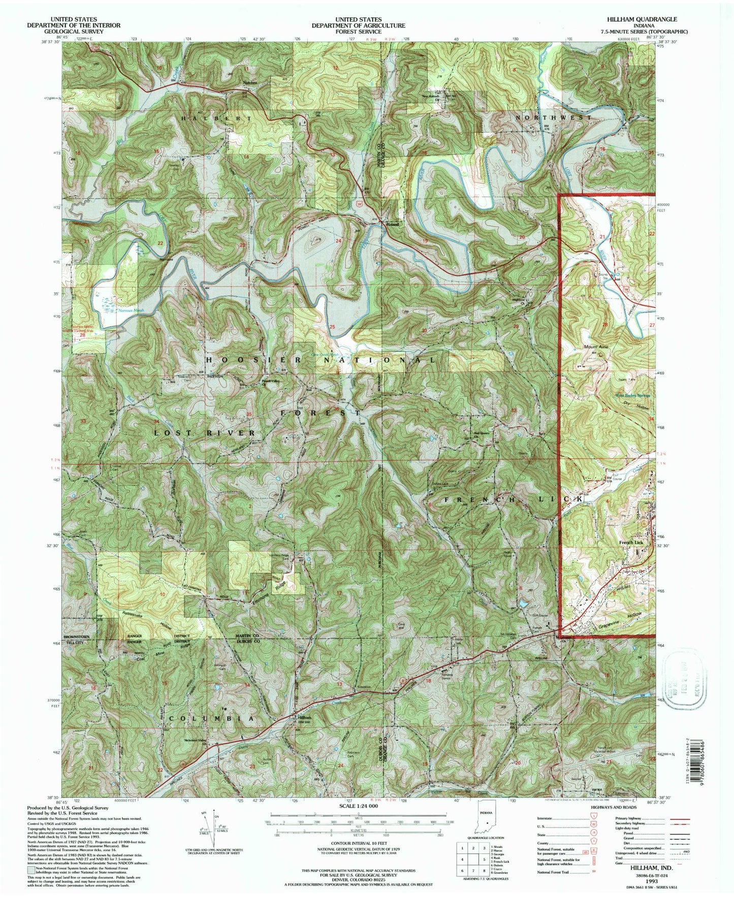
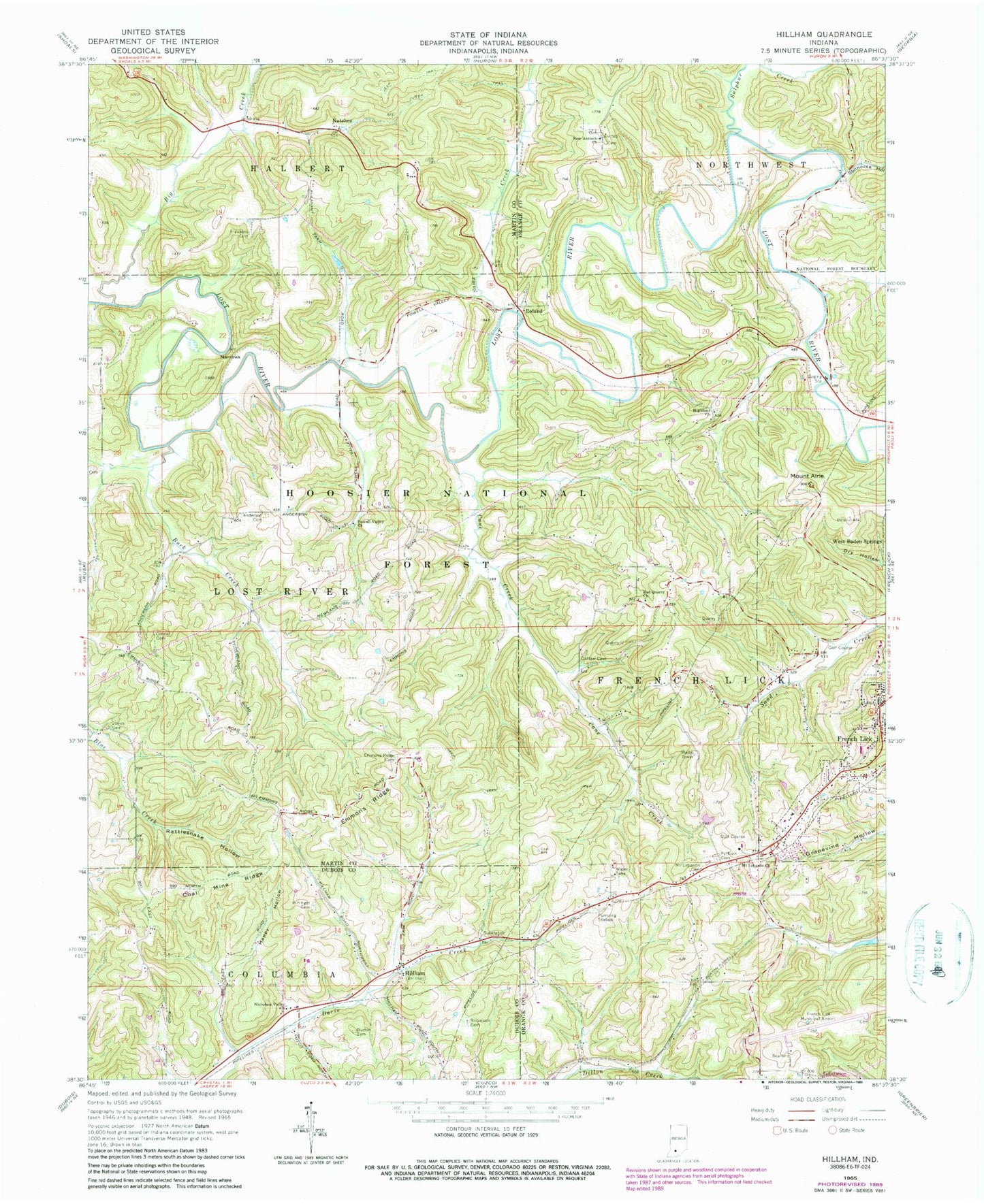
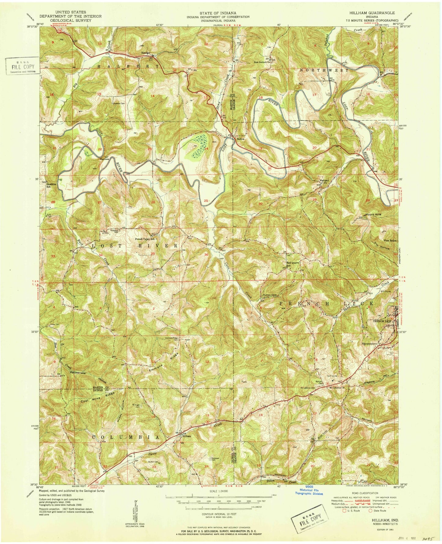
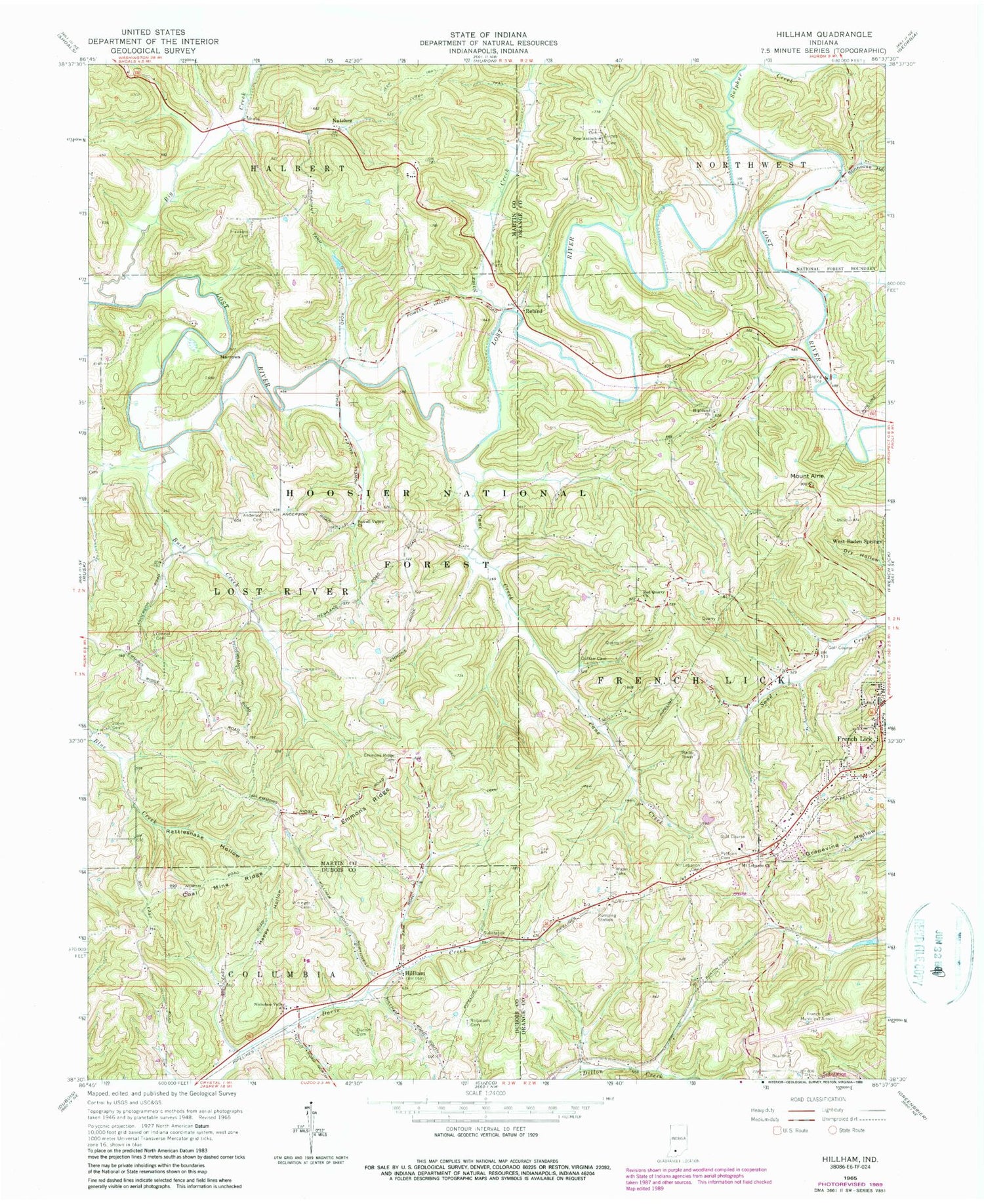
Classic USGS Hillham Indiana 7.5'x7.5' Topo Map
Couldn't load pickup availability
Historical USGS topographic quad map of Hillham in the state of Indiana. Map scale may vary for some years, but is generally around 1:24,000. Print size is approximately 24" x 27"
This quadrangle is in the following counties: Dubois, Martin, Orange.
The map contains contour lines, roads, rivers, towns, and lakes. Printed on high-quality waterproof paper with UV fade-resistant inks, and shipped rolled.
Contains the following named places: Anderson Cemetery, Big Creek, Buck Creek, Burton Cemetery, Coal Mine Ridge, Connell Cemetery, Emmons Ridge, Emmons Ridge Cemetery, French Lick Dam Number F-2, French Lick Municipal Airport, Happy Hollow, Hawkins Cemetery, Highland Church, Hillham, Jones Cemetery, Mount Airie, Mount Lebanon Cemetery, Mount Lebanon Church, Narrows, Natchez, New Antioch Church, Nicholson Valley Church, Powell Valley Church, Pythian Cemetery, Rattlesnake Hollow, Red Quarry Church, Robinson Cemetery, Roland, Sams Creek, Stillhouse Hollow, Sulphur Creek, Wininger Cemetery