MyTopo
Classic USGS Hilliard Florida 7.5'x7.5' Topo Map
Couldn't load pickup availability
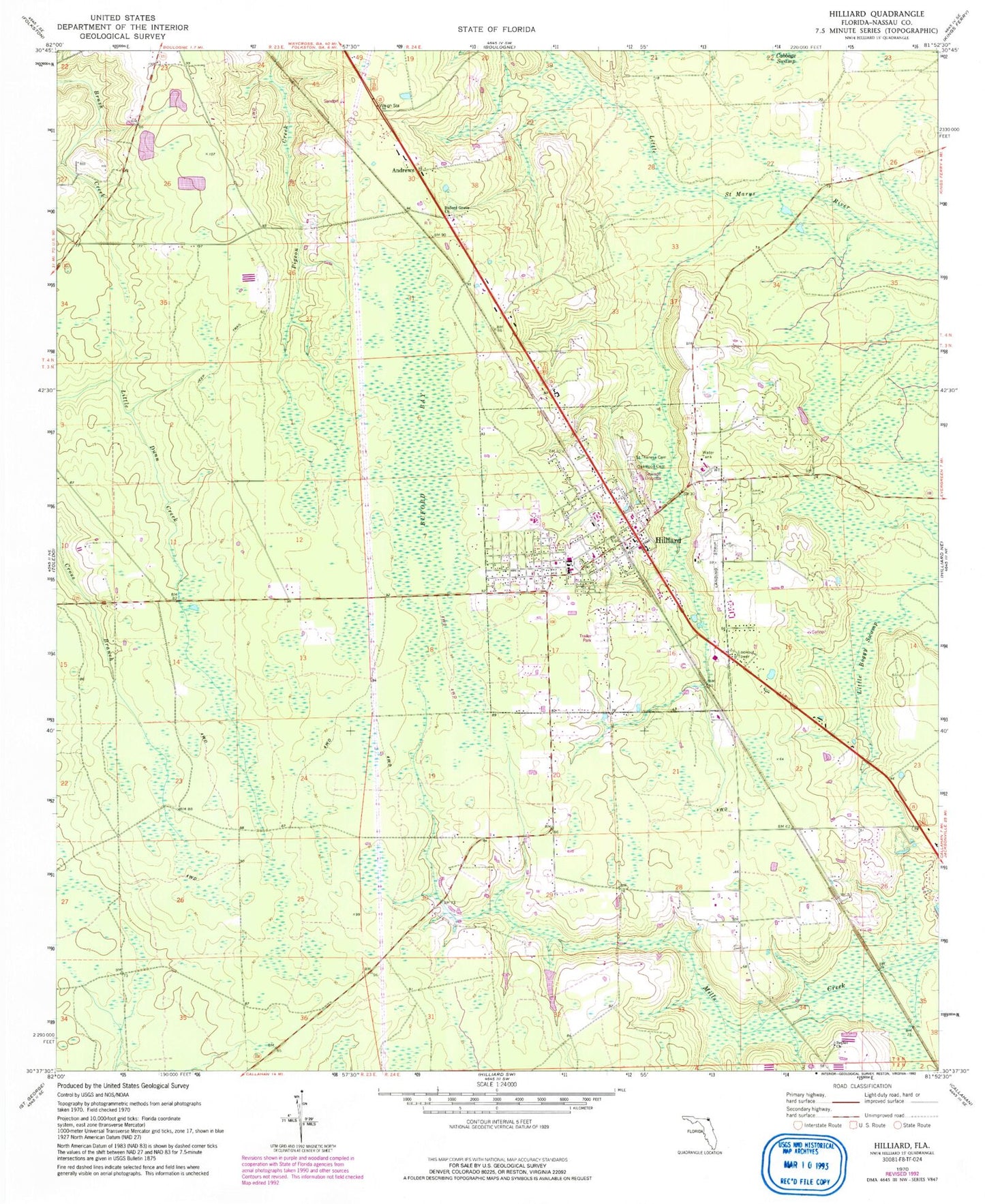
Historical USGS topographic quad map of Hilliard in the state of Florida. Map scale may vary for some years, but is generally around 1:24,000. Print size is approximately 24" x 27"
This quadrangle is in the following counties: Nassau.
The map contains contour lines, roads, rivers, towns, and lakes. Printed on high-quality waterproof paper with UV fade-resistant inks, and shipped rolled.
Contains the following named places: Andrews, Bethel Church, Buford Bay, Buford Grove Church, Hilliard, Hilliard Airpark, Hilliard Elementary School, Hilliard Middle - Senior High School, Hilliard Post Office, Hilliard Volunteer Fire Department, Little Boggy Swamp, Nassau County Fire and Rescue Station 4, Nassau County Fire and Rescue Station 40, Nassua County Sheriff's Office Hilliard Substation, Oakwood Cemetery, Saint Theresa Cemetery, Town of Hilliard, ZIP Code: 32046