MyTopo
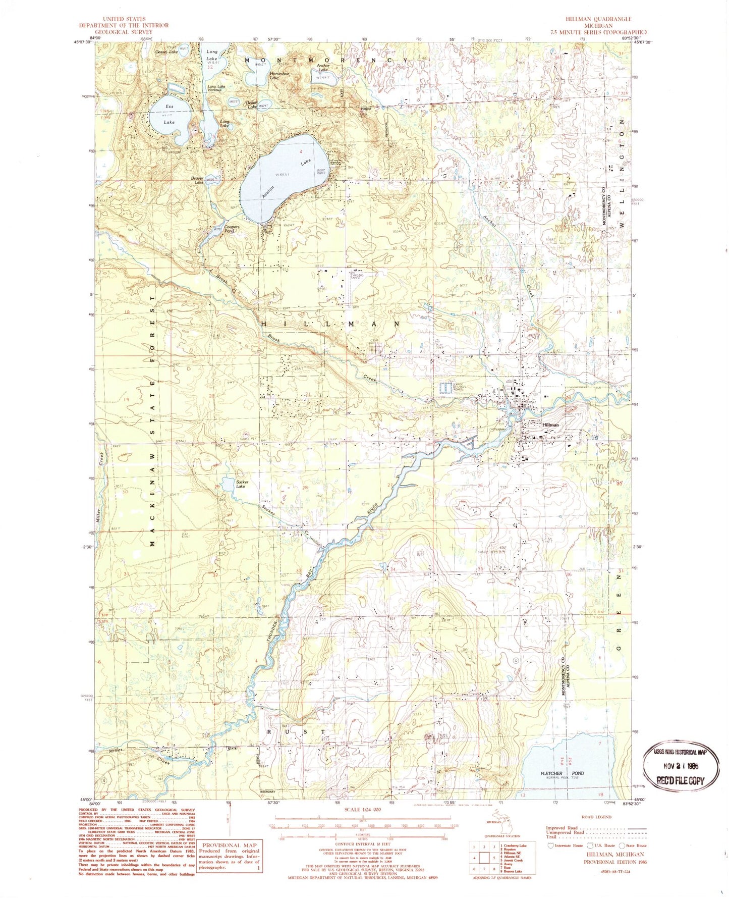
Classic USGS Hillman Michigan 7.5'x7.5' Topo Map
Couldn't load pickup availability
Historical USGS topographic quad map of Hillman in the state of Michigan. Map scale may vary for some years, but is generally around 1:24,000. Print size is approximately 24" x 27"
This quadrangle is in the following counties: Alpena, Montmorency.
The map contains contour lines, roads, rivers, towns, and lakes. Printed on high-quality waterproof paper with UV fade-resistant inks, and shipped rolled.
Contains the following named places: Anchor Creek, Anchor Lake, Avalon Lake, Beaver Lake, Brush Creek, Calvary Church Historical Marker, Calvary Episcopal Church, Coopers Pond, Dollar Lake, Ess Lake, Ess Lake State Forest Campground, Gassel Lake, Hillman, Hillman Airport, Hillman Cemetery, Hillman Elementary School, Hillman Fire Department, Hillman Free Methodist Church, Hillman Junior Senior High School, Hillman Post Office, Hillman Station, Hillman United Methodist Church, Hillman Wright Library, Horseshoe Lake, Little Brush Creek, Long Lake Narrows, Miller Creek, Montmorency Township Hall, Niergarth School, Saint Augustine Cemetery, Saint Augustine Church, South Bay Campground, Sucker Creek, Sucker Lake, Thunder Bay Golf Resort, Village of Hillman, ZIP Code: 49746