MyTopo
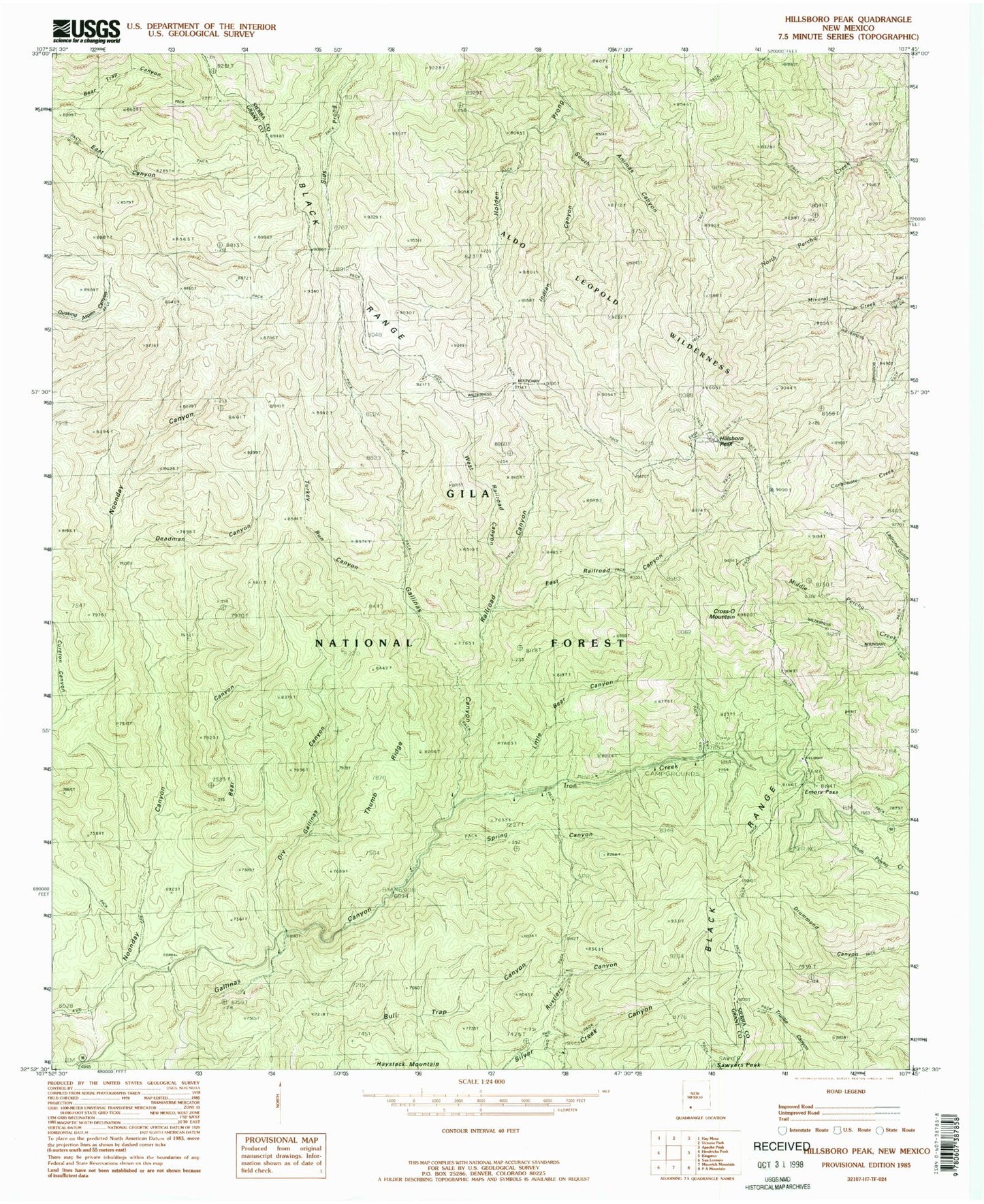
Classic USGS Hillsboro Peak New Mexico 7.5'x7.5' Topo Map
Couldn't load pickup availability
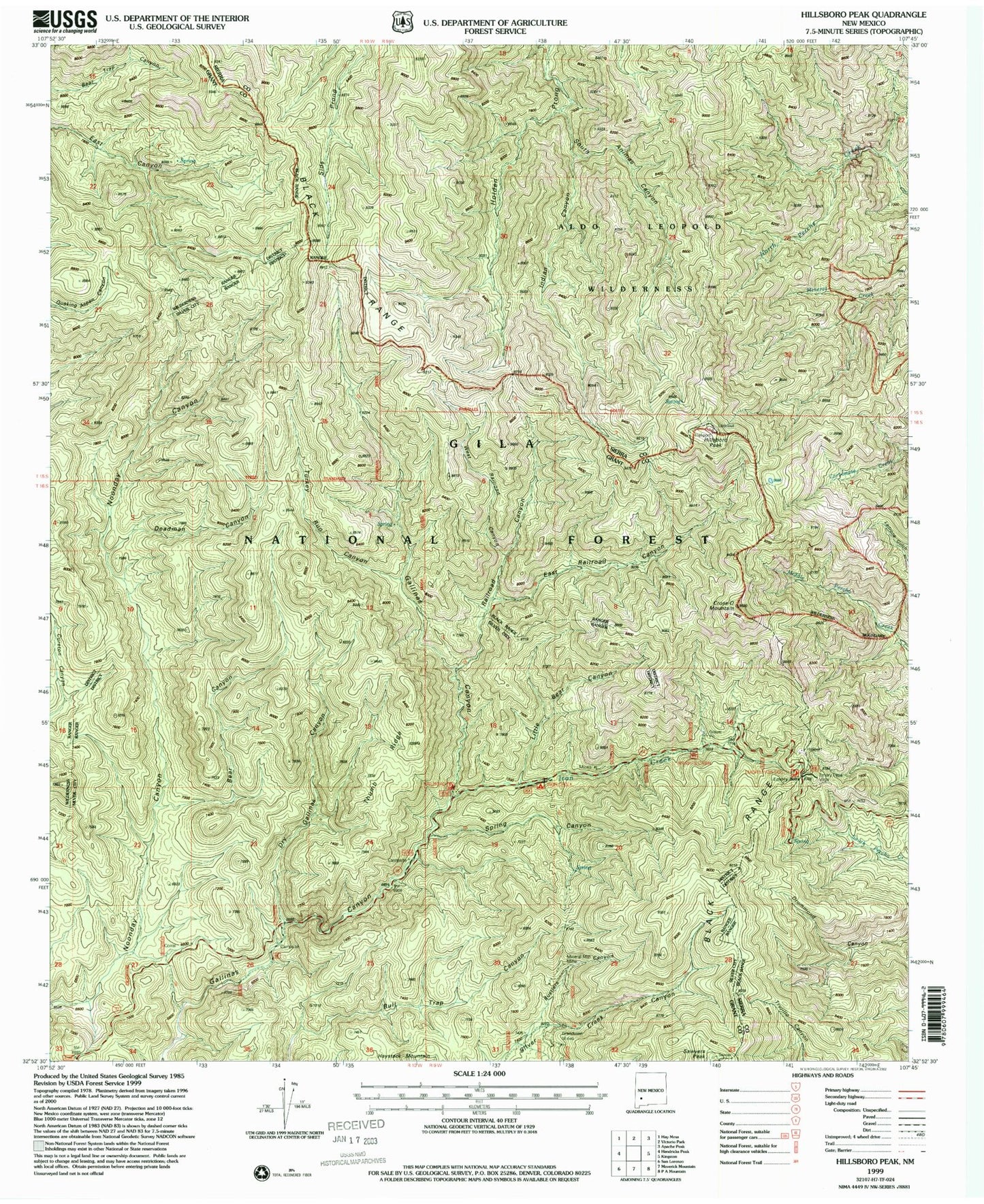
Historical USGS topographic quad map of Hillsboro Peak in the state of New Mexico. Typical map scale is 1:24,000, but may vary for certain years, if available. Print size: 24" x 27"
This quadrangle is in the following counties: Grant, Sierra.
The map contains contour lines, roads, rivers, towns, and lakes. Printed on high-quality waterproof paper with UV fade-resistant inks, and shipped rolled.
Contains the following named places: Hillsboro Peak Lookoout, Emory Pass Vista Campground, Wrights Cabin Campground, Iron Creek Campground, Upper Gallinas Campground, Gallinas Recreation Area, Old Government Trail, Bear Canyon, Cross-O Mountain, Deadman Canyon, Dry Gallinas Canyon, East Railroad Canyon, Emory Pass, Grandview Mines, Hillsboro, Indian Canyon, Iron Creek, Little Bear Canyon, Mineral Mountain Mine, Railroad Canyon, Rustlers Canyon, Sawyers Peak, Silver Creek Canyon, South Animas Canyon, Spring Canyon, Thumb Ridge, Turkey Run Canyon, West Railroad Canyon, Emory Pass Historical Marker, Railroad Campground