MyTopo
Classic USGS Hillsboro Alabama 7.5'x7.5' Topo Map
Couldn't load pickup availability
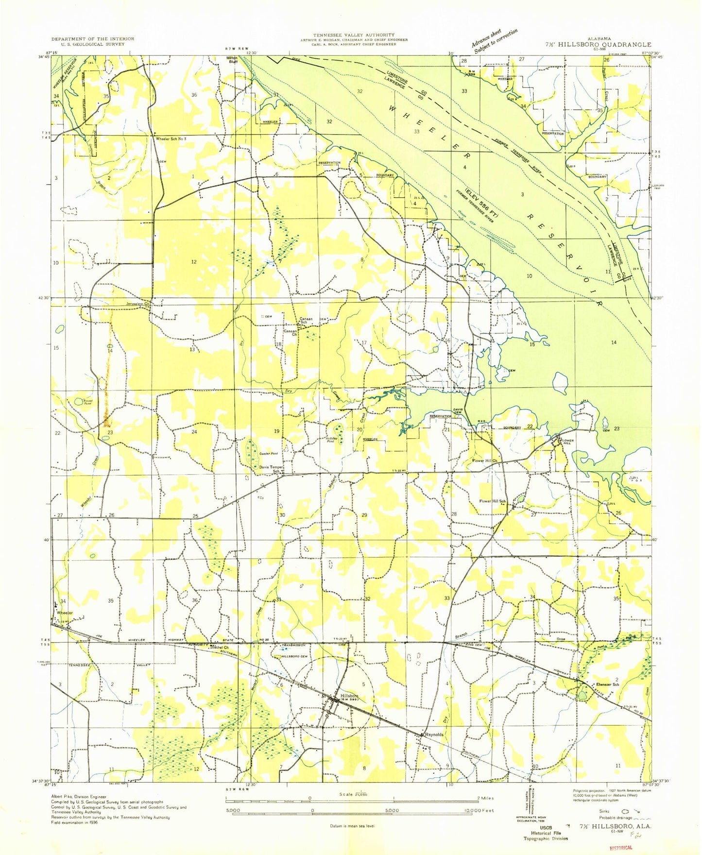
Historical USGS topographic quad map of Hillsboro in the state of Alabama. Map scale may vary for some years, but is generally around 1:24,000. Print size is approximately 24" x 27"
This quadrangle is in the following counties: Lawrence, Limestone.
The map contains contour lines, roads, rivers, towns, and lakes. Printed on high-quality waterproof paper with UV fade-resistant inks, and shipped rolled.
Contains the following named places: Barclay Cemetery, Bethlehem Primative Baptist Church, Blue Pond, Blue Spring, Bobo Cemetery, Brides Hill, Brides Hill Cemetery, Canaan Church, Canaan Missionary Baptist Church, Canaan School, Caney School, Clardy Cemetery, Coss Ferry, Cottingham Cemetery, Cramer Cemetery, David Temple Primitive Baptist Church, David Temple School, Davis Cemetery, Dry Branch, Dry Creek, Early Cemetery, Ebenezer Church, Ebenezer School, Egypt Bluff, Elk River Shoals Canal, Elliott Jackson Cemetery, Ennix Cemetery, Fish Pond, Fish Pond Branch, Flower Hill, Flower Hill Cemetery, Flower Hill Church, Flower Hill School, Foster - Davis Cemetery, Gander Pond, Goldfield Branch, Goose Pond, Gordon Cemetery, Gordon Spring, Graves Cemetery, Hacklin Cemetery, Hackwell Branch, Harty Pond, Hillsboro, Hillsboro Area Volunteer Fire Department, Hillsboro Division, Hillsboro Elementary School, Hillsboro Police Department, Hillsboro Post Office, Holliday Pond, Jerusalem, Jerusalem Church, Jones Cemetery, Knight Island, Lakeview, Locklayer Cemetery, Lovettville, Lower Bar, Mallard Creek, Mallard-Fox Creek Wildlife Management Area, Mason Hollow, McBride Cemetery, Mount Olive Church, Newman Cemetery, Paradise Shores, Peters Ridge, Piney Chapel Church of Christ, Pointer Cemetery, Pointer Quarters, Poplar Creek, Poplar Creek Cabin Site Area, Poplar Point, Porter Cemetery, Prairie Creek, Red Branch, Reynolds, Reynolds Cemetery, Rocky Branch, Round Pond, Shackelford Cemetery, Smith Cemetery, Swoope Bottom, Swoope Branch, Swoope Cemetery, Tennessee Valley Junior High School, Town of Hillsboro, United Church, Upper Bar, Wheeler, Wheeler Grove Church, Wheeler School, Wheeler School Number 3, ZIP Code: 35643