MyTopo
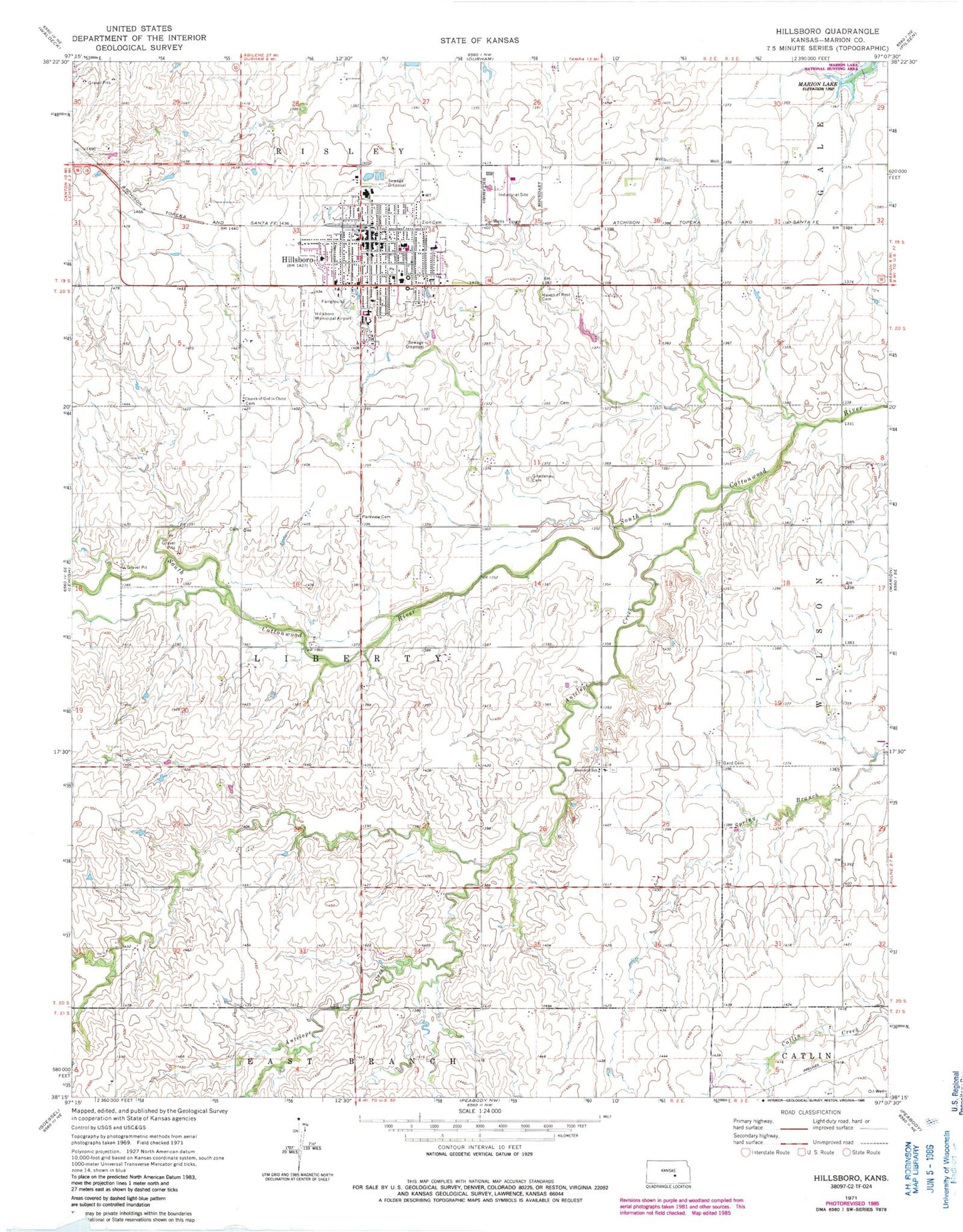
Classic USGS Hillsboro Kansas 7.5'x7.5' Topo Map
Couldn't load pickup availability
Historical USGS topographic quad map of Hillsboro in the state of Kansas. Map scale may vary for some years, but is generally around 1:24,000. Print size is approximately 24" x 27"
This quadrangle is in the following counties: Marion.
The map contains contour lines, roads, rivers, towns, and lakes. Printed on high-quality waterproof paper with UV fade-resistant inks, and shipped rolled.
Contains the following named places: Advent Church, Alexanderfeld Church of God in Christ, Alfred Schroeder Field, Antelope Creek, City of Hillsboro, Cresswell School, Creswell, Ebenfeld Mennonite Brethren Church, Ebenfeld School, Finch School, First Mennonite Church, First Southern Baptist Church, Gard Cemetery, Gnadenan School, Gnadenau Cemetery, Gnadenau Village Cemetery, Haven of Rest Cemetery, Hillsboro, Hillsboro City Hall, Hillsboro Community Medical Center, Hillsboro Elementary School, Hillsboro Fire Department, Hillsboro Mennonite Brethren Church, Hillsboro Middle / High School, Hillsboro Middle School, Hillsboro Municipal Golf Course, Hillsboro Police Department, Hillsboro Post Office, Hillsboro Public Library, Hillsboro United Methodist Church, Holy Transfiguration Orthodox Christian Church, Hope Valley School, Kansas Highway Patrol Troop C Marion, Lighthouse School, Marion County Fairgrounds, Marion Industrial Park, Mennonite Church, Mennonite Settlement Museum, Parkview Mennonite Brethren Church, Rollin Homes Mobile Home Court, Tabor College, Team Marketing Alliance Grain Elevator Number 19, Township of Liberty, Trinity Mennonite Church, Williams School, Zion Cemetery, Zion Lutheran Church, ZIP Code: 67063