MyTopo
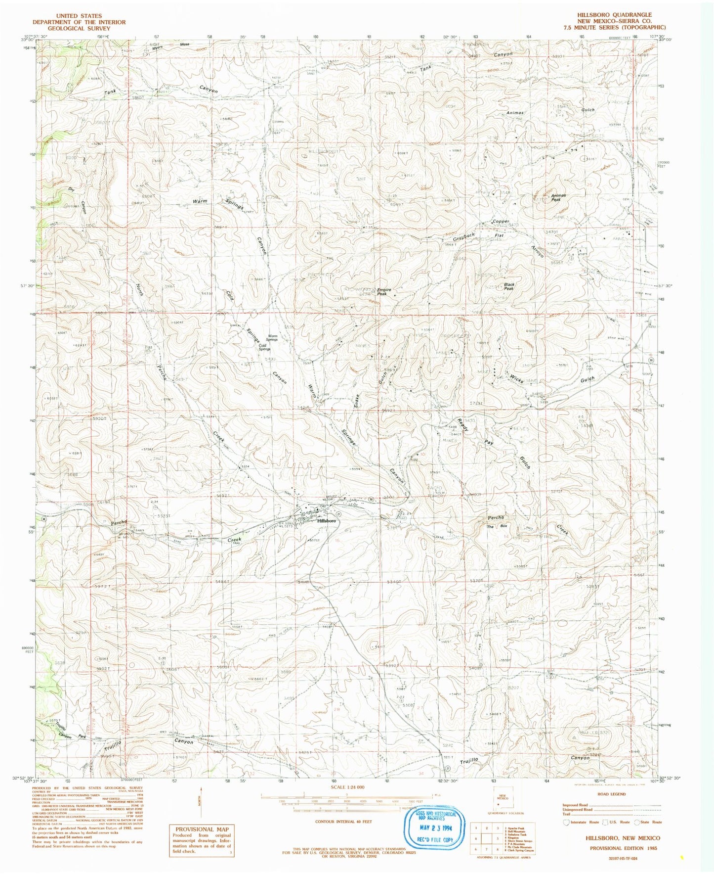
Classic USGS Hillsboro New Mexico 7.5'x7.5' Topo Map
Couldn't load pickup availability
Historical USGS topographic quad map of Hillsboro in the state of New Mexico. Map scale may vary for some years, but is generally around 1:24,000. Print size is approximately 24" x 27"
This quadrangle is in the following counties: Sierra.
The map contains contour lines, roads, rivers, towns, and lakes. Printed on high-quality waterproof paper with UV fade-resistant inks, and shipped rolled.
Contains the following named places: Animas Peak, Bigelow, Black Peak, Black Peak Mine, Black Range Museum, Bonanza, Buetecke Mine, Bullion Mine, Carrajel Shaft, Chance Mine, Christ Episcopal Church, Cincinnati Mine, Cold Springs Canyon, Copper Flat, Copper Flat Bulk Sample Plan Mine, Copper Flat Mine, Copper King Mine, Crescent Lode Mine, Dry Canyon, Dutch Gulch, Eighty-Five Mine, Empire, Empire Mine, Empire Peak, Freidberg, Fullerton, Garfield-Butler, Gold Dust Camp, Gold Dust Placers, Golddust Camp, Golden Rule, Grayback Arroyo, Hall Mine, Hillsboro, Hillsboro Cemetery, Hillsboro Census Designated Place, Hillsboro Community Library, Hillsboro Historic District, Hillsboro Peak lookout Tower and Cabin, Hillsboro Post Office, Hillsboro Volunteer Fire Station 1, Hillsboro Weather Station, Hillsboro-Copper Flat, Homestake Mine, Jackpot Mine, Katherine, Lake Valley Mining District, Little Wonder Mine, Lost Arrowhead, Luxemburg, Mary Richmond, McKinley Mine, Morning Glory Mine, National Defense, National Defense Department Number One, North Percha Creek, Opportunity, Palma, Palma Group, Petroglyph Mine, Quintana Incline, Rattlesnake, Rattlesnake Placers, Ready Pay, Ready Pay Gulch, Republic Mine, Sherman, Snake Gulch, Stowaway Mine, Sweetwater, The Box, Tom Murphy House, Tripp Mine, Trujillo Park Canyon, Union Community Church Historic Site, Vanadinite Mine, Virginia Claim, Warm Springs, Warm Springs Canyon, Wicks, Wisconsin Mine