MyTopo
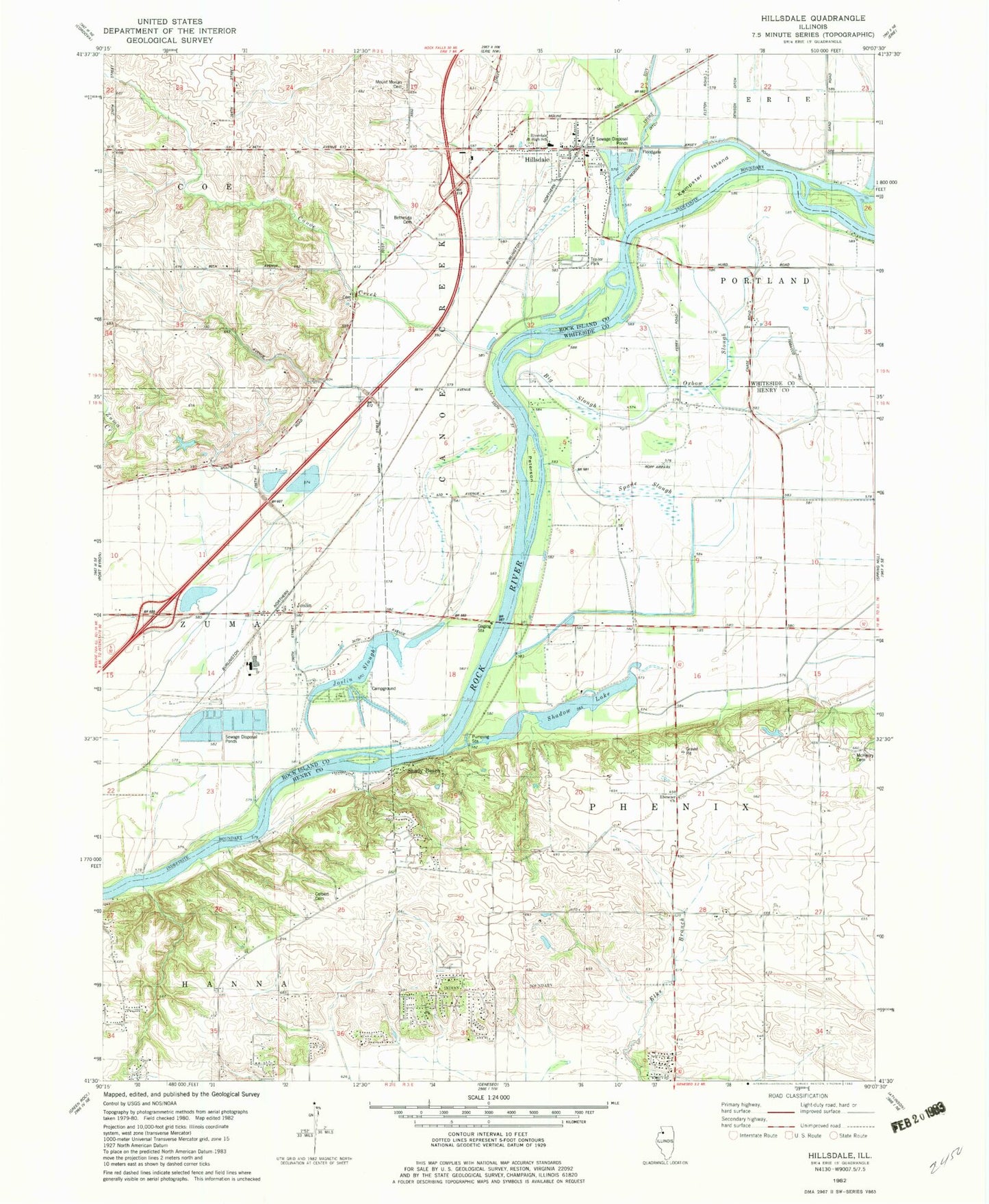
Classic USGS Hillsdale Illinois 7.5'x7.5' Topo Map
Couldn't load pickup availability
Historical USGS topographic quad map of Hillsdale in the state of Illinois. Map scale may vary for some years, but is generally around 1:24,000. Print size is approximately 24" x 27"
This quadrangle is in the following counties: Henry, Rock Island, Whiteside.
The map contains contour lines, roads, rivers, towns, and lakes. Printed on high-quality waterproof paper with UV fade-resistant inks, and shipped rolled.
Contains the following named places: Bethesda Cemetery, Big Slough, Black Airport, Canoe Creek, Colbert Cemetery, Ebenezer Cemetery, Ebenezer Community Church, Ebenezer School, Hillsdale, Hillsdale Fire Protection District, Hillsdale Post Office, Joslin, Joslin Census Designated Place, Joslin School, Joslin Slough, Kempster Island, Kempsterville School, McHenry Cemetery, Mount Moriah Cemetery, Oak Grove School, Oxbow Slough, Peterson Island, Phenix School, Poplar Grove School, Riverdale Junior High School, Ropp Airpark, Shadow Lake, Shady Beach, Spade Slough, Township of Canoe Creek, Township of Phenix, Village of Hillsdale, ZIP Code: 61257