MyTopo
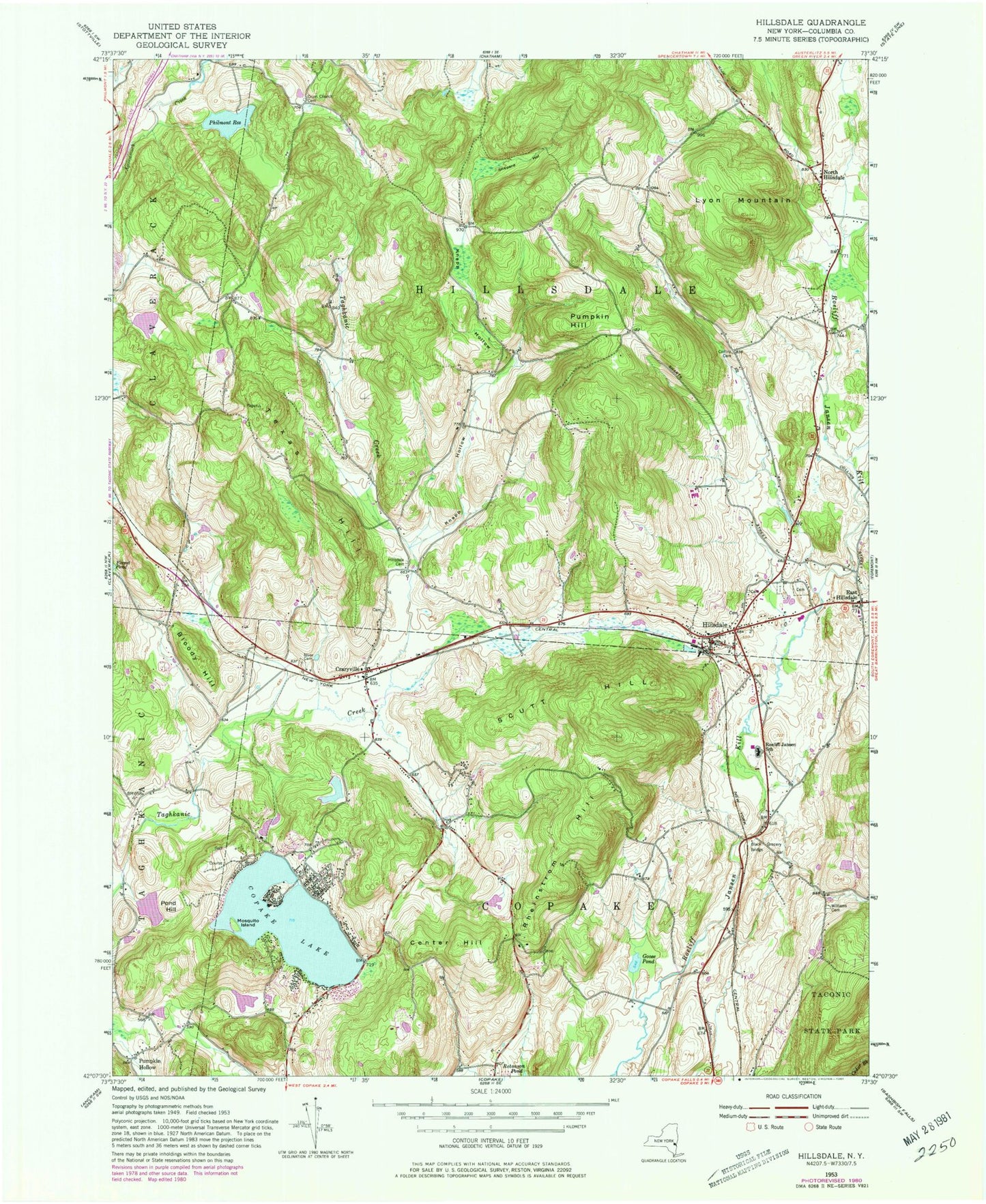
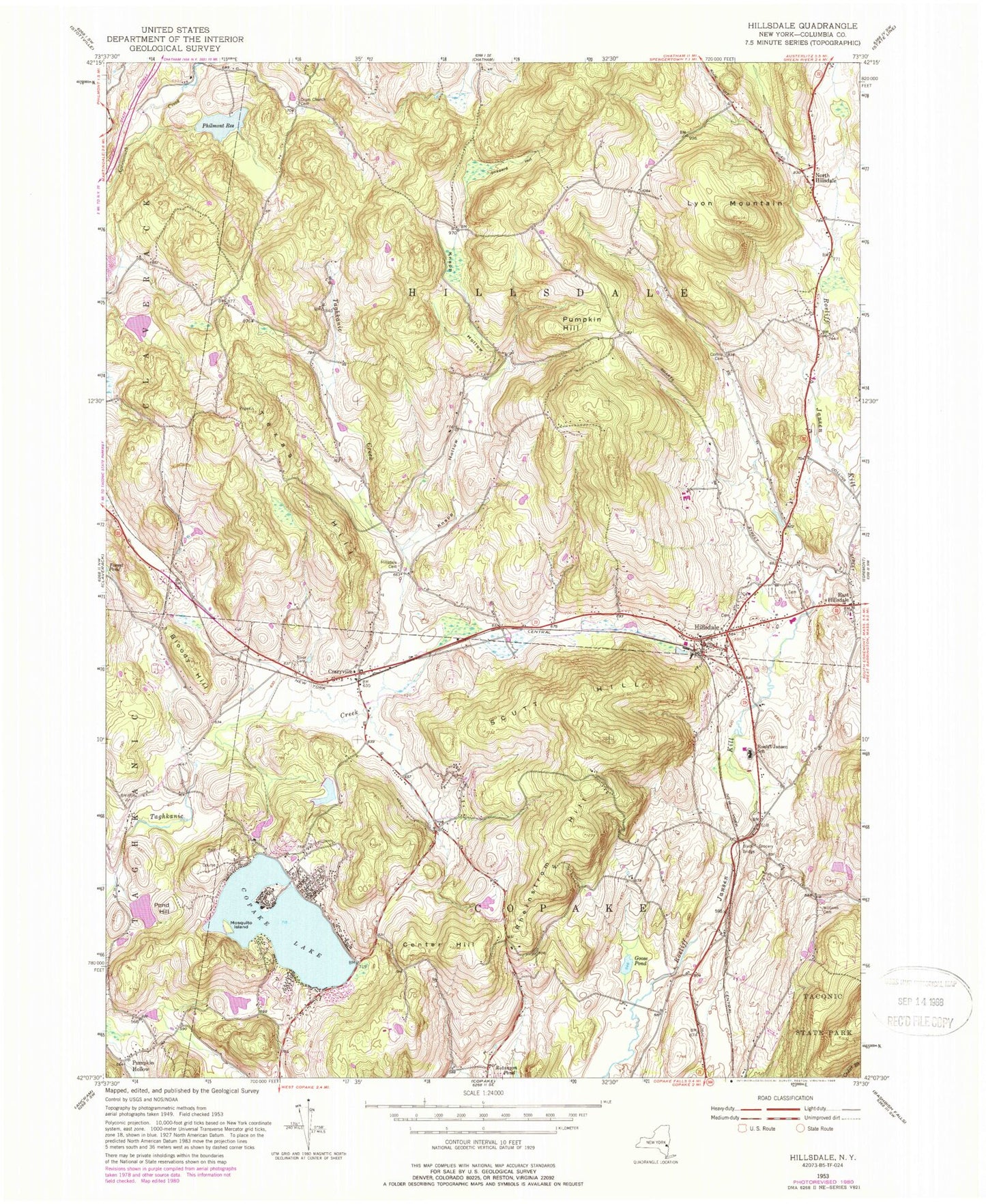
Classic USGS Hillsdale New York 7.5'x7.5' Topo Map
Couldn't load pickup availability
Historical USGS topographic quad map of Hillsdale in the state of New York. Typical map scale is 1:24,000, but may vary for certain years, if available. Print size: 24" x 27"
This quadrangle is in the following counties: Columbia.
The map contains contour lines, roads, rivers, towns, and lakes. Printed on high-quality waterproof paper with UV fade-resistant inks, and shipped rolled.
Contains the following named places: Black Grocery Bridge, Bloody Hill, Center Hill, Collins Cemetery, Copake Lake, Craryville, Krum Church Cemetery, East Hillsdale, Goose Pond, Hillsdale, Hillsdale Cemetery, Knapp Hollow, Lyon Mountain, Mosquito Island, North Copake Cemetery, North Hillsdale, Philmont Reservoir, Pond Hill, Pumpkin Hollow, Pumpkin Hollow, Rheinstrom Hill, Roeliff Jansen School, Scutt Hill, Shepard Hollow, Texas Hill, Williams Cemetery, Copake Lake Seaplane Base (historical), Town of Copake, Town of Hillsdale, Copake Lake, Copake Lake Census Designated Place, B Flat Farm Airport, Little Rainbow Chevre, White Oak Farms, Copake Country Club, Craryville Post Office, Hillsdale Post Office, Taconic Hills Elementary School, Taconic Hills Middle School, Taconic Hills High School, Hillsdale Fire Company 1, Craryville Volunteer Fire Company