
MyTopo
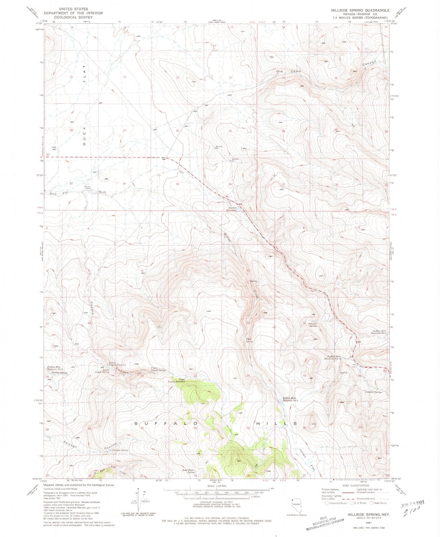
Classic USGS Hillside Spring Nevada 7.5'x7.5' Topo Map
Couldn't load pickup availability
Historical USGS topographic quad map of Hillside Spring in the state of Nevada. Map scale may vary for some years, but is generally around 1:24,000. Print size is approximately 24" x 27"
This quadrangle is in the following counties: Washoe.
The map contains contour lines, roads, rivers, towns, and lakes. Printed on high-quality waterproof paper with UV fade-resistant inks, and shipped rolled.
Contains the following named places: Buffalo Hills Reservoir Number 10, Buffalo Hills Reservoir Number 6, Buffalo Hills Reservoir Number 7, Buffalo Hills Reservoir Number 9, Chicken Spring, Coyote Canyon, Dead Heifer Spring, Disabel Reservoir, Hillside Spring, Hoover Ranch, Jones Flat, Lower Coyote Reservoir, Lower Coyote Spring, No Savvy Creek, Old Camp Canyon, PWR Spring, Smokey Spring, Summit Springs, Summit Springs Post Office, Upper Coyote Reservoir, Upper Coyote Spring, Willow Creek


