MyTopo
Classic USGS Hinckley New York 7.5'x7.5' Topo Map
Couldn't load pickup availability
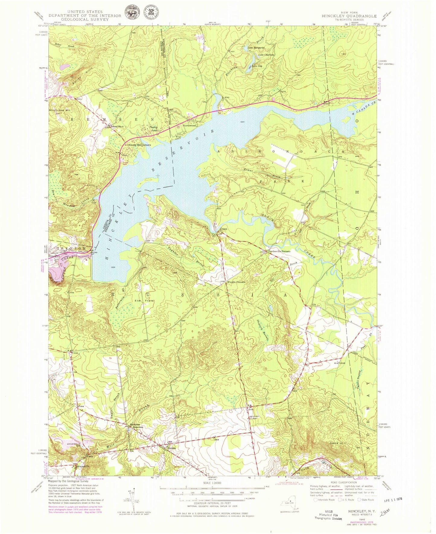
Historical USGS topographic quad map of Hinckley in the state of New York. Typical map scale is 1:24,000, but may vary for certain years, if available. Print size: 24" x 27"
This quadrangle is in the following counties: Herkimer, Oneida.
The map contains contour lines, roads, rivers, towns, and lakes. Printed on high-quality waterproof paper with UV fade-resistant inks, and shipped rolled.
Contains the following named places: Ash Brook, Ash Creek, Bailey Hills, Beaver Meadow Creek, Black Creek, Buttermilk Brook, Century Cemetery, Lake Charlotte, Elm Flats, Fox Brook, Lake Gay, Grant, Gravesville, Gravesville Cemetery, Herkimer Reservoir, Hinckley, Hinckley Reservoir, Kreskern Brook, Lake Margarite, Ninety Five Hill, Ninety Six Corners, Northwood, Pardeeville Corners, Paul Brook, Remus Brook, Russia, Sand Hill, Shepard Swamp, Taylor Brook, Taynter Brook, Thomas Pond, Tygert Swamp, Wilt Brook, Woodin Corners, School Number 4 (historical), Town of Russia, Baileys Mobile Home Park, Woodin Corners Cemetery, Hinckley Post Office