MyTopo
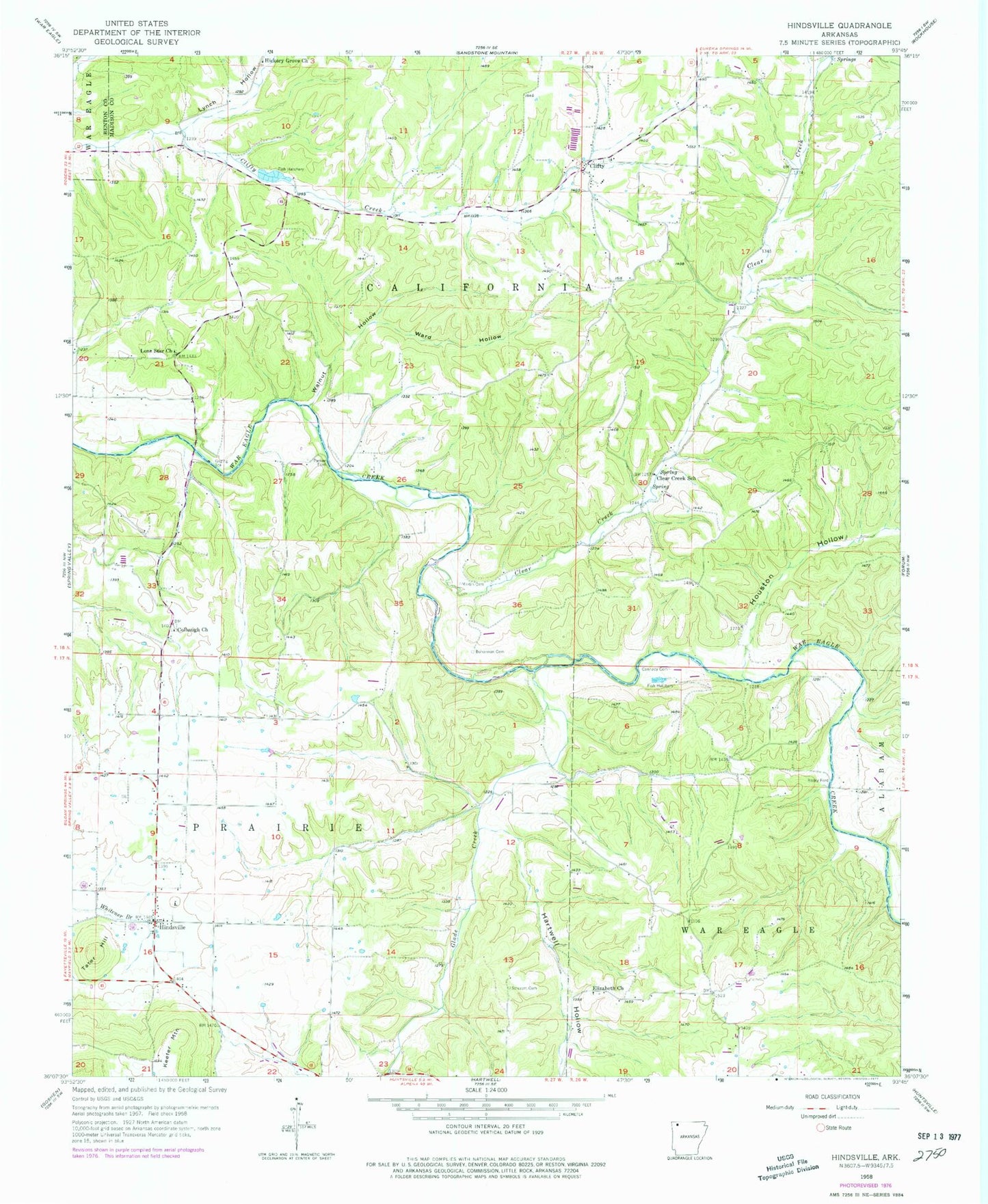
Classic USGS Hindsville Arkansas 7.5'x7.5' Topo Map
Couldn't load pickup availability
Historical USGS topographic quad map of Hindsville in the state of Arkansas. Map scale may vary for some years, but is generally around 1:24,000. Print size is approximately 24" x 27"
This quadrangle is in the following counties: Benton, Madison.
The map contains contour lines, roads, rivers, towns, and lakes. Printed on high-quality waterproof paper with UV fade-resistant inks, and shipped rolled.
Contains the following named places: Bohannan Cemetery, Cannady Cemetery, Clear Creek, Clear Creek School, Clifty, Clifty Cemetery, Clifty Volunteer Fire Department, Colbaugh Cemetery, Colbaugh Church, Elizabeth Church, Glade Creek, Hartwell Creek, Hartwell Hollow, Hickory Grove Church, Hindsville, Hindsville Fire Department, Hindsville Post Office, Houston Creek, Houston Hollow, Lone Star Church, Lynch Hollow, Martin Cemetery, Parker Ford, Poyner Hollow, Rocky Ford, Scissom Cemetery, Smyrna Volunteer Fire Department, Tater Hill, Town of Hindsville, Township of Prairie, Walnut Hollow, Ward Hollow