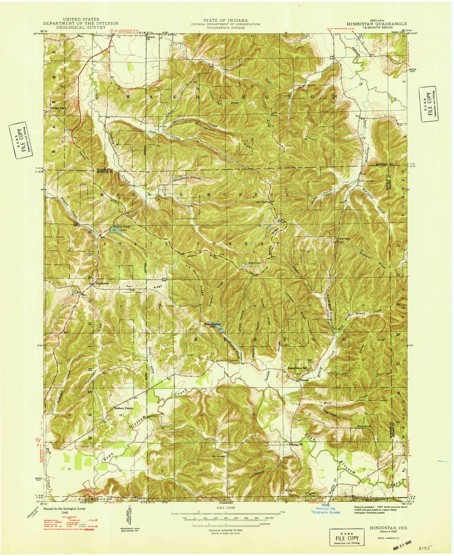
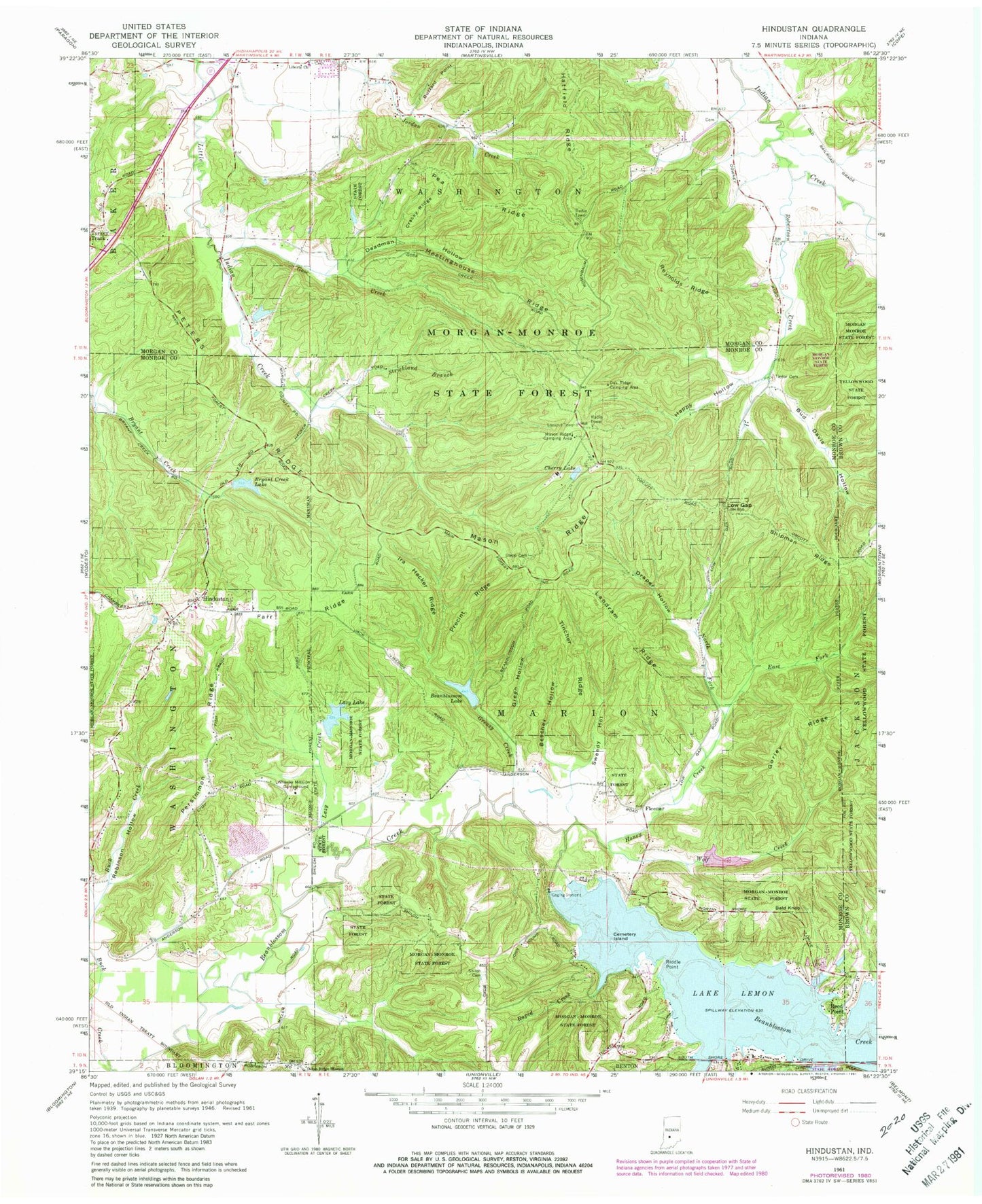
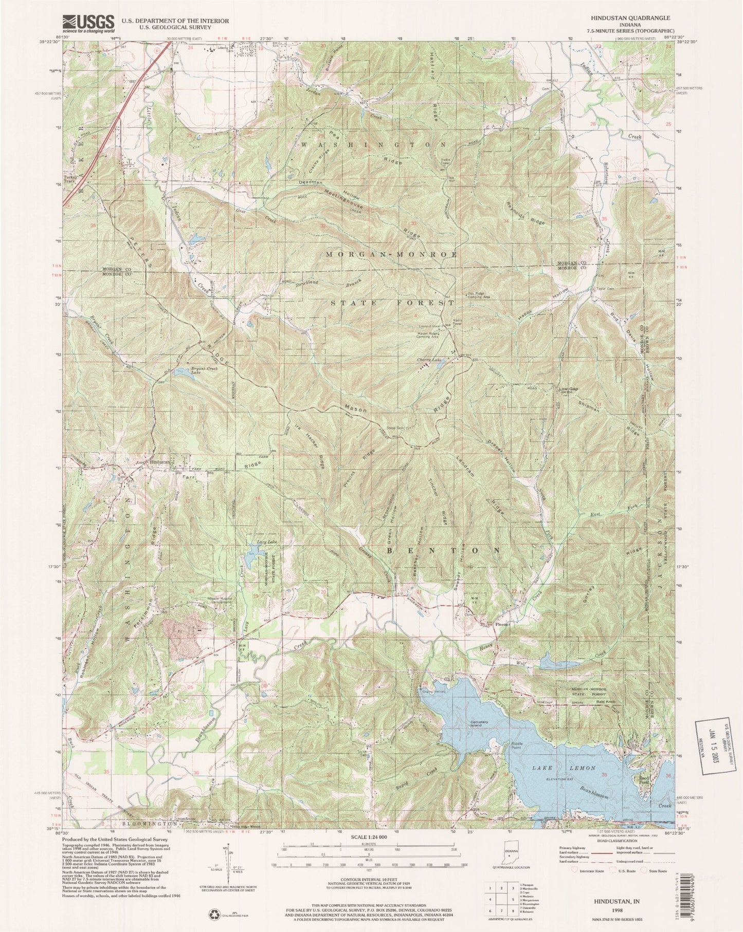
MyTopo
USGS Classic Hindustan Indiana 7.5'x7.5' Topo Map
Couldn't load pickup availability
Historical USGS topographic quad map of Hindustan in the state of Indiana. Scale: 1:24000. Print size: 24" x 27"
This quadrangle is in the following counties: Brown, Monroe, Morgan.
The map contains contour lines, roads, rivers, towns, lakes, and grids including latitude / longitude and UTM / MGRS. Printed on high-quality waterproof paper with UV fade-resistant inks.
Contains the following named places: Bald Knob, Beanblossom Lake, Beecher Hollow, Brown Elementary School, Buck Creek, Bud Davis Hollow, Cemetery Island, Cherry Lake, Cracky Ridge, Deadman Hollow, East Fork Honey Creek, Farr Ridge, Fleener, Gorley Ridge, Gose Creek, Greasy Creek, Green Hollow, Happy Hollow, Hindustan, Honey Creek, Ira Hacker Ridge, Landram Ridge, Lazy Creek, Lazy Lake, Lake Lemon, Liberty Church, Low Gap, Mason Ridge, Meetinghouse Ridge, North Fork Honey Creek, Payne Hollow, Pea Ridge, Persimmon Ridge, Peters Ridge, Precint Ridge, Rapid Creek, Reed Point, Reynolds Ridge, Riddle Point, Robertson Creek, Robinson Hollow, Shiloh Cemetery, Shipman Ridge, Stepp Cemetery, Strickland Branch, Sweedy Hollow, Taylor Cemetery, Tincher Ridge, Turkey Track, Wheeler Mission Campground, Wolf Creek, Egenolf Lake Dam, Egenolf Lake, Lazy Lake Dam, Cherry Lake Dam, Bryant Creek Lake Dam, Bean Blossom Dam, Scout Ridge Nature Reserve, Scout Ridge Youth Campground, Three Lakes Trail, Mason Ridge Camping Area, Oak Ridge Camping Area, Bryant Creek Lake, Monroe Mills Post Office (historical), Indiana Department of Natural Resources - Division of Forestry Fire Control Headquarters, Draper Hollow