MyTopo
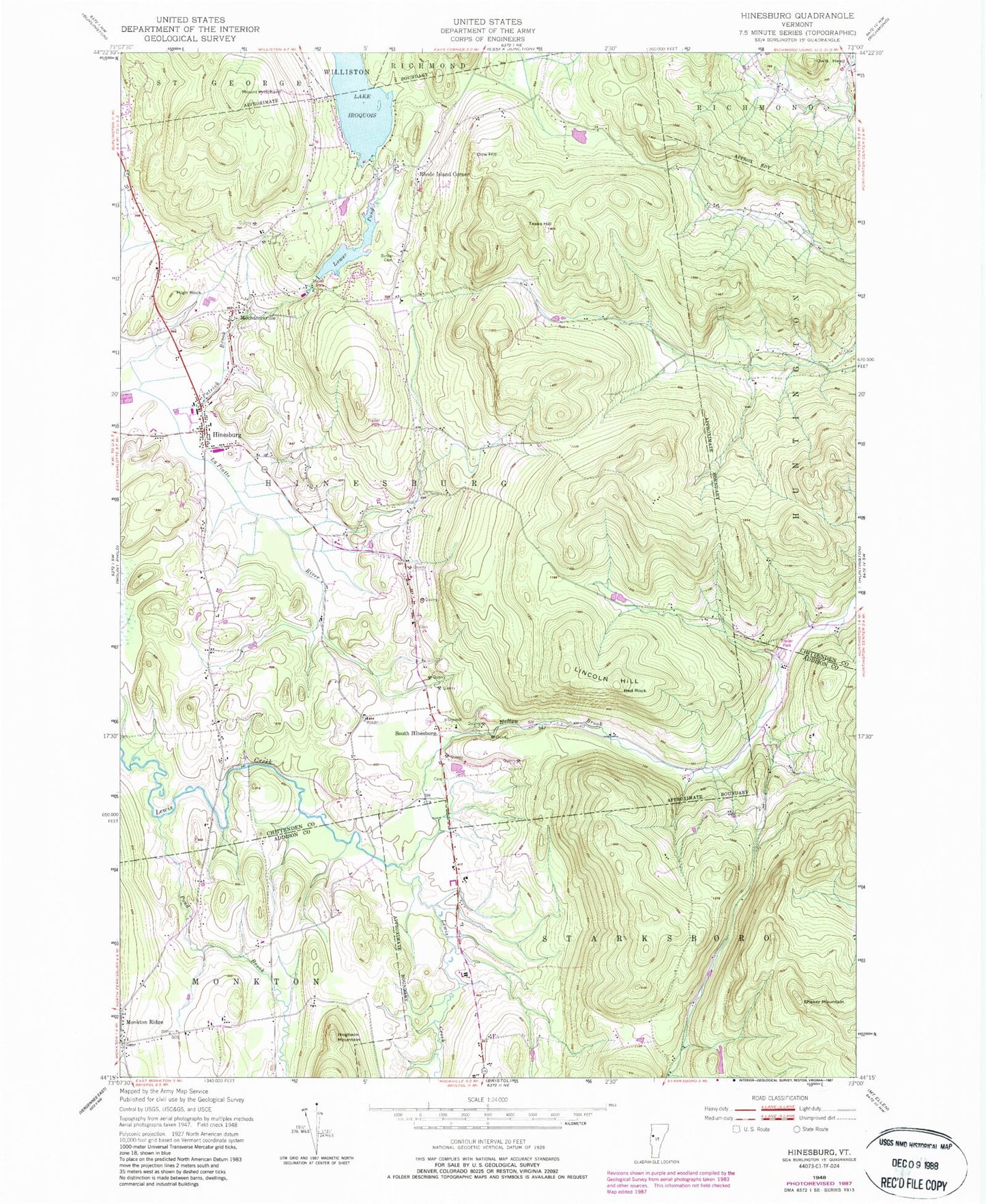
Classic USGS Hinesburg Vermont 7.5'x7.5' Topo Map
Couldn't load pickup availability
Historical USGS topographic quad map of Hinesburg in the state of Vermont. Map scale may vary for some years, but is generally around 1:24,000. Print size is approximately 24" x 27"
This quadrangle is in the following counties: Addison, Chittenden.
The map contains contour lines, roads, rivers, towns, and lakes. Printed on high-quality waterproof paper with UV fade-resistant inks, and shipped rolled.
Contains the following named places: Annettes Playschool Il, Barker Cemetery, Champlain Valley Union High School, Dow Hill, Fred Johnson Wildlife Management Area, High Rock, Hinesburg, Hinesburg Cemetery, Hinesburg Census Designated Place, Hinesburg Community School, Hinesburg Fire Department, Hinesburg Police Department, Hinesburg Post Office, Hogback Mountain, Hollow Brook, Lake Iroquois, Lake Iroquois Dam, Lincoln Hill, Lower Pond, Lower Pond Dam, McDonough Cemetery, Mechanicsville, Monkton Post Office, Monkton Ridge, Monkton Ridge Cemetery, Monkton Volunteer Fire Department, Mount Pritchard, Owls Head, Patrick Brook, Pond Brook, Red Rock, Rhode Island Corner, Sarah Carpenter Memorial Library, Shaker Mountain, Sherman Hollow Ski Touring Center, South Hinesburg, Texas Hill, Town of Hinesburg, Tracy Cemetery, ZIP Code: 05461