MyTopo
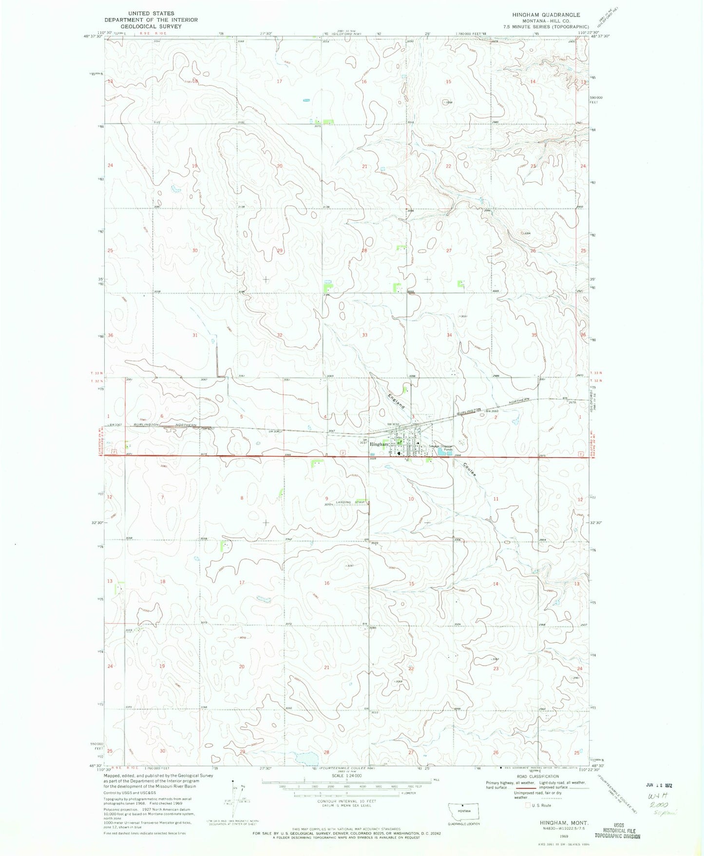
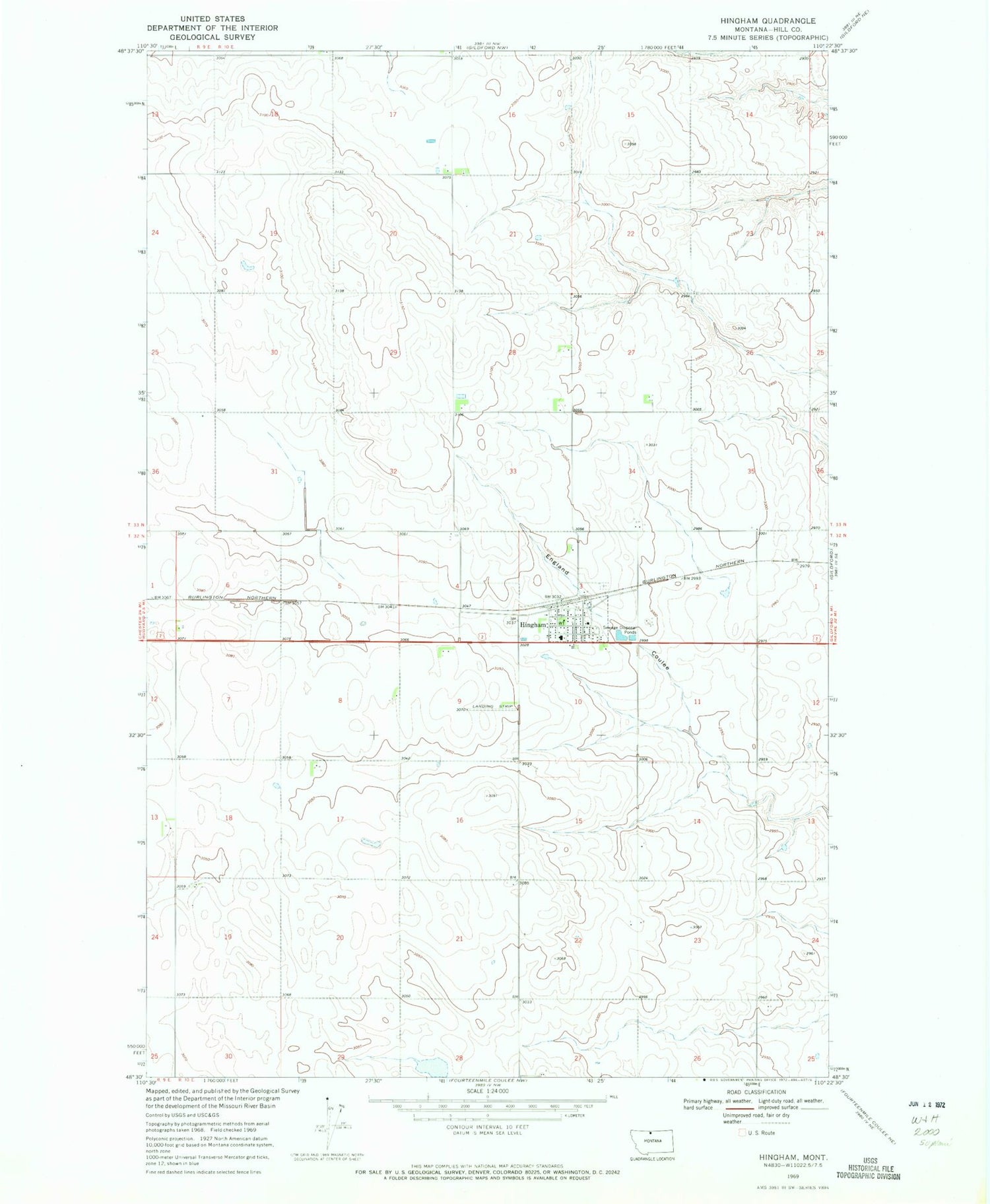
Classic USGS Hingham Montana 7.5'x7.5' Topo Map
Couldn't load pickup availability
Historical USGS topographic quad map of Hingham in the state of Montana. Map scale may vary for some years, but is generally around 1:24,000. Print size is approximately 24" x 27"
This quadrangle is in the following counties: Hill.
The map contains contour lines, roads, rivers, towns, and lakes. Printed on high-quality waterproof paper with UV fade-resistant inks, and shipped rolled.
Contains the following named places: Clinton, Evangelical Chapel, General Mills Incorporated Elevator, Hingham, Hingham Farmers Elevator, Hingham Lutheran Church, Hingham Post Office, Hingham Sanitarium, Hingham School, Hingham Volunteer Fire Department, Hi-Way Quick Stop Campground, Our Lady of Ransom Catholic Church, Town of Hingham, United Methodist Community Church, ZIP Code: 59528