MyTopo
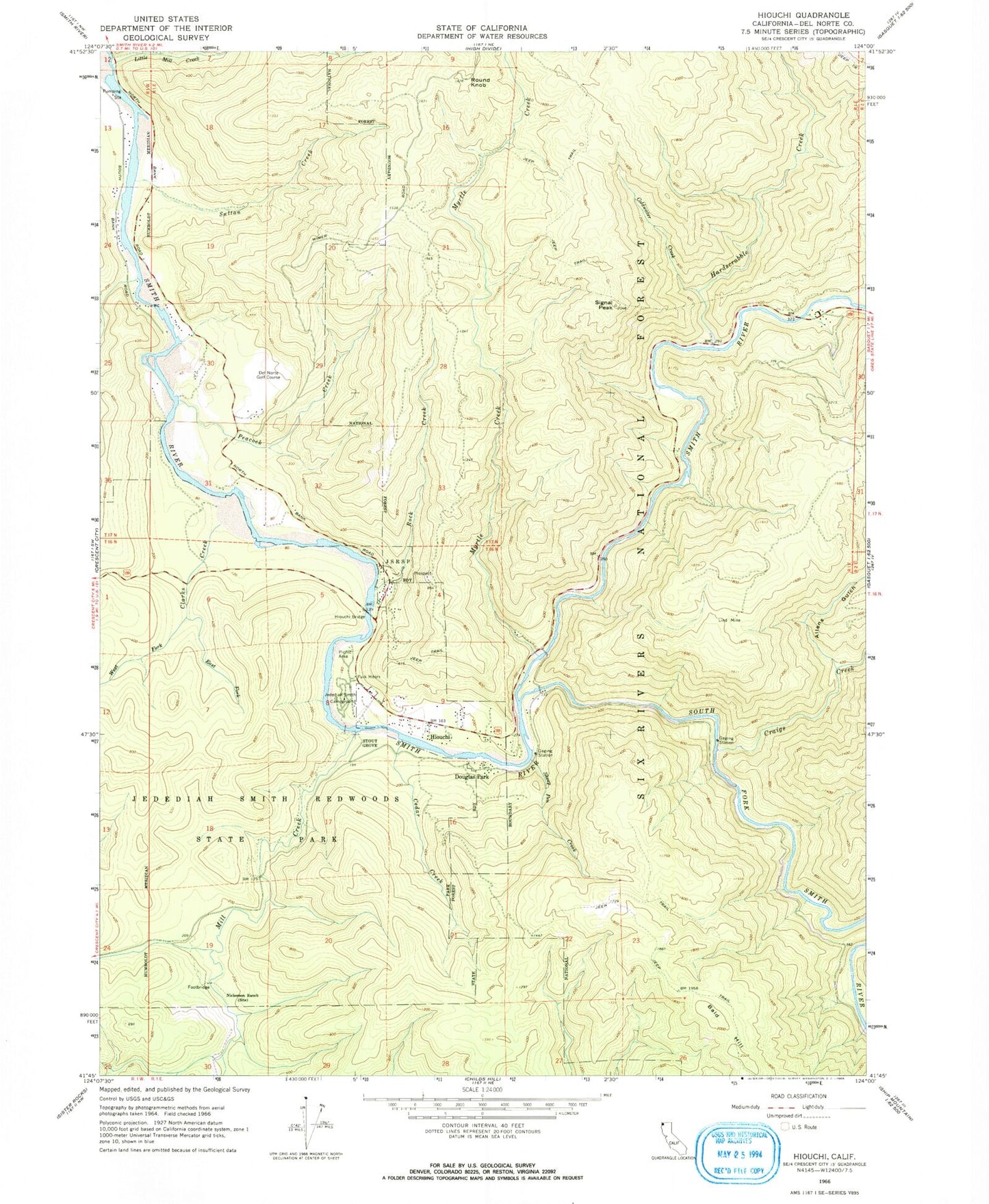
Classic USGS Hiouchi California 7.5'x7.5' Topo Map
Couldn't load pickup availability
Historical USGS topographic quad map of Hiouchi in the state of California. Typical map scale is 1:24,000, but may vary for certain years, if available. Print size: 24" x 27"
This quadrangle is in the following counties: Del Norte.
The map contains contour lines, roads, rivers, towns, and lakes. Printed on high-quality waterproof paper with UV fade-resistant inks, and shipped rolled.
Contains the following named places: Allens Gulch, Cedar Creek, Clarks Creek, Coldwater Creek, Craigs Creek, East Fork Clarks Creek, Hardscrabble Creek, Hiouchi, Hiouchi Bridge, Jedediah Smith Campground, Jedediah Smith Redwoods State Park, Lind Mine, Little Mill Creek, Mill Creek, Myrtle Creek, Nickerson Ranch, Peacock Creek, Rock Creek, Round Knob, Sheep Pen Creek, Signal Peak, Bald Hill, South Fork Smith River, Stout Grove, Sultan Creek, West Fork Clarks Creek, Hiouchi Information Center, Del Norte Golf Course, Daughters of the American Revolution Grove, Ferrel Grove, Krause Grove North, Wellman Grove, Douglas Park, Hiouchi School (historical), Peacocks Ferry (historical), Hiouchi Census Designated Place, Redwood Heritage State Wilderness