MyTopo
Classic USGS Hiteman Iowa 7.5'x7.5' Topo Map
Couldn't load pickup availability
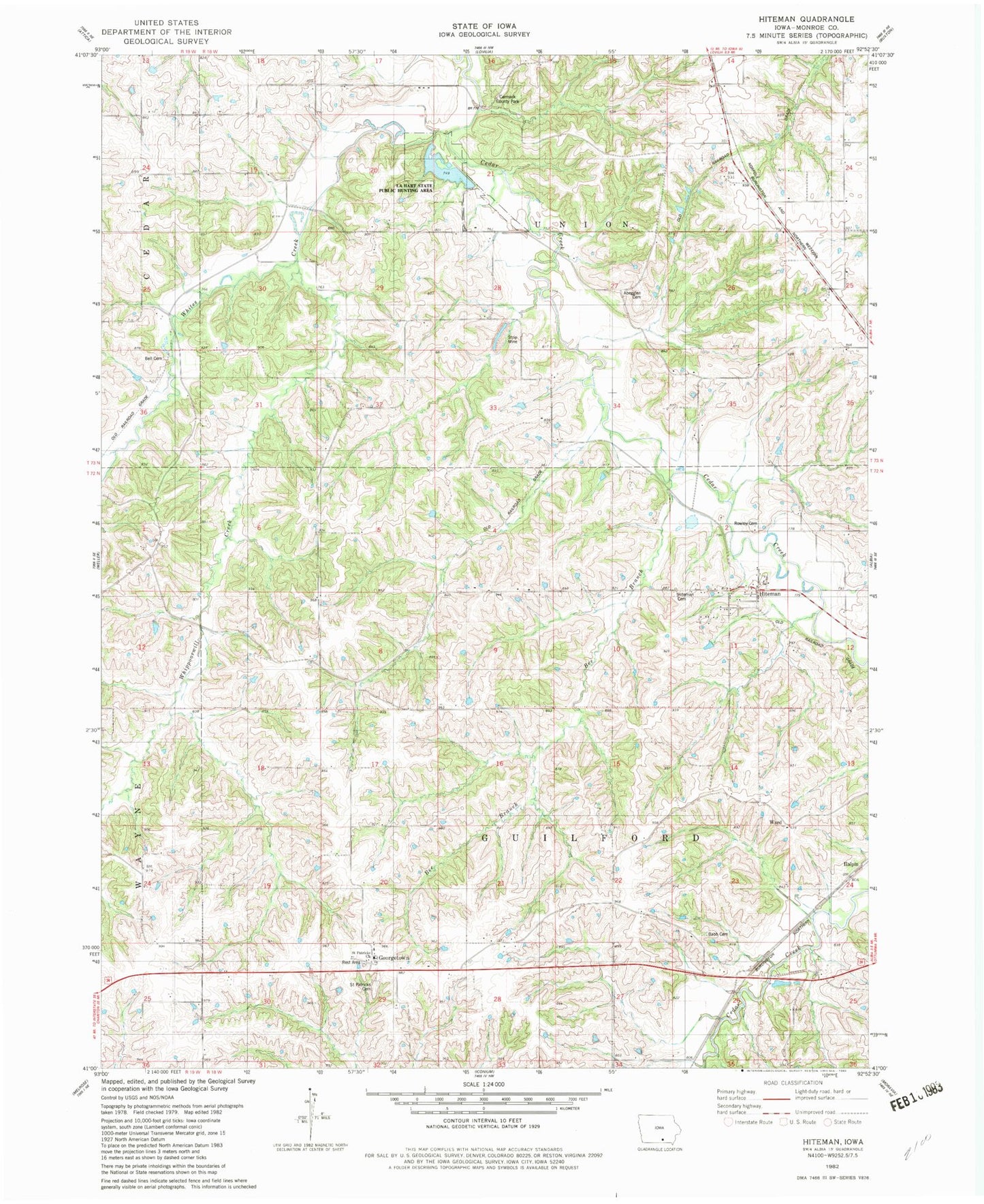
Historical USGS topographic quad map of Hiteman in the state of Iowa. Map scale may vary for some years, but is generally around 1:24,000. Print size is approximately 24" x 27"
This quadrangle is in the following counties: Monroe.
The map contains contour lines, roads, rivers, towns, and lakes. Printed on high-quality waterproof paper with UV fade-resistant inks, and shipped rolled.
Contains the following named places: Abegglen Cemetery, Babb Cemetery, Bee Branch, Bell Cemetery, Carmack County Park, Coalton Post Office, Craig School, Flattery School, Georgetown, Georgetown Cemetery, Georgetown Post Office, Georgetown Rest Area, Halpin, Hiteman, Hiteman Cemetery, Hiteman Mine Number 10, Hiteman Post Office, La Hart State Public Hunting Area, Maple Number 2, Miller School, Morris School, Mountain View School, Rex 4 Mine, Rex Number 4, Rexfield, Rexfield Post Office, Rowley Cemetery, Ryan School, Saint Patricks Cemetery, Saint Patricks Church, Smoky Hollow Mine, Tower, Township of Guilford, Township of Union, Wanlock Post Office, Ward, Ward Post Office, Whippoorwill Creek, Whites Creek