MyTopo
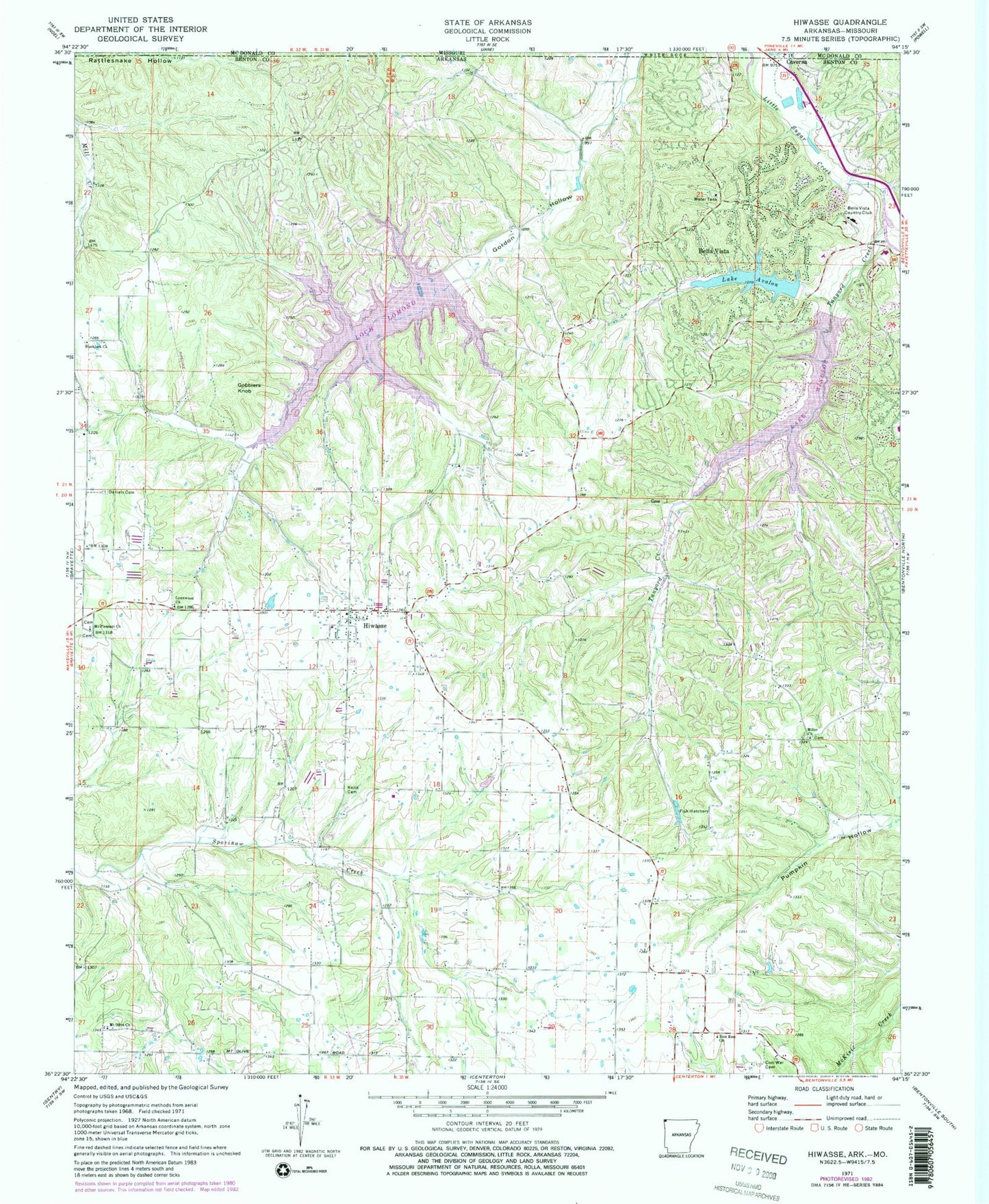
Classic USGS Hiwasse Arkansas 7.5'x7.5' Topo Map
Couldn't load pickup availability
Historical USGS topographic quad map of Hiwasse in the states of Arkansas, Missouri. Map scale may vary for some years, but is generally around 1:24,000. Print size is approximately 24" x 27"
This quadrangle is in the following counties: Benton, McDonald.
The map contains contour lines, roads, rivers, towns, and lakes. Printed on high-quality waterproof paper with UV fade-resistant inks, and shipped rolled.
Contains the following named places: Ashmore Field, Banks School, Bella Vista, Bella Vista Country Club, Bella Vista Fire Department Station 3, Benton County Sheriff's Office Bella Vista Division, Bertschy Farms, Blackjack Church, Boling Farms, Calis, Caverna, Centerton Gamble Elementary School, City of Bella Vista, City of Gravette, Cross Lanes School, D and J Farms, Daniels Cemetery, Donivan School, Gobblers Knob, Hiwasse, Hiwasse Census Designated Place, Hiwasse Post Office, Hiwasse School, Hiwassee Fire Station, Keith Cemetery, Lake Avalon, Lake Avalon Dam, Lake Windsor, Lake Windsor Dam, Lynn Church of Christ, Miller, Miller Cemetery, Miller Church, Miller School, Mount Olive Church, Mount Pleasant Cemetery, Mount Pleasant Missionary Baptist Church, Pleasant Hill School, Race, Rocky Comfort, Rocky Comfort Church, Rocky Comfort School, Tanyard Creek, The Highlands Post Office, Township 10, Township of Dickson, Township of Garland, Zion Rest Baptist Church, ZIP Codes: 72715, 72739