MyTopo
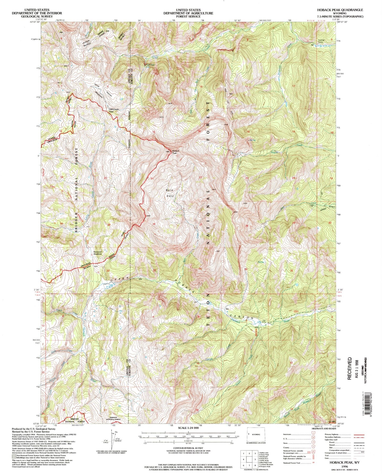
USGS Classic Hoback Peak Wyoming 7.5'x7.5' Topo Map
Regular price
$16.95
Regular price
Sale price
$16.95
Unit price
per
Couldn't load pickup availability
Historical USGS topographic quad map of Hoback Peak in the state of Wyoming. Scale: 1:24000. Print size: 24" x 27"
This quadrangle is in the following counties: Lincoln, Sublette.
The map contains contour lines, roads, rivers, towns, lakes, and grids including latitude / longitude and UTM / MGRS. Printed on high-quality waterproof paper with UV fade-resistant inks.
Contains the following named places: Bare Creek, Bare Hole, Cascade Creek, Cliff Creek Falls, Cliff Creek Pass, First Creek, Fourth Creek, Grizzly Creek, High Line Trail, Hoback Peak, Hole-in-the-Wall Creek, Horse Heaven Meadows, Roosevelt Meadows, Second Creek, Third Creek