MyTopo
Classic USGS Hobart Mills California 7.5'x7.5' Topo Map
Couldn't load pickup availability
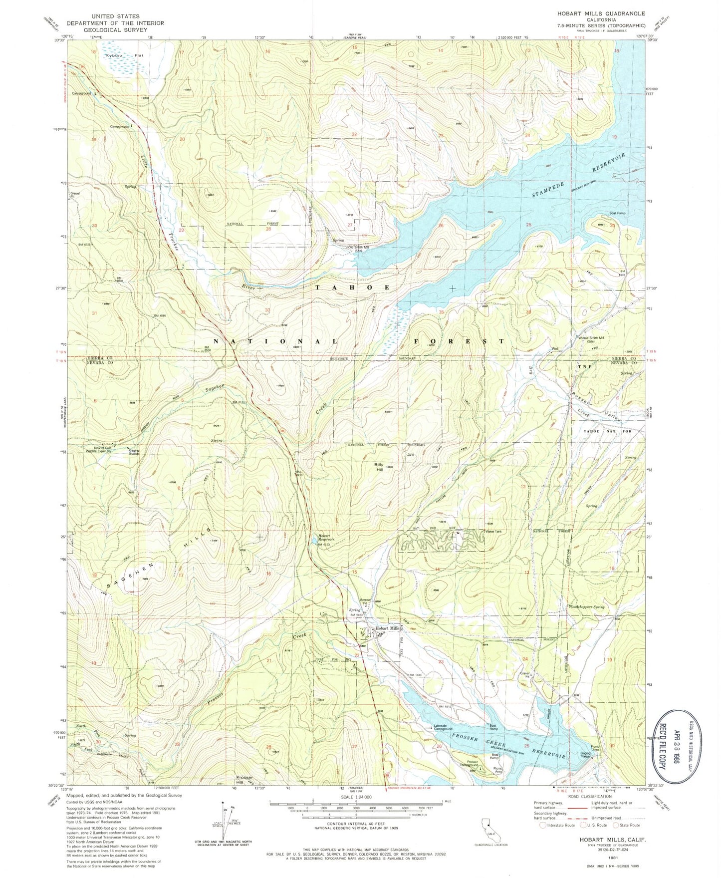
Historical USGS topographic quad map of Hobart Mills in the state of California. Typical map scale is 1:24,000, but may vary for certain years, if available. Print size: 24" x 27"
This quadrangle is in the following counties: Nevada, Sierra.
The map contains contour lines, roads, rivers, towns, and lakes. Printed on high-quality waterproof paper with UV fade-resistant inks, and shipped rolled.
Contains the following named places: Billy Hill, Hobart Reservoir, North Fork Prosser Creek, Prosser Hill, Sagehen Creek, Alder Creek, South Fork Prosser Creek, Stampede Reservoir, Woodchoppers Spring, Annie McCloud Campground, Donner Camp Picnic Area, Prosser Campground, Prosser Ranch Group Campground, Logger Campground, Captain Roberts Boat Ramp, Lower Little Truckee Campground, Lower Little Truckee Campground, Upper Little Truckee Campground, Prosser Creek Reservoir, Hobart Mills, Sagehen Creek Campground, Prosser Creek Dam, Lakeside Campground, University of California Wildlife Experiment Station, Old Smith Mill (historical), Winnie Smith Mill (historical)