MyTopo
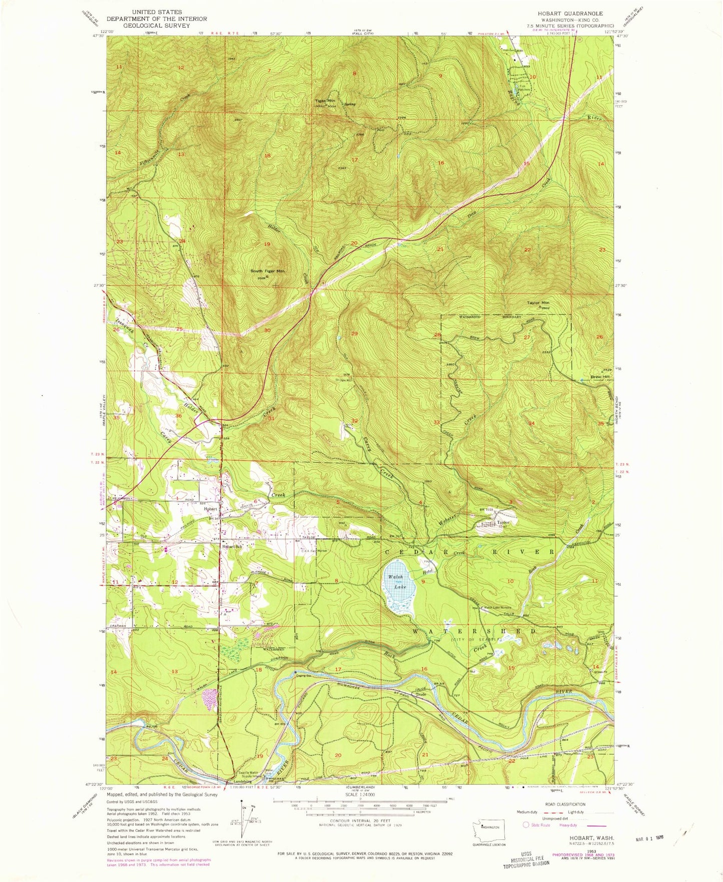
Classic USGS Hobart Washington 7.5'x7.5' Topo Map
Couldn't load pickup availability
Historical USGS topographic quad map of Hobart in the state of Washington. Typical map scale is 1:24,000, but may vary for certain years, if available. Print size: 24" x 27"
This quadrangle is in the following counties: King.
The map contains contour lines, roads, rivers, towns, and lakes. Printed on high-quality waterproof paper with UV fade-resistant inks, and shipped rolled.
Contains the following named places: Taylor Mountain, Brew Hill, Carey Creek, Deep Creek, Hobart, Hobart School, Holder Creek, Hotel Creek, Rock Creek, Shingle Mill, South Tiger Mountain, Taylor, Tiger Mountain, Trude, Walsh Lake, Walsh Lake Diversion Ditch, Webster Creek, Tiger Mountain State Forest, Tiger Mountain Lookout, Holmes Dam, Taylor Mill Pond Dam, Taylor Mill Pond, Seattle Water Supply Intake, Walsh Lake Nursery, Levdansky County Park, Tiger Mountain Trail, Mirrormont, Tahoma-Maple Valley Division, Hobart Census Designated Place, Mirrormont Census Designated Place, King County Fire Protection District 43 Maple Valley Fire and Life Safety Station 85, Eastside Fire and Rescue Battalion 3 Station 76 - Tiger Mountain, Hobart Post Office