MyTopo
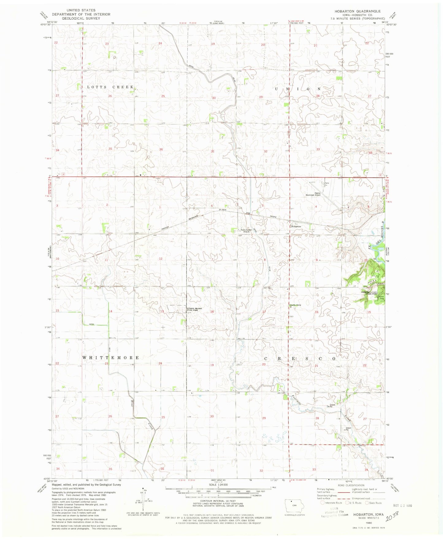
Classic USGS Hobarton Iowa 7.5'x7.5' Topo Map
Couldn't load pickup availability
Historical USGS topographic quad map of Hobarton in the state of Iowa. Map scale may vary for some years, but is generally around 1:24,000. Print size is approximately 24" x 27"
This quadrangle is in the following counties: Kossuth.
The map contains contour lines, roads, rivers, towns, and lakes. Printed on high-quality waterproof paper with UV fade-resistant inks, and shipped rolled.
Contains the following named places: Algona Municipal Airport, Ambrose A Call State Park, Cresco Post Office, Ditch Number 9, Ditch Number Eightythree, Hobart Post Office, Hobarton, Hobarton Post Office, KLGA-AM (Algona), Kossuth County Care Facility, Stinson Prairie State Park, Township of Cresco, West Bend Elevator Company Elevator