MyTopo
Classic USGS Hobbs Maryland 7.5'x7.5' Topo Map
Couldn't load pickup availability
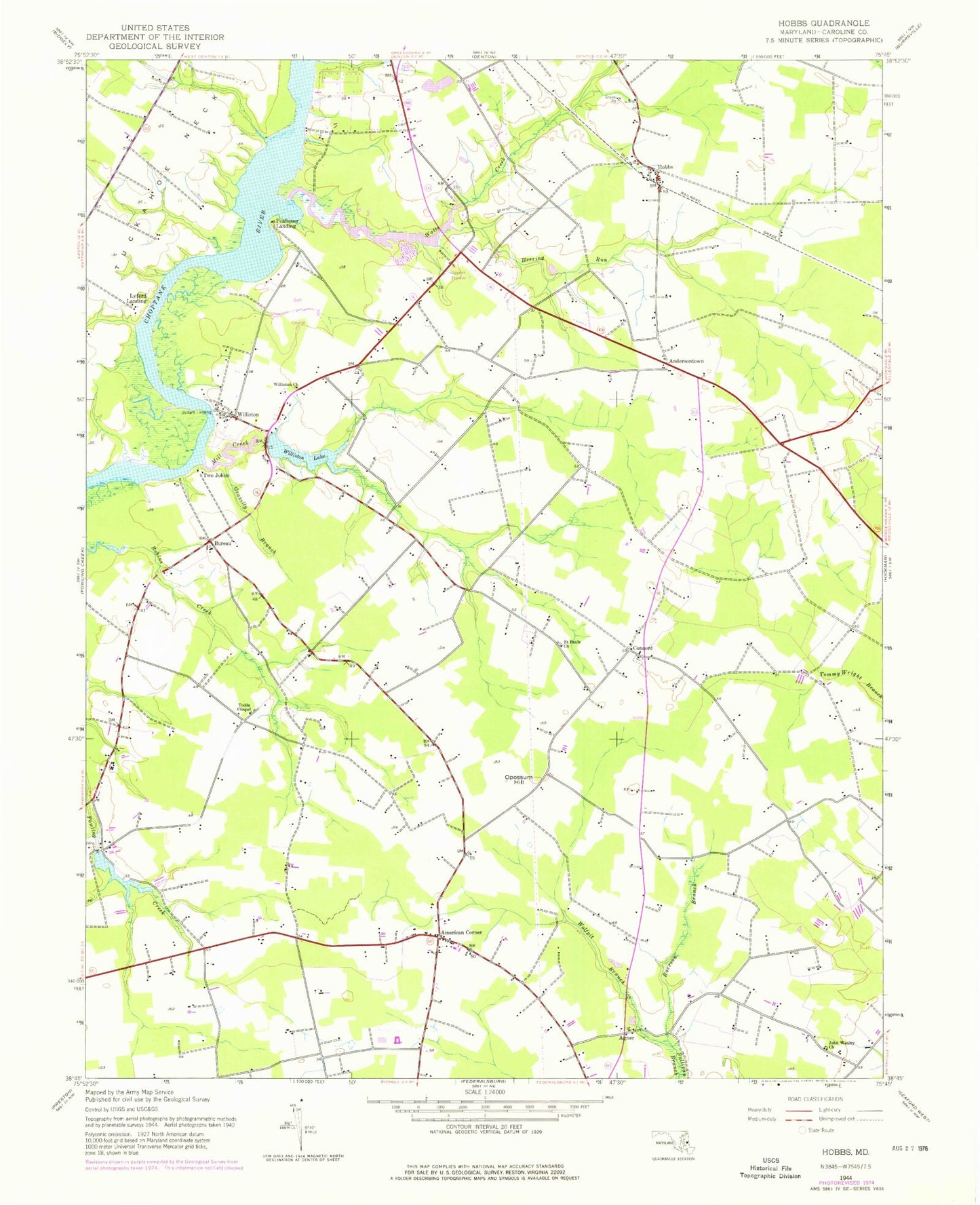
Historical USGS topographic quad map of Hobbs in the state of Maryland. Map scale may vary for some years, but is generally around 1:24,000. Print size is approximately 24" x 27"
This quadrangle is in the following counties: Caroline.
The map contains contour lines, roads, rivers, towns, and lakes. Printed on high-quality waterproof paper with UV fade-resistant inks, and shipped rolled.
Contains the following named places: Agner, American Corner, Ames Methodist Cemetery, Ames United Methodist Church, Andersontown, Asbury, Bridgetown Hundred, Bureau, Caroline Country Club, Caroline County, Caroline County 4-H Club and Youth Park, Chestnut Grove Cemetery, Chestnut Grove Methodist Church, Choptank Plantation, Colonel Richardson High School, Colonel Richardson Middle School, Concord, Concord Cemetery, Concord Methodist Episcopal Church, Country Club Estates, Denton Elementary School, Denton Industrial Park, Denton Plaza Shopping Center, District 3 Denton, District 8 American Corner, Double Hills Estates, Fairways, Fork Hundred, Fowling Creek Mill, Gravelly Branch, Herring Run, Hobbs, Houghton Airport, Hubbards Cross Roads, John Wesley Church, John Wesley School, Jones Corner, Lake Pinehurst, Laurel Grove Church, Legion Heights, Long Branch, Lyford Landing, Martinak State Park, Mill Creek, Nagels Mill Pond Dam, Opossum Hill, Pealiquor Landing, Peninsula Girls Scout Camp, Poor House Run, Potters Landing, Raccoon Branch, Saint Paul Cemetery, Saint Pauls Church, Schaefer Farms and Greenhouses, School Number 1, School Number 11, School Number 12, School Number 13, School Number 17, School Number 2, School Number 5, School Number 9, Slater Field, Smithville Community Lake, Smithville Lake Dam, Stafford Heights, Todds Chapel, Todds Chapel Cemetery, Two Johns, Two Johns Estates, Watts Creek, Williams Heights, Williston, Williston Census Designated Place, Williston Church, Williston Lake, Williston Mill, Williston Mill Dam, Wolfpit Branch, ZIP Code: 21629